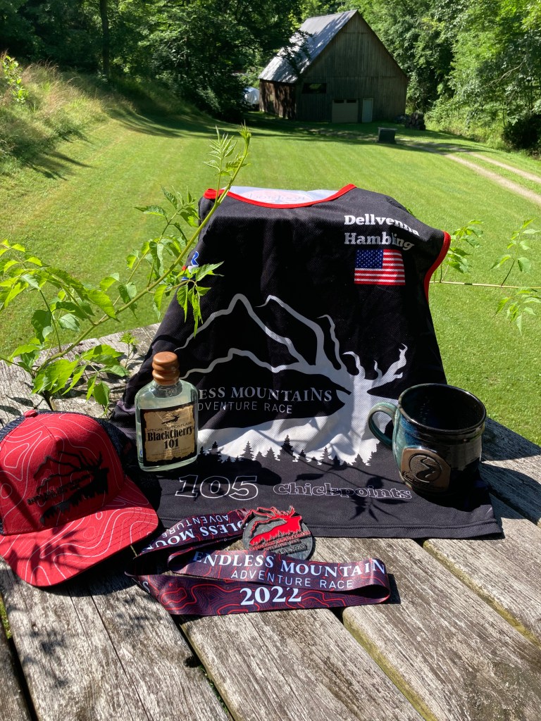
51/86 possible cp’s, all mandatory plus one bonus
2nd of three in division
24/32 teams overall
94.6 miles via raft and canoe
84.8 miles via foot
145.5 miles via bike
Total of 325 miles in 4 days 23 hrs 47 mins
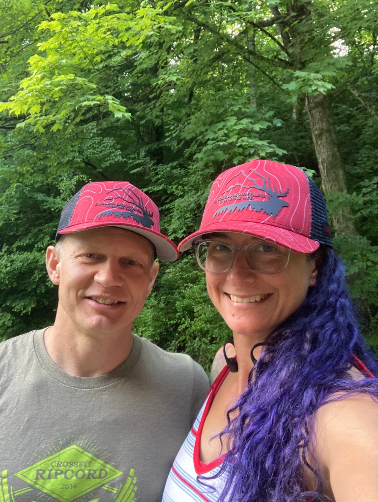
Lead Up: When Karen asked back at the start of the year if we’d be interested in an expedition race, I’d done enough dot watching of Sea-to-Sea and Expedition Oregon to know that it was a huge leap from a 30 hr race but that I wanted the challenge! For most of 2022, the race just sort of loomed in the back of my mind, emails would arrive in my inbox, I’d glance at them and then the daily stress of teaching would pull me back into the real world. Karen on the other hand was 100% dedicated to a training program that kept her hopping and firmly in race mode! She’d alert Kristy and I when something time urgent came up or to a piece of gear that we’d neglected to pay attention to. It all started to feel “real” in May when Steve finally started assembling his DIY packraft kit he’d purchased in February. From then on, it was a steady stream of REI and Amazon packages arriving! One of the big ticket items that we had to have was a bike box for transport. Luckily Steve’s teammate Paul had designed and built one and was kind enough to trade bike boxes for some custom printed T shirts!
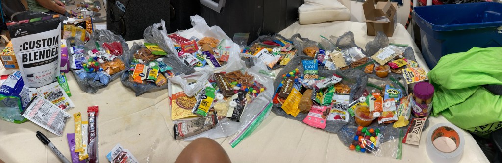
One week out from the race weekend, we started packing our food bags. I honestly think this was more stressful than the actual race. Trying to decide (having zero experience with this) what would taste good on day 4, my food bags looked like a pre-schooler had been turned loose in the junk food aisle! I have done extended back country trips but those always has the luxury of a stove and hot water, not something we would necessarily have on the race outside of a TA. In the end, I had like 9 bags of food to distribute the weight from bike box, paddle bag, and bin. When I went back to them at the race dorm because I definitely had too much food packed, I discovered that the combo of wintergreen mints and jalapeño pretzels had combined to make the most unappetizing smell ever! I evicted ALL of the spicy pretzels and most of the mints since if it did sound yummy now odds were it would sound worse on a race stomach!
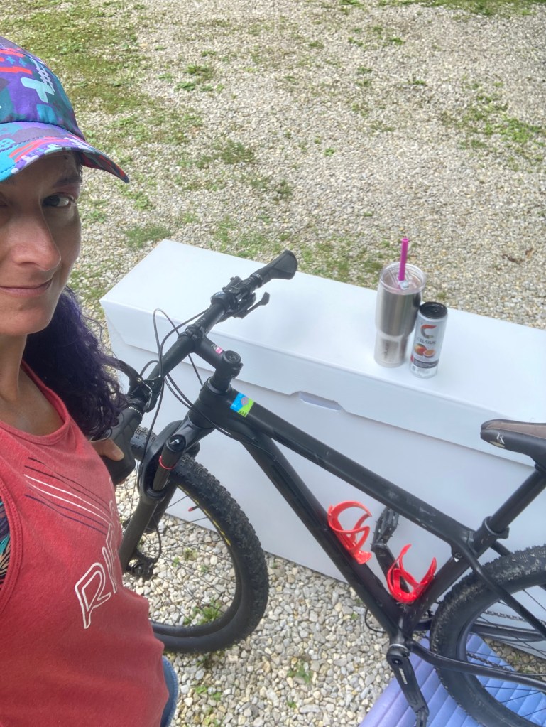
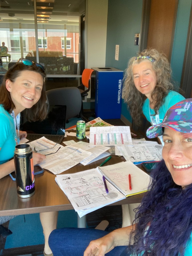
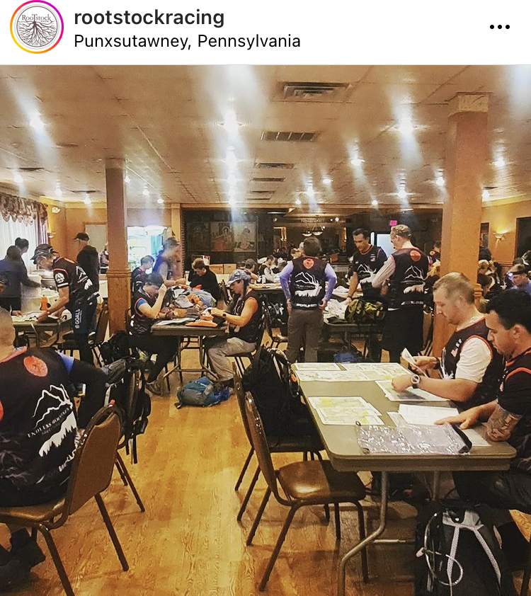
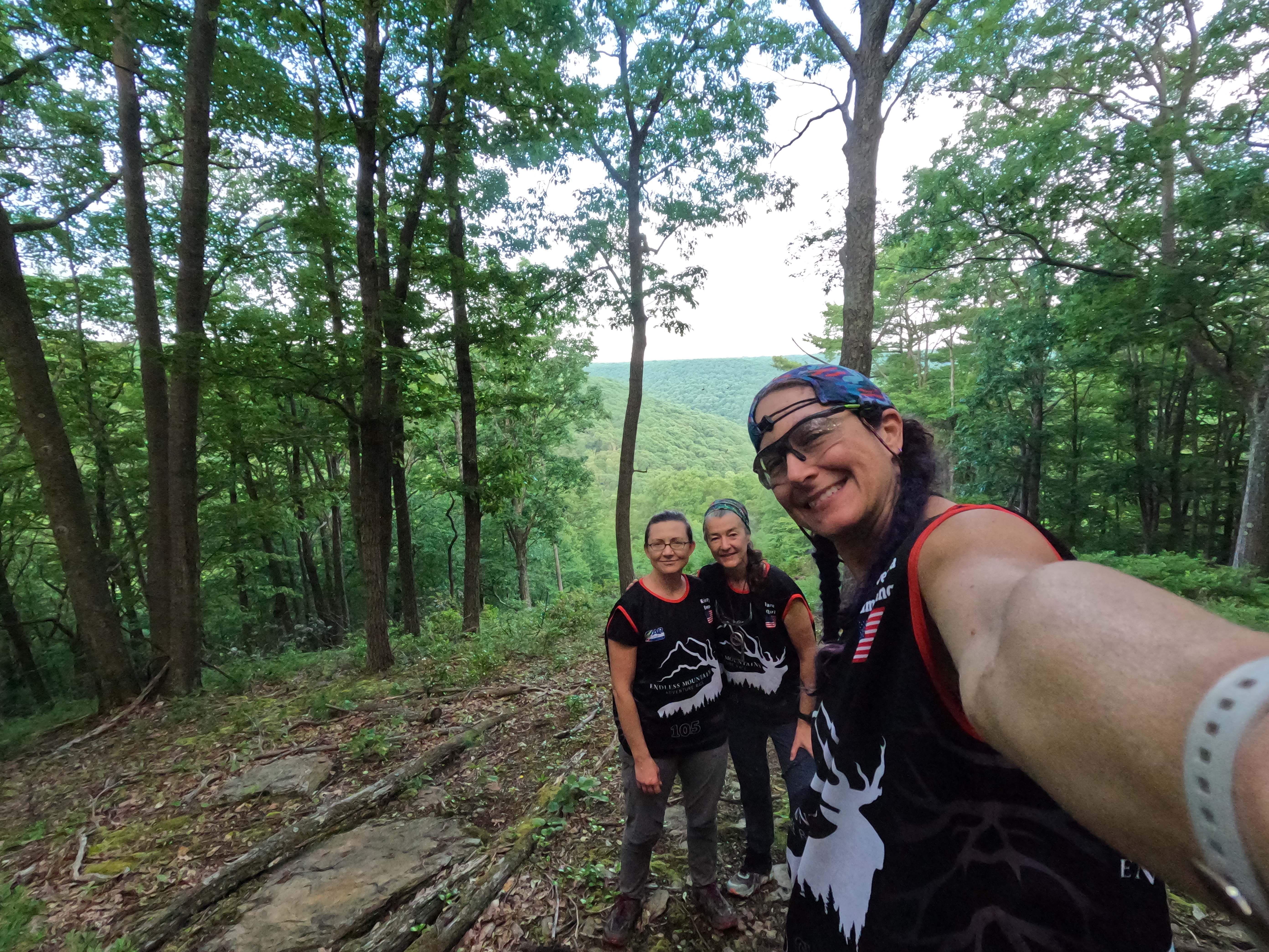
The pre-race dorm in Clarion was a great staging location. It allowed teams who don’t live near each other the time and space to combine gear and share tips before the race started. Like the handy tip Karen shared with us, the lock out on the derailleur! I’d struggled with taking the back wheel off my bike prior to this trick but now it was so much easier! The bike stuff was initially my biggest concern but I’d put in enough practice that I felt ok with the tear down and assembly, as long as nothing major went wrong! I’d love to do a basic bike mechanics course before another expedition race.
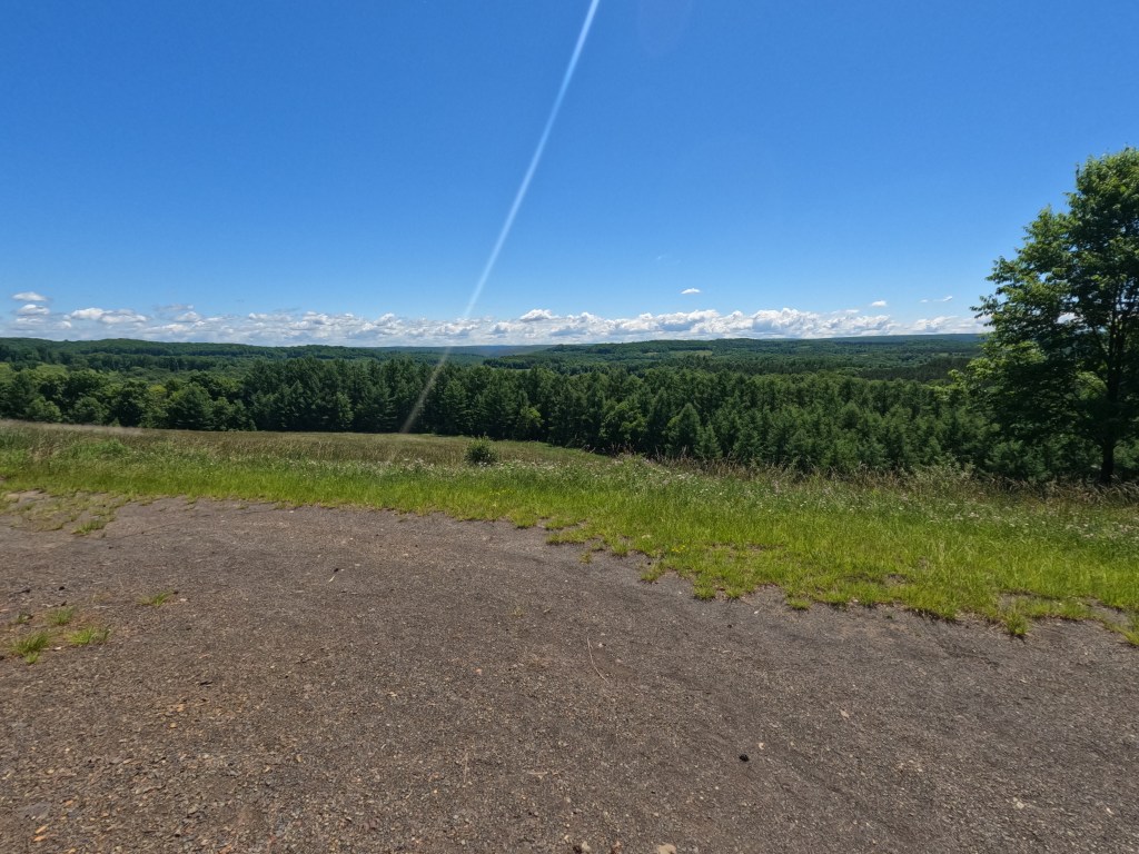
We’d been given our race booklet earlier and spent a good portion of the day getting an overview of the course. We knew we’d be starting urban and then quickly making our way into the wilds. With gear bins, bags, and boxes packed and dropped off for transport, we had a nice dinner at the Clarion Brewing Company and headed to bed.
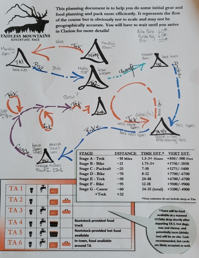
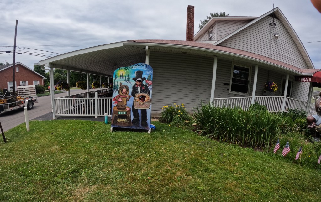
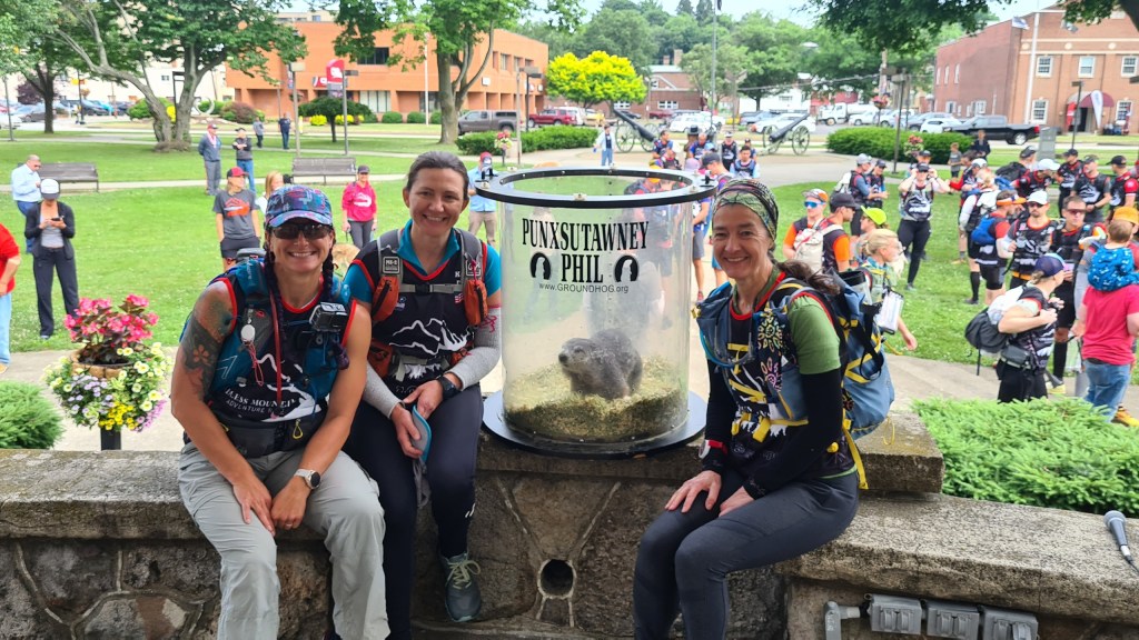
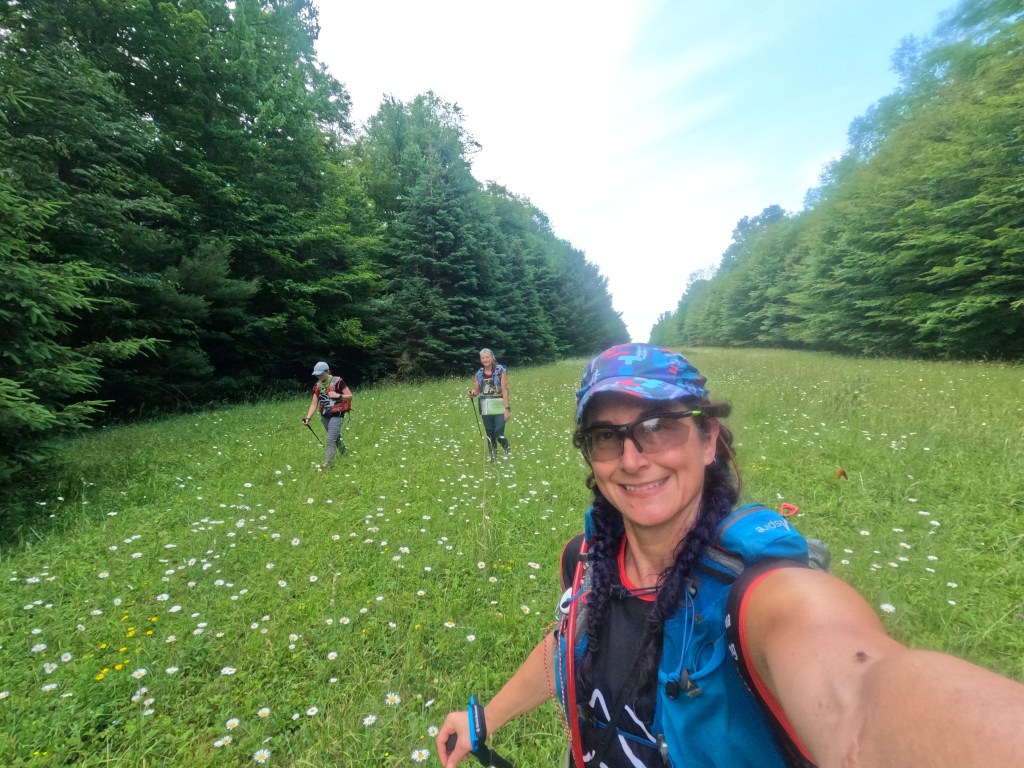
Start: We were handed a set of maps (minus Stage A) and loaded onto the busses for our ride to the start. Map planning on a bus is not easy but we had almost 2 hrs of lockdown when we got to town to route plan and have breakfast. This time went quick, Karen working on the trek sections, Kristy on the bike, and myself on the water sections. Mine being the simplest, I then helped with distance measuring and marking for the bike section. Note: make sure the shorthand you use during planning is something that will make sense 3 days later… also, measure out every bike segment possible! After our lockdown, we headed to the main square and had a couple of welcoming speeches and the chance to get our picture with the town celebrity Punxsutawney Phil! Stage A maps were enclosed in an envelope and at 10 am we all eagerly ripped them open and BAM off we went!
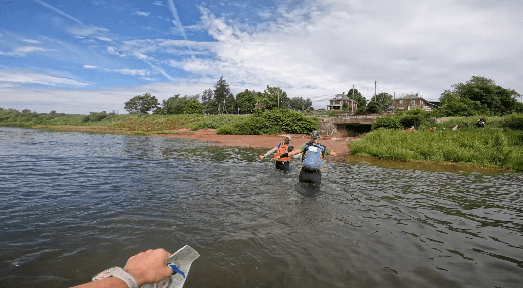
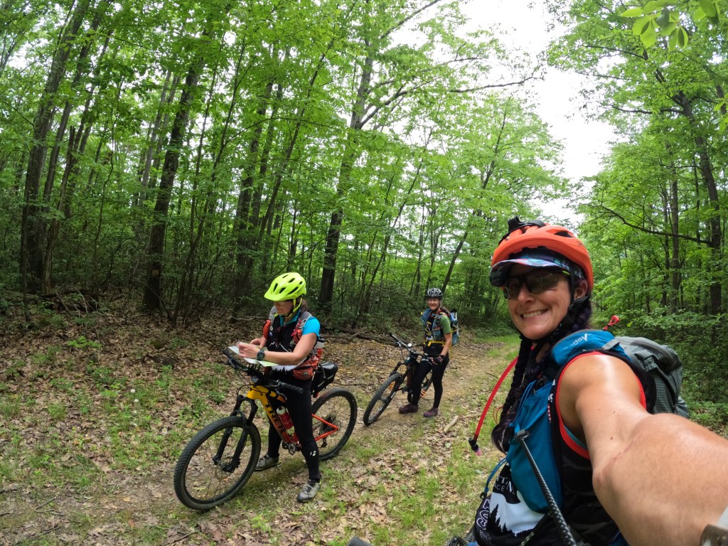
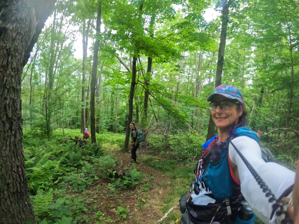
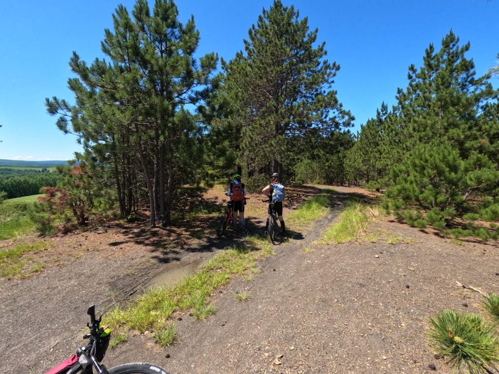
Stage A (9.33 mile trek ~ 2 hrs 35 mins): This was a hunt for 13 groundhog statues scattered around Punxsutawney Pennsylvania. This was a rather simple rogaine style course running around an urban environment. We did end up thigh deep in a river within the first 15 mins of the race, short cutting a bit of distance! This stage ended with a hike up to gobblers knob where we did our first bike assembly and headed out for a fast and flowy bike ride.
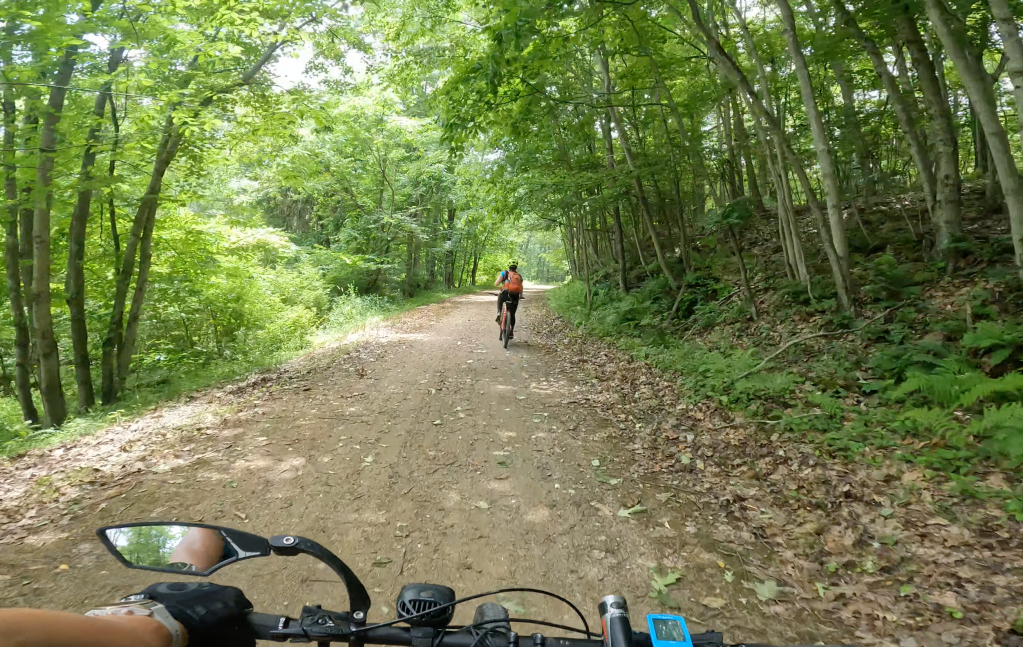
Stage B (23.5 mile bike ~ 2 hrs 55 mins): First thing I noticed is that once you take your tires off and put the back on, you need to pump the brakes a few times for them to engage again (or at least that is what I have to do with my bike)! This first bike stage took us out of town on a lovely gravel path (Mahoning Shadow Trail) two the first bike CP right at the trail head. The next bit took us out into the old gas well area. We had a bit of a bobble with a parallel error, thinking we were at one location but being on a parallel trail. The 1:50k maps were a challenge for sure! We backtracked to the main trail and navigated to the CP from a different route. Looking back, I’m still confused and really glad that Kristy was the one reading the maps here! From CP3 to the TA, it was a pleasant road ride without any hills that made a lasting impression. We rolled into to TA2 at 3:51 pm. I tried to use my watch lap times to track our TA times but due to hitting the button several times on accident I have no idea other than I take way too long to transition. Certainly an area I can work on as a team member!
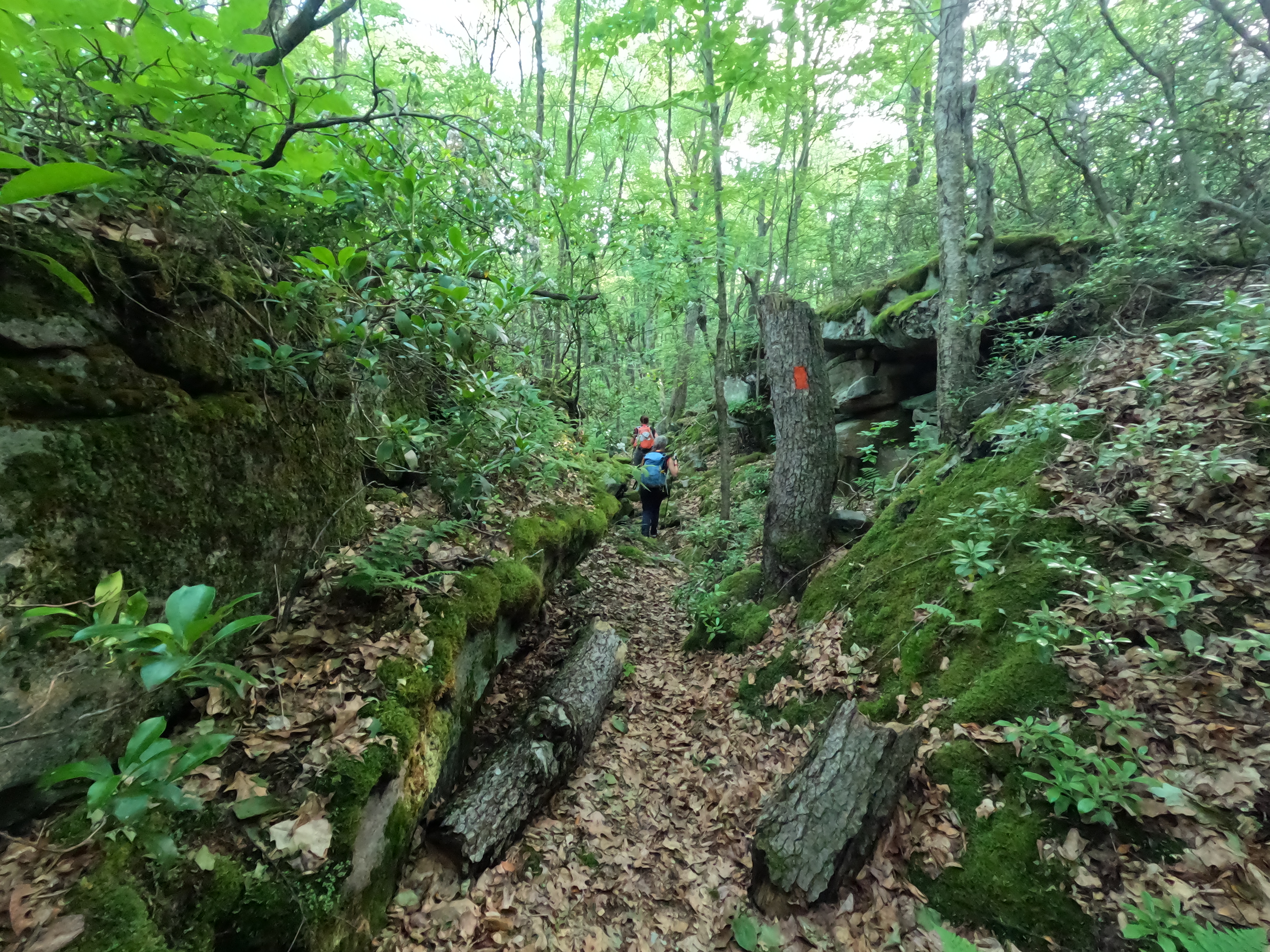
Stage C (27 mile packraft with 6 mile trek ~16 hr 5 mins): We hit the water in daylight, anticipating making some time on the other female teams since we were in single rafts and heard the water was low and favored single rafts over tandems. This sadly was not the case! The Wildlings are excellent paddlers and once they hit the water they were out of sight. Over the course of the next 13 1/2 hrs, we would spend a fair bit of time beached on rocks, occasionally enjoying a nice bit of flow, scootching over rock gardens in ankle deep water, all the while counting the bridges to the next landmark. We hit CP4 at 9:41 pm, about 5 hrs after leaving the TA. We paused on the beach for a bit of real food and a chance to stretch the legs. It was solidly dark now and we grabbed our headlamps before heading back on the water. As soon as we turned them on though, we found ourselves swarmed with bugs, to the point that it was more trouble than it was worth! The moon was about half full and the sky was clear, so as soon as we got beyond the rocky river parts and into the deeper water feeding the lake, we paddled in darkness. I’d stop and look behind me for the glow sticks making Karen and Kristy. After midnight, Karen was falling asleep while paddling and this resulted in two things. The first was her new headlamp slipped off her head and into the water! It wasn’t turned on so retrieving it was impossible given the water depth. I didn’t relish a dark water dive. She had a spare light in her bag so we continued on. The next thing was she’d doze off and then turn into the bank! We remedied this by tying her raft to mine. This allowed us to stay together better and the group chatter helped with the sleepiness. We came to the high hill that CP6 was on top of and the maps showed a nice peninsula. At this point we were allowed to portage our rafts and Kristy was 100% over paddling (not her favorite activity but she is really good at it)! Instead of finding an attack point closer to the CP, we went down the the peninsula hoping for a clear area and access to trails. Well friends, this did not pan out for us! The guys team we’d been leapfrogging with (The Dirt Merchants I think) had the same idea and went down further. We all ran into each other again in the middle of the peninsula, which was a tangled mess of trees, shrubs, and grass, all of which was over my head! I quickly decided that nope, this was not easier and we headed back to the river bank. From there I found what I thought was a small deer trail but it did become the marked trail I was looking for on the map. This CP was responsible for most of the altitude gain during the packraft! From there it was back in the boats and around the lake shore to collect the 3 that required boats to get to. The sun was rising as we made our way from CP 10 to the TA area. The remaining 4 CPs we elected to get on foot since we’d been sitting for so long. After about 2 hrs, we rolled back into the TA to transition to bikes and saw we were one of the last teams to leave… this theme would follow us the whole race!
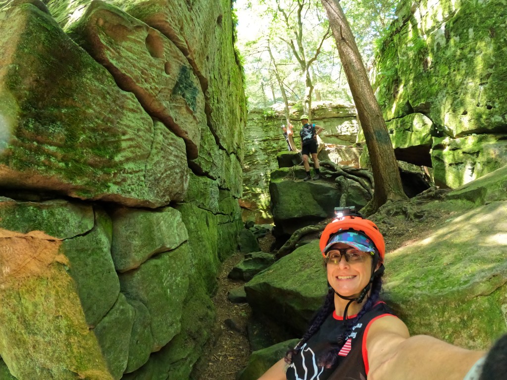
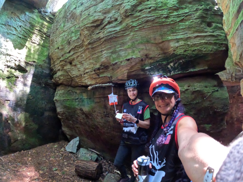
Stage D (54 mile bike ~13 hrs): This was the first of two long bike legs we’d face during the race. I was a little nervous having changed out my saddle a few days before and this would be the longest ride on it yet. One of the first things we had to tackle was a never ending hill on the way up to Bilgers Rocks. This was going to be an out and back for us so we stashed our excess food and water on a pull out, keeping just the mandatory gear with us. After the summit, we had a small parallel road error before correcting and rolling into Bilgers Rocks (https://www.visitclearfieldcounty.org/parks_cabins_bilgers). This area was a real treat for us since we hit it in the middle of the day and we had about 2 hrs of rock scrambling and CP hunting in the cool shade! The Ice Cave gave us and several other teams the most trouble, thanks to Electric Mayhem for the tip! Since the back of the pack teams had all missed the snack bar, which had stayed open all night the night before, Rootstock ordered us pizza and soda! Carb loaded and sipping on Mt. Dew, we made a few changes to our route since we were falling steadily behind on our original schedule, mostly due to the rafting time frame. We left Bilgers and worked our way back down the hill, much easier with gravity on our side, and then off to CP 14. This CP took us about 1 hr 45 mins to nail down. We were for sure on the right trail but things just weren’t matching up. Other teams went out and came back with no luck the same direction we were heading. After some frustration, Kristy just said it has to be this way and off we went! After CP 14, the others were super easy! We knew that before the bike stage was over we had to descend down and then climb back up a rather steep gully. The climb out was on Jack Dent Road and while rather crushing, it didn’t murder me as bad as Globe Rd did in Nationals 2019! We made it to the remote TA 4/5 around 10pm on Tuesday, ready for a meal and our first sleep! I’m sure I’ve forgotten some low moments but overall I was pretty happy with the bike stage! We choose to sleep at the TA with all of our comfort items instead of heading right out on the trek and sleeping rough. The TA terrain was rocky but I went up on the ridge and had an excellent snooze in the grass, using the sleep timer on my Garmin to ensure we didn’t oversleep. All told, I think we spent about 5 1/2 hrs in TA, which again, is probably too long and mostly my fault!
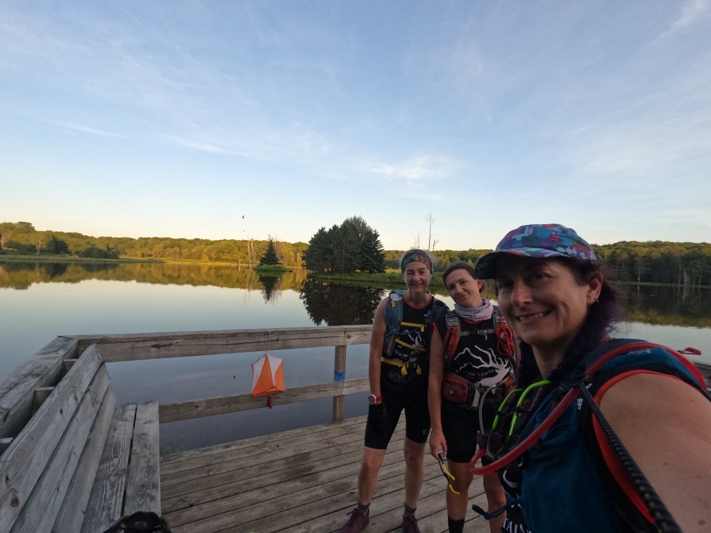
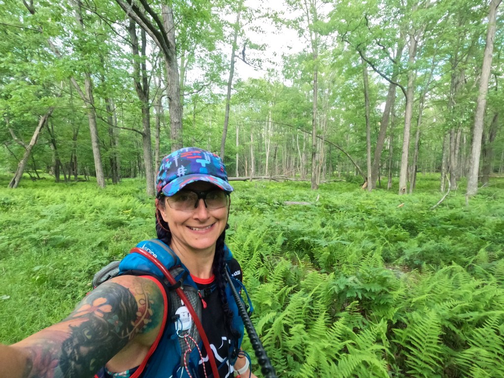
Stage E (50 mile trek ~23 1/2 hrs): Ooof, the epic trek! We knew going in that we’d be cutting it close to get just the mandatory points on this leg and we’d budgeted 24 hrs to do it. The mandatory CP’s were plotted in a loose circle that teams either tackled clockwise or counterclockwise, except for us! We did a fun figure 8 loop, which was actually on purpose, not because we messed up! We started at 4:30 am heading to CP 18 and ended the upper section at Table Falls CP24 around 11:30 am. We opted to lunch at the falls and tend to some foot issues. Vlad, one of the race photographers, was amazing and brewed up a French press of coffee! Talk about luxuries! After our lunch stop, we headed to CP28.
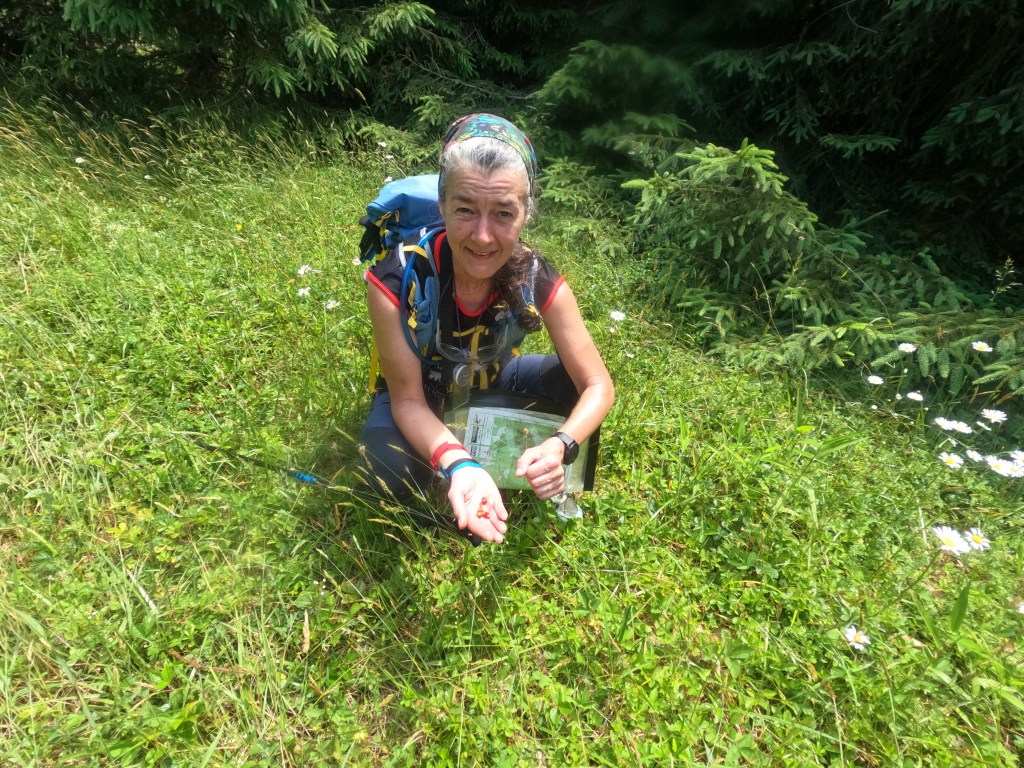
This section of the trek may be my favorite part of the whole race. We used a pipeline cut that was absolutely lovely! In Indiana, pipeline and power line cuts are gross, so overgrown with multiflora rose and other thorny things that you can’t traverse them. Here though we had a wide, rolling cut filled with daisies, wild blueberry bushes, and wild strawberries! Karen pointed one out and asked if it was a strawberry. I said most likely not since in the last time I’d seen a real wild strawberry was back in 1998! All the ones I’d seen since have turned out to be the mock strawberry, totally not related and also not delicious! I told Karen to squish one and if it was sort of white and styrofoam like, it was a mock one. Turns out, it squished and smelled amazing! We hiked and snacked our way down the trail, enjoying the day and the adventure.
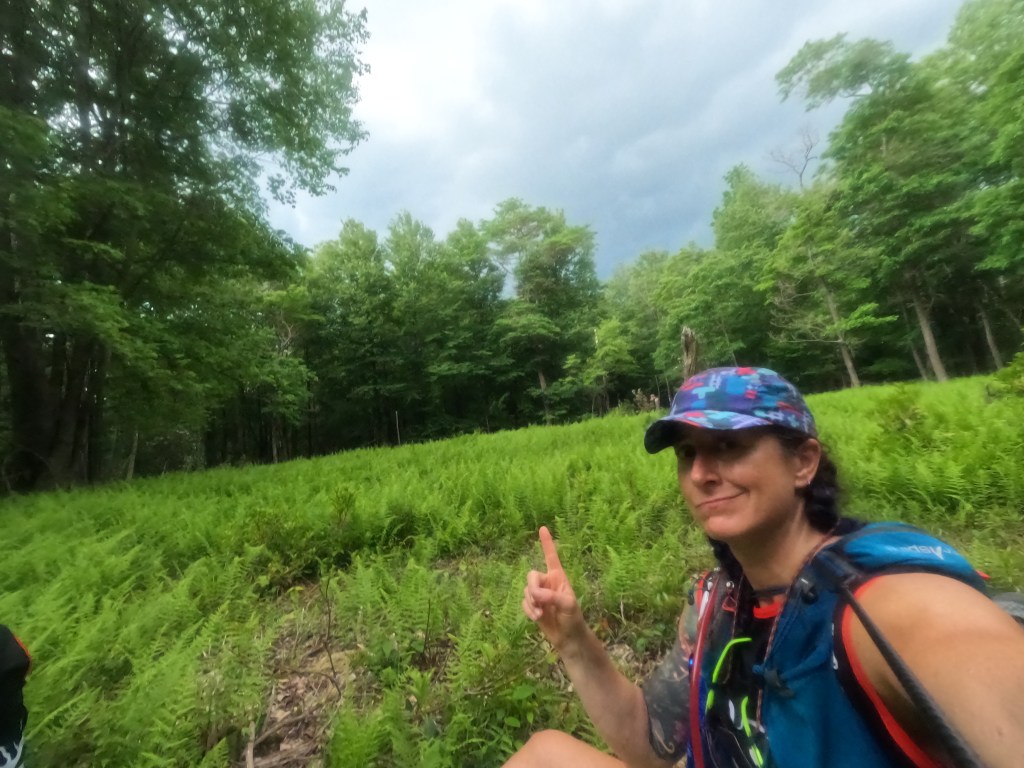
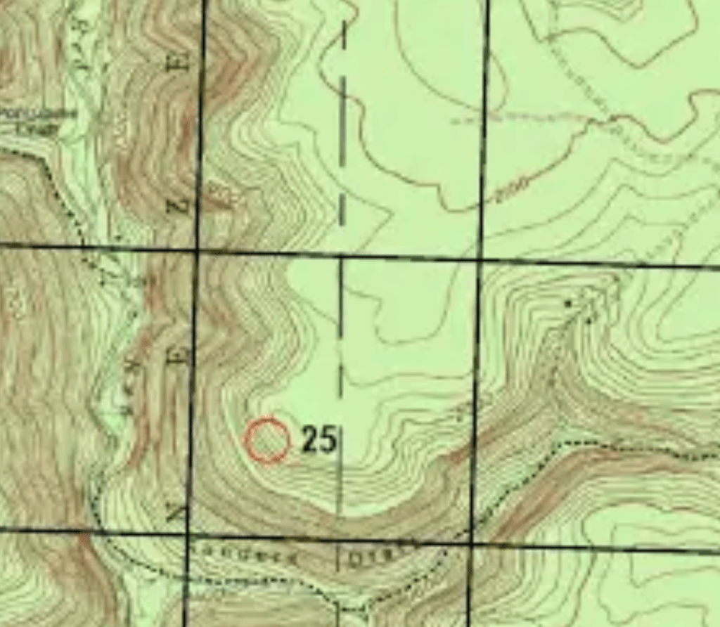
The next couple of CP’s were not too challenging ones found off nice trails. The ruins were cool, remnants of old homesteads in the area. As the afternoon wore on we made our approach to CP25, the main reason we had elected to do a figure 8 instead of a loop. Attacking it from the bottom meant a very steep climb up to the ridge line. We stuck with our plan to approach from the top, even after running into other teams who said that this wasn’t the best idea. The map showed some trails which forked, providing a good jumping off spot for a bearing. As we made our way out to the plateau we ran across the RoBros having a water stop. They asked if we were on our way to 25 and gave us the beta that the trails didn’t really exist. Armed with this, we paid more attention to the landscape as we hiked out the one main trail that still existed. We could find the flat areas of the old homestead road/trail but after scouting a bit, the trail fork was not apparent. Karen found the slight dip that lined up with the fork and used that to shoot a bearing. All of this was happening as a thunderstorm was looming on the horizon! Compasses in hand, bearing lines in sight, I started my pace counting as Karen worked a parallel course. Many repetitions of 72 step counts later, seeing only the next tree in line due to pelting rain, we came to the cliff top. The clue said top of rock band, not cliff edge, so we scouted from the top for a break in the cliff. True to our team nature, the bearing had drifted too far to the left. Seriously, our team drifts to the left in everything but biking! Still, I think it is pretty bad ass that Karen pretty much spit us out within range of the CP! The brush was so thick up top that we dropped down and scouted from the the lower edge. Making our way north along the rocks, I caught a glimpse of orange and there it was, solidly on top of a large chunk of rock that was not attached to the cliff edge any longer. I boosted Kristy up to punch our passport and then we made our way down the steep side.
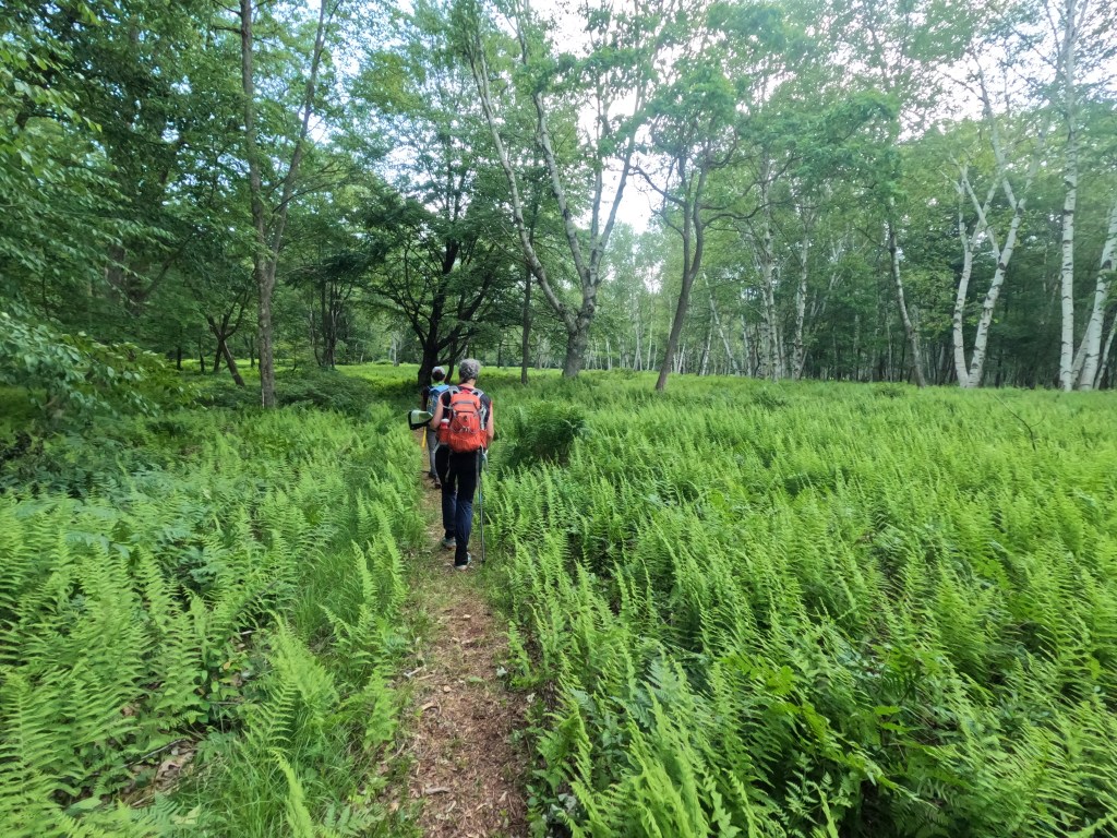

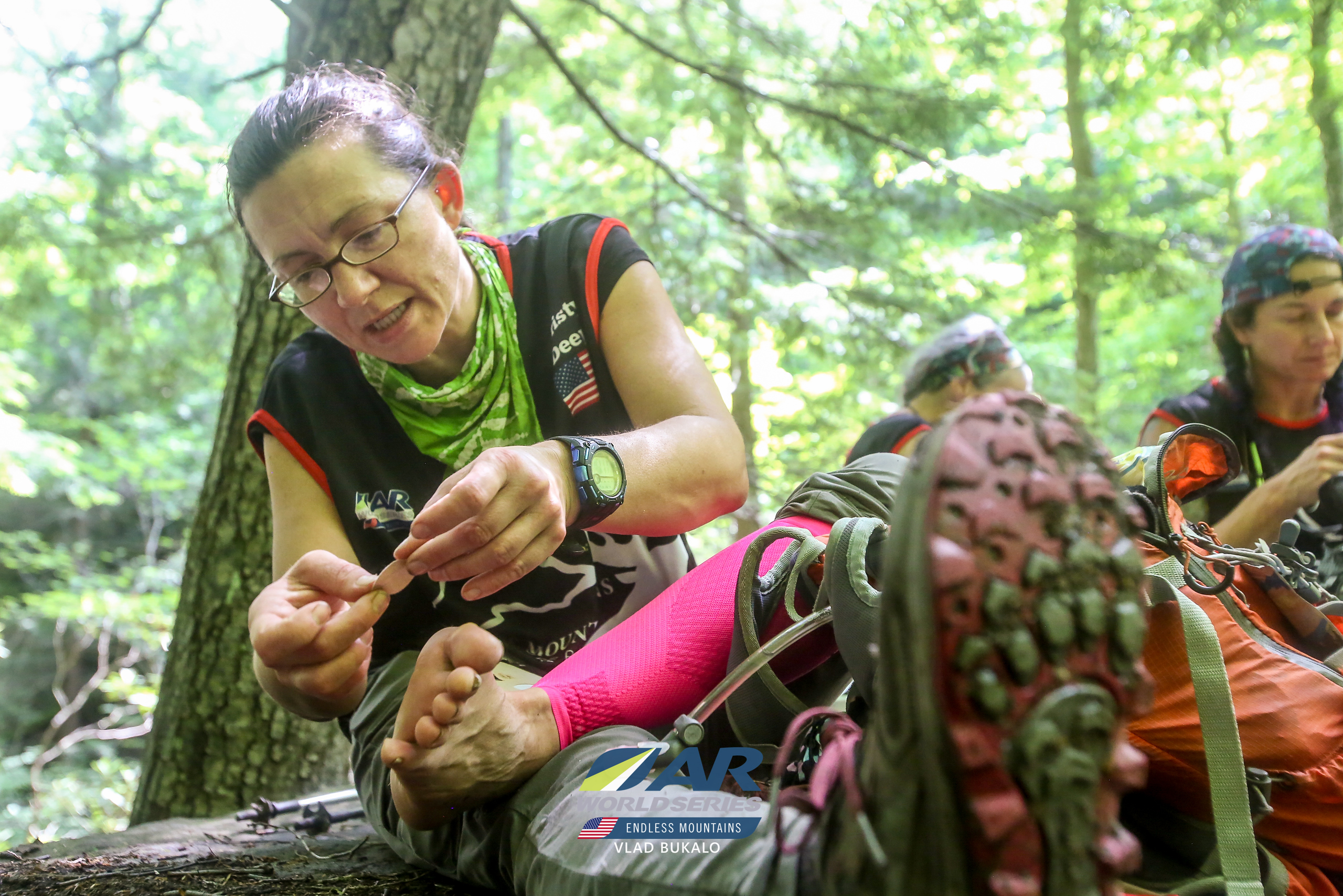
This put us back on the road to Table Falls and we’d completed 3 of the 4 segments of our figure eight. Our earlier visit to the falls had us hoping (but not expecting) Vlad to still be there with coffee! We knew this was highly unlikely but we did have a plan to see if we could bushwhack from the falls up the ravine to CP 23. This was quickly decided as a team to be a bad decision given it was now almost full dark and the underbrush was super thick. It might have been doable in light but we didn’t want to risk climbing up only to find an impassable cliff area. We made our way back to the road and the used our lovely pipeline cut to jump up to the main road. This last section was the final 3 mandatory CP’s we needed to clear the stage and they seemed to be the easiest ones if looking at the map, not too far off of clear roads or trails. The issues we had were mainly that everyone’s feet were sore but Kristy was getting some big blisters, and the fatigue of hiking for about 19 hrs at this point was taking a toll. I’m the junior navigator in the team but I somehow was the least footsore and mostly awake, so I tried to support the navigation as best I could! We changed our route on the fly when it was decided that road travel would be less fatiguing than cross country on the pipeline, which became a boggy mess. This might have lost us some time but I think it was a good decision overall.
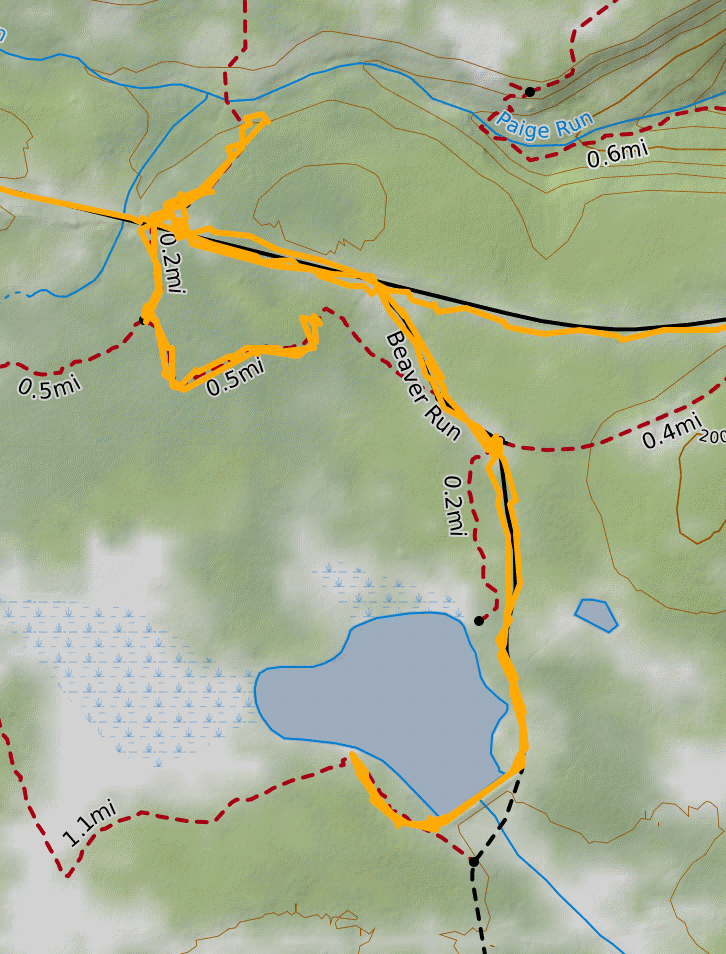
Probably our biggest goof of the whole trek was on silly CP22. If you look at our trace, you’ll see we walk right past the main entry (we did see the sign and foolishly decided to get 23 first), then you’ll see we attempt the trail to get back to CP22, which we abandon just 290 meters away from the junction, turn around and retrace our steps to the highway, then backtrack to the main entry. All told, this was about 1 1/2 miles of needless travel, with Kristy’s feet getting worse with each step. We finally find the pond but with the utter darkness could not see just how big it was. I later saw some of the pics from teams there in the daytime and it looked lovely! We made our way around the muddy trail and picked up the checkpoint, electing to just retrace our route on the way back so we could keep on the main road. This left just one more! The last clue was beaver dam but on the map there was no pond showing, just a reentrant. We took the trail and found the stream leading to the reentrant but Karen and I quickly decided nope, not doing that! A little farther down, the trail intersected with the pipeline and we felt it would be worth the extra distance to have a better attack point. It was a 4 1/2 mile hike from 22 to 21 and it took us 2 hr 5 mins. So, note to self, a reasonable slow estimate for footsore and fatigues night road navigation pace is 2.2 mph. The last 2.83 miles was just a slog on the road back to the TA. Road hiking with little stimulus is when I tend to fall apart. I for sure questioned why a road sign I’d been tracking ahead of us was no longer there, thinking a team was standing in front of it, when Karen said, you mean that sign we just walked past?? Finally, at 4:13 am on Thursday, 23 hrs and 45 mins after we started, we made it back to the TA! All in all, we knew Wednesday was going to be a tough race day, we prepared for it to suck, but to my surprise, it was a really (mostly) fun stage that I feel we did in true Chickpoint fashion, making our own plan and sticking with it! Oh, and the best food I had the whole race was my packet of ramen which I soaked in hot water in a ziplock bag!
TA 4/5: Our plan was to have another good sleep at the TA before saying good bye to our gear bin. As we were packing up for the night (morning, whatever) I asked Kristy how long to set the sleep timer, she said 4 is good, 5 would be fabulous. As much as I wanted to believe her, I knew it was sleepy Kristy talking, not race Kristy, so I set it for 4 hrs. I went back to my ridge and with earplugs in, then tossed and turned for a good 45 mins. I was awakened in a panic with Karen nudged me and I looked at my watch and saw a 1 with some zeros, 1:00, which I mistook for 10 am! Crap, I missed the alarm! No, it was just that we had 1 hr of sleep left but Karen and Kristy were already up. Whew! I fully admit to being slow on this transition, never a morning person at the best of times.
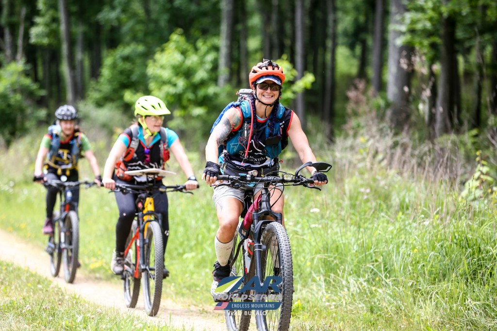
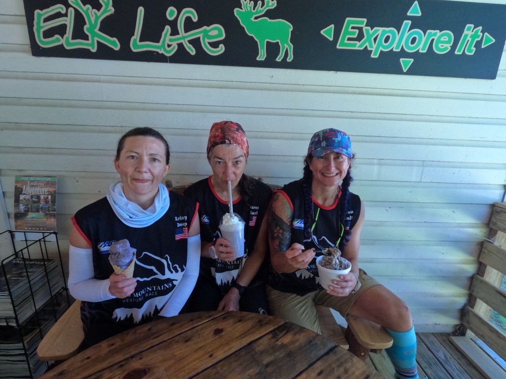
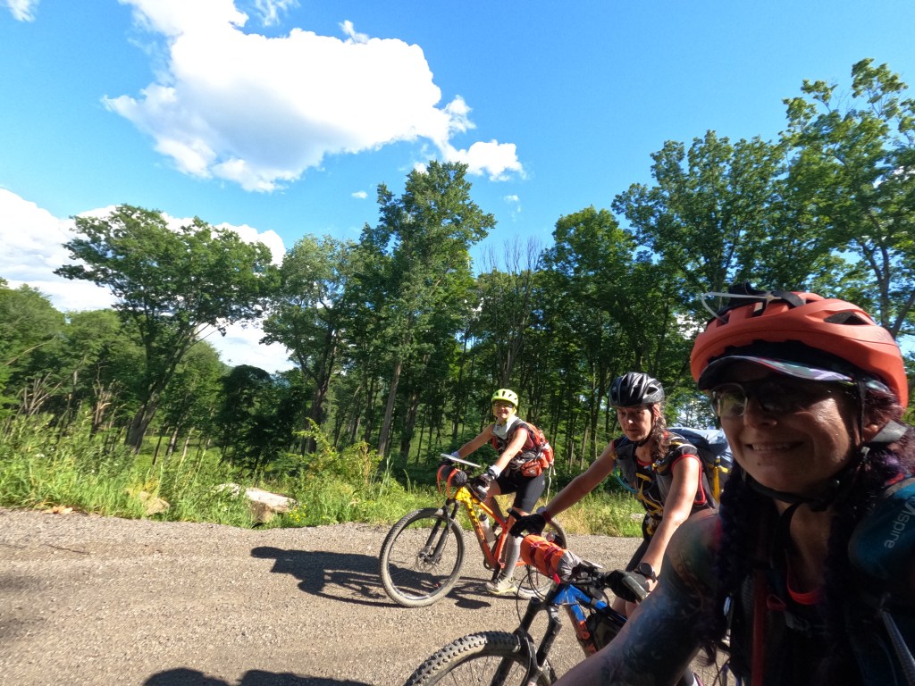
Stage F (67 mile bike ~11 hr 13 min): With some gentle chivying Karen and Kristy got me moving with the promise of ice cream! Just a short bike ride to the town of Benezette we’d been told a local place was happy to serve racers. We had also elected to do the alternate route map, skipping all but the mandatory checks. I recall a lot of nice downhill and flat on the way to our treat but mostly I remember how delicious the ice cream was! We also ordered bosco sticks to take with us for a meal later that day. Sure, we could have raced on past this lovely stop but part of our race plan is to enjoy the areas we are traveling through.
Fueled by espresso and ice cream, we tackled the uphill to our first CP of the day. This section was taking us through the area most likely to see elk but due to our timing, we saw zero elk. The Wildings told us of their majestic view of elk in a field with mist all around! Most of this day is a blur of riding bikes while hot, looking for water to dunk in, pushing bikes uphill while hot, looking for more water to dunk in, and eventually admitting defeat at CP 32 and calling for a 10 min trail nap.
Feeling much refreshed, we moved on know that at the end of a long flat trail, we’d come to CP33 at Straub Brewery! This 8ish mile long trail (West Creek Rec Trail) was exactly what we thought it would be, long and flat. I was hopeful that we’d have some access to the creek it was running along but given it was an old rail bed, the grade was too high and steep to make it down to the creek. I made myself promise that I would bike without stopping for 30 mins, then I could have a 5 min break. This was a bargain so I could keep up with the chamois cream and minimizing the chafing. Skin care is a huge part of longer races, it cannot be neglected until it is causing issues! We made our way along and then our lovely trail just dumped us off into the scrub. Obviously we’d left the well groomed section and were now in the wilder and unmaintained area.
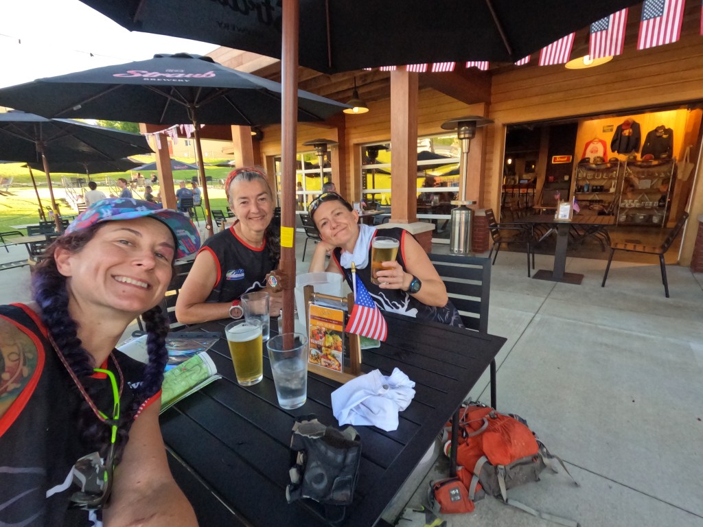
Looking at CalTopo after the fact, I can clearly see that the trail ends and becomes a different rec area. We opted to just head to the paved roads and look for road signs to Saint Marys and the brewery. Straub Brewery was kind enough to have a token bottle opener for us to take and allow incredibly stinky racers to take over their outdoor seating. Many teams opted to stop and have a beer and a meal. I’ll say that the portion sizes here are huge and the cold beer was delicious! The Wildlings rolled in and after a quick snack, we all headed out together. I’m not very comfortable in a pace line of bikes given that I never get to practice it, so I prefer to be at the front or the back. The Wildlings took the front and we made excellent time to the town of Ridgeway. We pealed off and made a stop at the Dollar Store for some supplies. Basically we were all very tired of our food options at this point and we had to have food for the next 36 hrs to take on our canoe stage. A short shopping spree later we rolled into the TA, just in time for the fireworks display! Holy smokes, this had to be the most intense fireworks show I’ve ever seen, either that or just being sleep deprived and suddenly overstimulated made it feel so! We worked to pack our bikes away and prep our paddle gear, planning a couple hrs of sleep. We strung a tent fly out over two of the bike boxes and used that to shelter our upper bodies from the dew. I slept in my rain clothes and space blanket, using my bike box padding for a pillow.
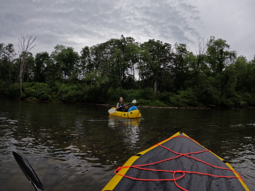
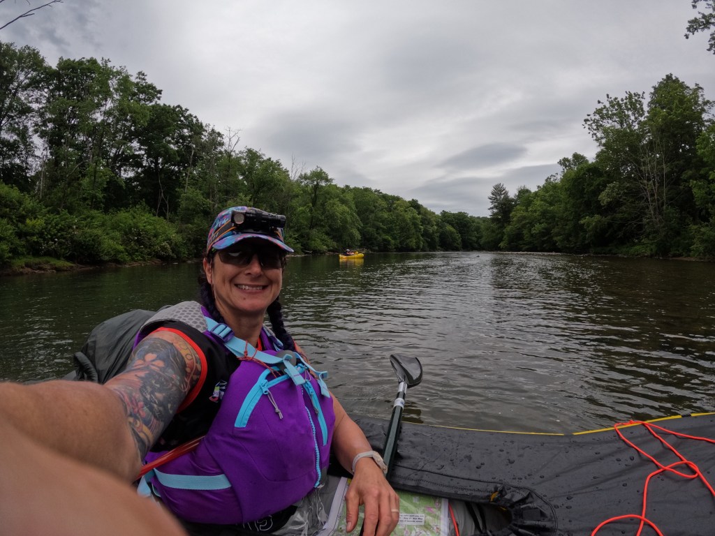
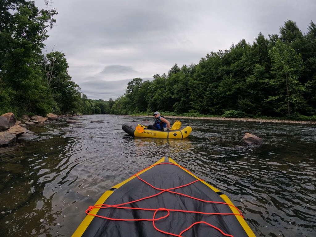
Stage G (67.5 miles of paddling with 16.5 miles of trek): I made up for my slow transition at TA 5 this time and while Kristy boiled water for coffee, headed over and picked out the best of the remaining 3 seat canoes. Glow sticks attached, pfd’s staged, it was time for breakfast. Over coffee we decided that our original plan (which turned out to not be unique) of towing a packraft behind the canoe to allow for sleeping on the river while maintaining forward motion wasn’t completely necessary given that we were down to a 36 hr race. After the fact we saw that Bend racing used a similar idea and towed one of their canoes. I’m curious how long they did this for and how effective it was! We loaded up our canoe with way more food that we needed, not really sure what we were thinking at this point! We were on the water and underway right around 5 am. I won’t sugarcoat this, I was terrified of the canoeing in the dark entirely because of the rapids, both names and otherwise! It was less of I’m afraid we’ll get hurt and more of just the whole shit show of trying to get the canoe upright again and being wet all over. So, for the next hour, as the same came up, my nerves were popping! I’d love to tell you that once we could see it was all clear sailing but that is a fairytale! The water level was such that many rocks were visible but many more lurked just under the surface, waiting to topple the boats. I called these hippo rocks, seemingly harmless until they charge! Luckily Karen and Kristy have excellent body awareness and control, so when we’d hit a rock, rather than frantically waving their arms or rocking wildly, we just absorbed the impact and went on. The bigger challenge was the shallows that continually thwarted our forward progress. We were making good time, finding nice channels, when we beached and I had to do the drag of shame while the Wildlings breezed by.
The first river CP was on an island that occurred right before the 3 named rapids. Having never been on this river, I wasn’t sure if there would be river milage signs from the livery or any other markings, so I tried to watch the topography, the river, and stern all at the same time. After navigating 2 rapids in close proximity that just happened to occur after a small island, I pulled over and had a small freak out. I was concerned that I’d missed the CP in my trying to navigate the waters. I now understand why the stern person should probably not be the water navigator when there is more going on than flat water! I handed the map to Karen and Kristy and focused on keeping us upright and moving. Once we saw the correct island it made sense and then even more when we came to a rock with a giant X on it for the XYZ rapids. CP35 was a quick little reentrant and then we came to the first trek section and CP36. This clue was Irish Rocks, which having not been looking at the map, I had zero clue where we were. I did see a rock with a giant eye painted on it and was like eye-rish maybe?? Just downriver from the art we did see the canoes of the other teams and found the CP. We elected to not do any of these trek points since they were all bonus ones and our time crunch was real. From 36 to 37 there was much dragging in shallows and searching for a more potable water source than the main river. We finally pulled up to the state park and used their water spigot to refill our water bladders and bottles. At 6 pm we finally made our way to the canoe take out where I was very solidly over paddling! If our bikes had magically appeared here, I would have been ecstatic, and I don’t like biking!! Honestly, if this section had been in pack rafts I think it would have been a lot of fun but it could have been slower. I’m not sure, having yet to experience a pack raft in water that it doesn’t drag on.
The trek here was 12 mandatory CP’s and 3 optional. The park area was through some virgin old growth trees and was really cool to see! We had to stay on the trails here which honestly was just fine! In my mind, this loop was like 10 miles even though the book clearly stated a 15 mile loop. I feel like we had a decent pace and route choice and made it back to the TA in about 6 hrs, including a 15 min trail nap I needed after succumbing to road psychosis. We had met up with Steve and Paul (The North Star) on their way and Steve could see how freaked out I was about doing the night paddle with all the rocks and rapids. Being the nice guy that he is, he slowed down enough so that our combined lights and his river skills would hopefully get us down the river safely. Once again, our team was almost dead last to leave the TA, but we did have a short 1 hr nap and some hot food before we moved on. From 3 am to sunrise, I was basically in a controlled panic (and sometimes not so controlled) as I tried to steer us away from rocks and keep us from toppling. Many thanks to Karen and Kristy for not taking my cussing the river and situation too seriously! At more than one point we just blindly (due to fog) pointed ourselves toward the sound of rushing water and held our paddles up, hoping for the best. Water that was actually moving was fine, it was the damn hippo rocks that loomed out of nowhere and high centered us. Probably the high point of this dark time paddle was when one large rock hit us dead center and the canoe started to tip but Karen slapped her hand down so hard on the rock that we righted and kept going! Not today river, not today!
Once the sun came up, Steve and Paul moved on at their faster paddle pace and we kept up our steady rhythm, working to avoid the shallows that plagued us once again. We saw several teams that had opted to camp on the banks after doing some nasty sections in the dark. One of the teams was actually repairing holes in their canoe! The river gradually deepened and widened, which was good and bad. Good in that the paddling was not technical at all but bad because it wasn’t flowing very fast now. As the adrenaline left my system I started to nod off. We were all feeling a little worse for wear and the effects of caffeine were becoming limited. Know that sitting in silence would eventually mean me falling completely asleep, I asked Kristy if she could start singing. She has a wonderful voice and knows all the best songs! I know about 2 lines for each song and can’t carry a tune in a bucket, but it did not stop me from singing along! It is amazing how this simple activity can trick the brain and ward of the sleepiness! So, for the last hour or so of paddling, we sang ever song that paddler knew (our nod to Janice Joplin)! Once the boat ramp was visible, it was go time!
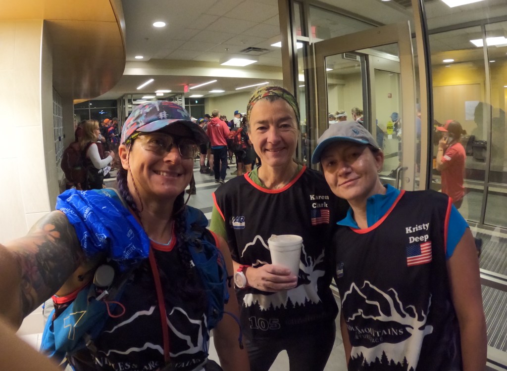
Trek to finish (3.37 miles 1 hr 23 mins): We were off the water at 8:23 am and anticipated a leisurely city trail hike to the final CP and then up to the campus finish area. I had hoped for a two hour buffer here but we were down to an hour and 38 mins. We headed out from the boat ramp and then it became very apparent that our city trail was not what we had thought. Instead we hiked with our paddle and pfd’s through shiggy taller than us, back along the river, on a trail that had seen minimal use other than racers! No problem, I had flipped the switch and was not going to let us be defeated or late! Once we hit the larger trail system and saw about 5 other teams all running around in a CP search our plan of a simple CP grab was dashed. After some initial trail searching, we asked Karen to do her magic and she took a bearing from up top and we walked basically straight down to the CP, snagging it at 9:15 am! We still had an uphill climb and a hike through campus to reach the finish but we did it, coming in at 9:47 am, 13 mins to spare!
Final thoughts: If you made it this far, congrats! Trying to recreate the race a week and a half later, over the course of multiple mornings and many cups of coffee, made this race report a little more verbose than my norm! This was my first expedition race so I had very little preconceptions or expectations going into it. I expected to hurt worse than I actually did, so that was a nice surprise! I also thought the lack of sleep would be my undoing, and while I did struggle with some sleepiness, overall it was much better than I thought it would be! Abby and Brent with the whole Rootstock crew took fabulous care of the entire pack of racers, not just the front teams, which I really appreciate! I know the front runners are the fun ones to watch, where most of the media crew hangs out, but the back of the pack is still giving it our all! One of the things I enjoyed most was how they had formatted the race so that the lead teams and the rear teams could still overlap at times and TA’s, keeping the whole herd together. The choose your own adventure with mandatory and option checkpoints was great, allowing us to continue as short course finishers without having to skip whole stages! Ninety five percent of this race was type I fun for me with the dark rapid paddling being a solid type II. Would I do another expedition race? Absolutely!