
May 7th, 2022
13/25 overall, 1st out of 2 in division 20/33 CP’s Time of 17:07
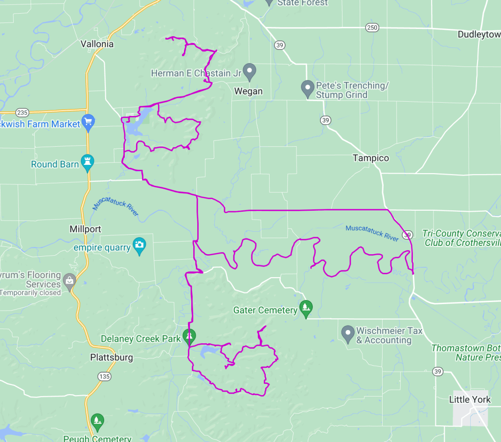
Leg 1 – Bike – 11.9 mi – 1hr 13 mins
Leg 2 – Canoe – 12.6 mi – 3 hr 24 mins
Leg 3 – Trek – 14.56 mi – 6 hr 43 mins
Leg 4 – Bike – 27 mi – 6 hr 13 mins
This was my longest solo race to date and I’ve waited way too long to write about it so here is what I can remember!
The pre-race meeting on Friday was nice, a chance to see and catch up with other racers. Brian gave us the minimal info as usual, I had to laugh when someone asked if he’d tell us what leg we were starting on. One of the things I really like about Brian’s races is that he keeps it old school, so basically show up and be ready for anything! He also said that we’d get the maps when we need the maps…
Leg 1: Fast forward to Saturday morning, when we in fact did need the maps. Brian had learned just a few minutes prior that the maps had been left behind, about 2 hrs north! Luckily, the course he had designed started with a straightforward bike to the paddle put in, with no CP’s to collect on the way to the river. Everyone was allowed to take pictures of the main map for the river section only and we were to use these pics to navigate on the water. The race started just a few minutes past 6 am with the pack following the DINO truck to the put in. This was when I discovered I had lost the smallest 4 chain ring gears on my bike! Nothing nothing about bikes, I just had to peddle like a crazed hamster on a wheel, then coast until I could get chain tension again. This meant that I just kept falling farther back in the pack the whole time. I could pass some on the climbs but on the flats and downs, I just had to coast.
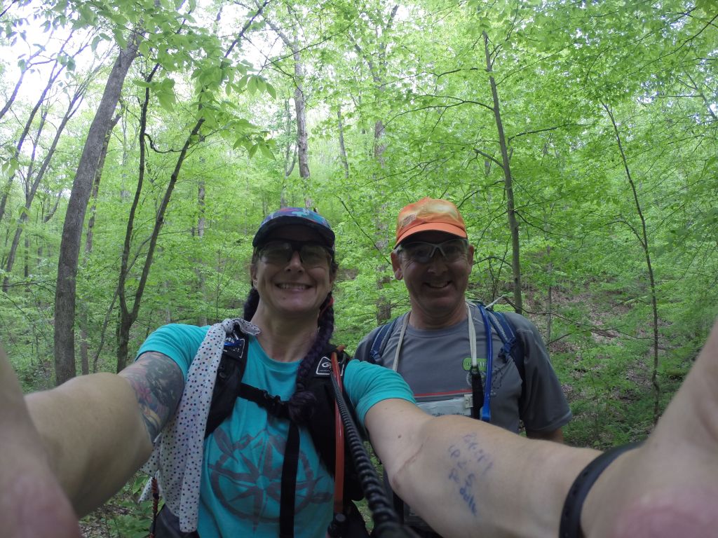
Leg 2: I made it to the river and grabbed one of the kayaks for solo racers. These are not awesome for speed but at least they aren’t super tippy! Now came the section that required using the pic on the phone to navigate to checkpoints. River nav can be challenging enough with a team but trying to juggle keeping the phone screen on, the kayak straight (or at least not pointing backwards) and watching the terrain was a struggle! About 1 1/2 hrs of paddling and juggling brought me to the first CP. I passed one bend in the river that looked similar and a couple of teams stopped there. I was 90% sure that it wasn’t correct and kept going until the next bend. The map showed a large creek flowing into our “river”. This was technically true but the water level was so low that it wasn’t navigable. A muddy sloped bank made for a tricky exit, then a short trek out and back, followed by a try not to flip kayak entry and wham, back on the water! A mere 30 mins later brought me to CP2. This one was close enough to see from the water but on a higher, steeper bank. When I pulled in, another solo racer was struggling to get out of the kayak and up to the CP. I offered my help and that was when I met Joel! We basically traveled in the same direction together but separate for the rest of the race since our speed and course decisions aligned. The next paddle CP was much easier to hike to, we found a nice tree root nest to wedge the kayaks onto. After 3 1/2 hrs of paddling, I pulled my trusty red yak out of the water and then the real race began!
Leg 3: After dumping the boat and paddle gear, I got my map and the list of 6 trek CP’s to plot. I finally feel like I know what I’m doing for plotting. I do always double check the first one though, just to be safe! The trek area was south at Delany Park, a 3.2 mile hike on roads. During this 2 hr hike Joel and I shared insights and history. Turns out, we had done several of the same races way back in the mid 2000’s! One of particular remembrance was the Urban Sprint by Planet Adventure where we had to swim to the bottom of pool and read a series of numbers, then come to the surface and do long division. Joel lost a contact during that section! Once we hit the park, the trail system was pretty easy to navigate, at least at first. CP6 was a nice big reentrant. I did ask Joel at this point if he’d prefer if I took a 5 min break to let him get ahead but he declined! From there I went out and back to CP8, the out to CP7. It was on the hike from CP7 to CP9 that I goofed. The Knobstone trail was running along side an old forest road. I convinced Joel to stay on the road since it was easy walking and going the same general direction, and it looked like we could dive back onto the Knobstone when we needed to. This in fact did not work out. In retrospect, I think I see what I did and where we missed the tie in with the trail. In the end, knowing we were off course, we decide to cross-country down the ridge to the creek and then work our way over to the CP. We hit the creek and knew we had to go west, looking for the big reentrant going south. Our backstop was going to the be Knobstone trail. We found the reentrant and Joel asked my confidence level. I said I was 80% sure it was the correct one, and that I was heading up! I’m not sure I’ll ever get tired of that feeling when you crest a hill and see the CP flag after making a nav choice that could have gone bad! From CP9, we popped over the ridge to CP11 and then made our way down the the creek for CP10. This one actually took us longer to find than it should have. In the end, with about 3 teams sweeping the area, it was located higher up than I was searching. From there, a mostly flat hike brought us to the TA where our bikes were waiting, having been trucked over from the canoe put in.
Leg 4: The bike leg was a mix of roads and trails, starting with the same 3 miles of road we had hiked down earlier. This brought us to the trail system around Starve Hollow Lake. The first CP was the rock ledge scramble after a decent hill climb. Nothing technical, just a lot of poison ivy to watch out for! More climbing brought us to the ridge and I stopped at the wrong spur, wasting about 5 mins. The next spur was the correct and much bigger one! Of course, my route brought me to it from the wrong side, so after fighting through nearly impassable thorns and brush, playing Marco Polo with Joel, the CP was found! The way out was much easier! Coming off the trails we were very close to the campground. I was completely out of water at this point and opted to take a short detour to the campground to fill up my bladder and bottles. It was getting dark at this point. After a resupply, Joel and I headed up the next big climb, meeting up with another couple of teams. At this point, we only had 3 hours left to go and this meant we had to be picky about which CP’s we went for. We opted for 4 on the top loop since it was just one climb and the trails were also mixed use one and pretty sloppy. What I learned in this section is I’m not great at night navigating! Definitely something I need to work on, preferably completely on my own since I still jump at shadows…
The bike back to the start was easy, all nice and downhill! Having been the victim of the steep penalty for being late to one of Brian’s races before, I made sure to come in with time to spare!

