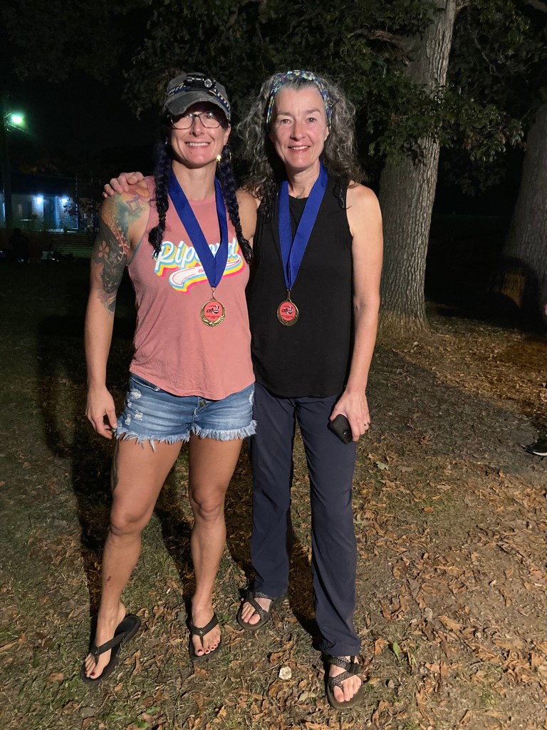
October 9th, 2021
Chickpoints 2F (Karen and me)
1st (and only) in Women’s division
11th out of 32 overall
24 of 30 checkpoints
Time: 11:25
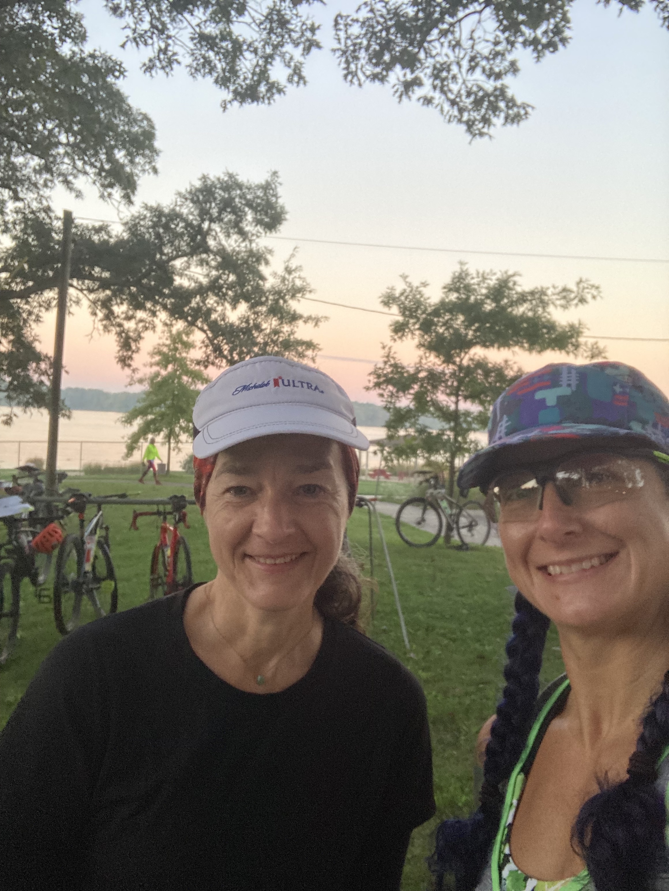
This was the first weekend of our Fall Break from school and it was a perfect way to start a vacation! Steve and I drove up on Friday and met up with Karen for check in. She was staying at the campground and we headed into town for our hotel. On the way, Karen called after she realized she didn’t have her backpack, it was sitting at home in Lexington! Due to my overpacking nature, it was not at issue at all. I had actually thrown in an extra pack this time (not my normal) since my Out There pack was lost in the mail and I thought I’d use Steve’s since he wasn’t. In the end, Karen used Steve’s and I took my giant UltraSpire one that actually rides really well. In the history of things I’ve messed up prior to a race, this one was an easy fix!
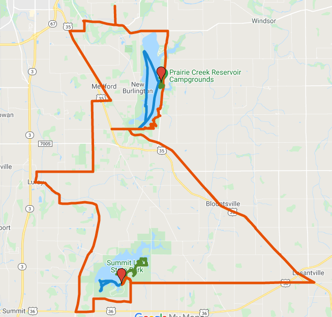
Stage 1: Paddle 6.22 miles
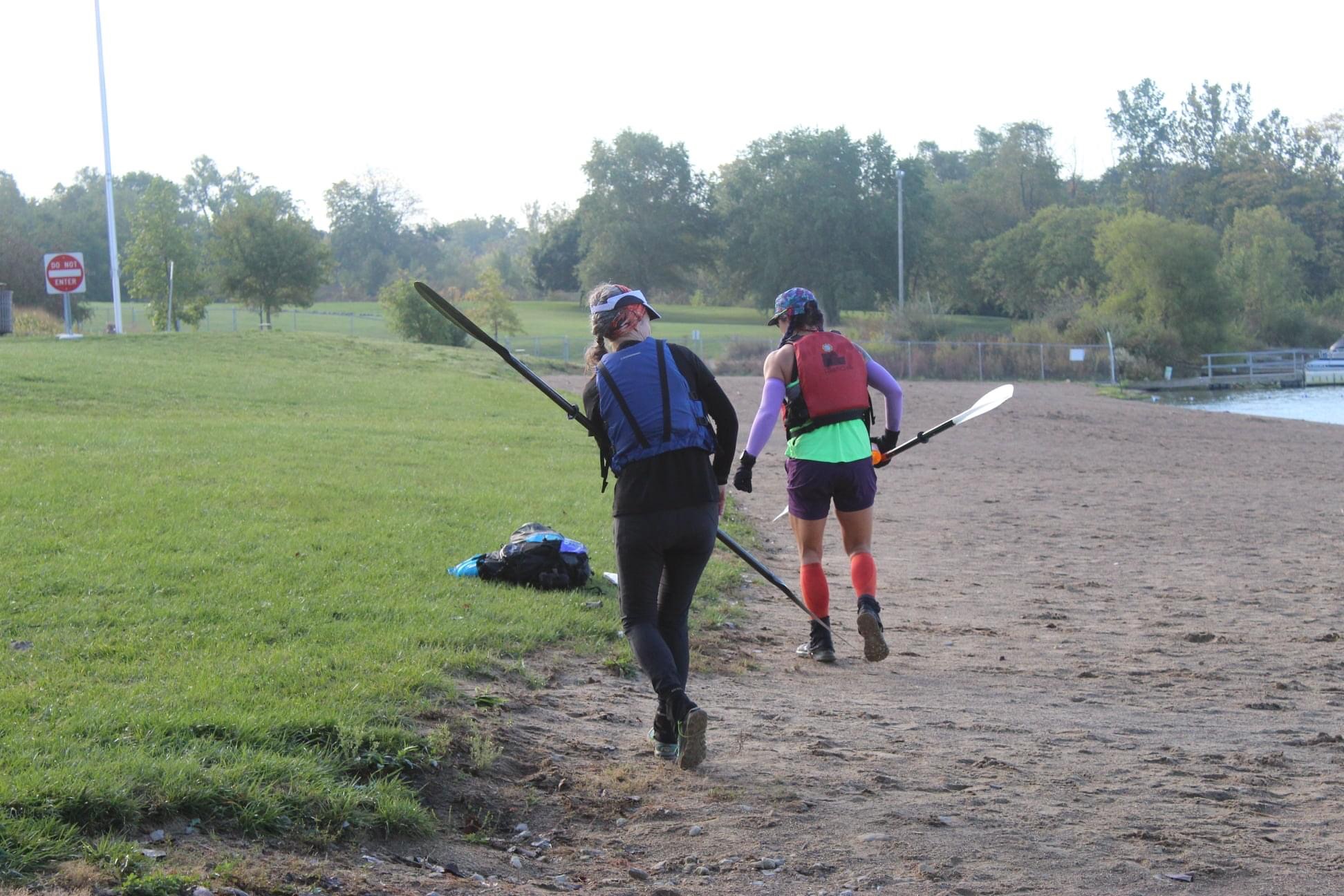
Saturday dawned warm and sunny, with a projected high in the low 80’s. Brian had told us we’d start on the paddle and to stage our boat and gear on the beach prior to the race start. We started with a short sprint up to the parking lot to get the first instructions and then back to the boats. Karen and I headed out in the first wave and made a beeline to the south end of the lake where we received our big map. There was just one point to plot, back on the north end of the lake. On the way we saw a two male team tip their canoe and decided to offer our help. Trying to right a canoe in the middle of the lake is a challenge and we opted to just tow them to the shore since it was pretty close. It only cost us about 15 mins and since we weren’t racing any other female teams it was the right thing to do! I wish I was better about marking time for segments but I’d guess the paddle took us about 1 1/2 – 2 hrs?
Stage 2: Bike 21.3 miles
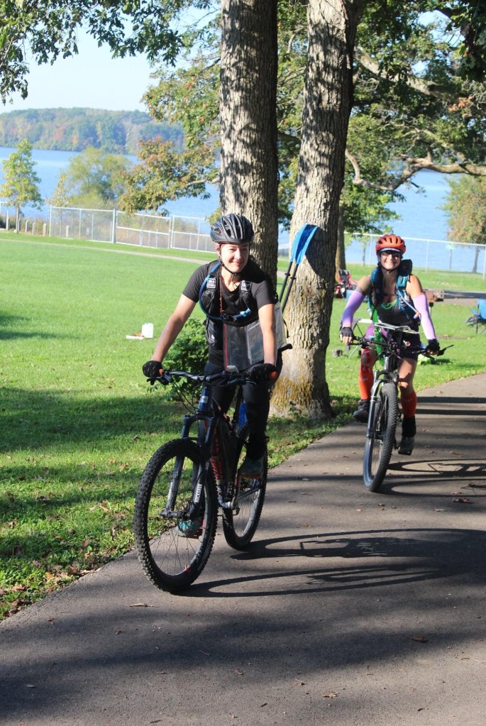
The bike leg started with a short trail section on a spaghetti bowl of trails! Karen let me do the nav for this race since I need the practice. This section didn’t have plotted points, just highlighted sections on a supplemental map so we could ride the trails and find the points. I actually really love this method for including points in a trail bike section! It allows the races to enjoy the flow of the trails and still pick up points. Bike nav for me means I have to slow waaaay down when we have to watch topography super close. I did mess up one intersection because I was confused on trail color but after that it was pretty quick work! We jumped onto the road instead of staying on the trail and that might have cost us some time since I missed the Greenway intersection… well, we rode right under it but I didn’t put it together until we were at the next road junction! Back to the Greenway and then up and out for a smooth sailing section. The rail to trail program up here is really nice! We went straight to Losantville and then headed due west to Summit Lake Reservoir. At the park we had to jump into the foot section since all of the boats were in use at the time.
Stage 3: Trek 6.0 miles
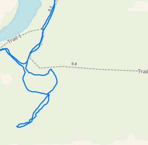
The trek was 4 points fairly close off trails. The first one was a quick out and back before heading into the loop for the other 3. Karen and I opted to not run this section since we still had a big bike to get back. We did say this is our goal for the next CIA, to run sections of it! The loop seemed straight forward but once again I fell victim to the trail map and ignoring the topo. The park had created a new trail section and had a sign calling it Trail 5, pointing that direction. The original trial map we were using did not show this segment so we assumed we had the correct trail. We did find the hill, but after searching for the CP, we decided to head back to the trail. This was when we ran into team DINO who had made the same mistake as us. Knowing the CP wasn’t behind us, we went out the other side of the trail, which was wrong based on the trail we THOUGHT we were on. Yep, the CP was at the top. One thing I love about Brian’s races is the CP’s are always were they are marked on the map so I knew we’d goofed somewhere. After the race analysis showed that there is a new trail in use and if I’d followed the topography more, I should have picked up on it! From this goof on CP15, we went out for the next one and instead of doing and out and back we continued on. The thought originally was to maybe cross country over but looking at the “field” that was a big NOPE. It actually worked out perfect for us since approaching from the east allowed us to step out to the lake shore and get a view of what was happening. From there it was just a matter of choosing an entry point to access the CP on the tree. Leaving this one we ran into Steve’s team coming back since they’d overshot it.
Stage 4: Row Boating 2.7 miles
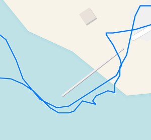
Ugh. So we had the option of a metal John boat with oars or an inflatable boat with 2 kayak paddles. We had originally planned on the inflatable but given the windy nature and the fact we’d be kneeling the whole time, we opted for the John boat. Did I mention that neither of us had ever rowed a boat like this? I started out facing the entirely wrong direction (forward on the back seat) before deciding this couldn’t be right! Then I remembered seeing people facing backward while rowing, so I tried that. Marginally better! The biggest issue was that my right side is so much more dominant than my left, so we went in some semi circles for a bit. Eventually I just had to shut my brain down and slow the whole process. Smooth is fast after all!
Stage 5: Bike 26.4 miles
Back to the bikes to get home to the start area. We plotted all the points and knew we had time to pick them all up since the roads were mostly flat and we could cruise. The route choice was pretty straight forward, we did have one section where we weren’t sure if the road went through or not (it didn’t). Not a big detour though! Working our way back it felt like we rode into the wind the whole time. One of the CP’s was at a neat bike shop, the Greenway 500. They had snacks and water available and we had to do a short bouldering scramble on their rock wall to get our CP punched. Fun little challenge! We came into the Start/Finish TA with plenty of time to do Stage 6.
Stage 6: Memorizable Trek 2 mile
This stage gave us two options. Option one was to memorize the map and go out together. Option 2 was to send one person out to punch and the other gave directions via a walkie talkie while getting to look at the map. We chose option one! I wasn’t sure how many notes we could make so Karen and I just did our best. I learned later that we could have drawn out whatever we wanted. The CP’s were grouped in 3’s, one group to the south and one to the north. Getting 3 punches = 1 CP. We did the south group first since it was closest. No major issues except we missed the first one we went for but got it on the return. The next group to the north was more spread out and we didn’t remember which structure we needed to look behind. Not a big goof but did take a few mins away. During this section a runner came through who was being directed via walkie talkie! She was doing great! Karen and I made it back to the TA with about 35 mins to go and took a look at stage 7. This could be done via paddle or foot but we decided that the closest point via foot would require a level of running we didn’t want to commit to this late in the race! Goals for next year, run more in a 12 hour race!