
Two Rivers 36 hr AR – May 29-30th, 2021
Weather: 47° start, 53° high. Light misty rain at times, cloudy the whole time.
Team: Semi Navi-Savvy with Rachael and Kate
Field: 42 total teams, 4 in all Female division
Placing: 31th overall, 2nd in division
Checkpoints total: 72
Checkpoints found: 43
Time on Course: 34 hrs 9 mins
Prologue Trek – 3 mi
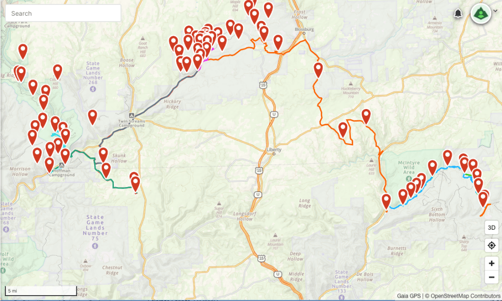
Stage 1 Trek – 14.3 mi
Stage 2 Bike – 32.3 mi
Stage 3 Trek – 5.63 mi
Stage 4 Bike – 16 mi
Stage 5 Trek/Raft – 11.5 mi (3.5 mi rafting)
Stage 6 Bike – 9.68 mi
Totals:
Trekking: 31 miles
Biking: 58 miles
Rafting: 3.5
Total Mileage: 92.5
I imagined writing this post race report while in a state of fatigue and sleep deprivation. What I did not anticipate was doing it at the hospital and that the lack of sleep would be from sitting all night with my mom. I had jokingly said to Steve on our drive home from the race that it wouldn’t be summer if shit didn’t immediately go sideways and my mom didn’t have a health crisis. Luckily she is trending better and I’ve got a night of sleep ahead of me before we do our next race!
Lead Up: So, back to the race report. Team Semi Savi Navi in this race came about by chance and mutual acquaintance via the magic of the Women of AR Facebook group. Due to the race delay of a year, the original team Rachael had planned couldn’t make it and I was able to sub in! We “met” on Zoom, chatted, and said yes, let’s do this! I late met Kate via Zoom and we hashed out the gear details and who was bringing what. The end result was a team made of 3 different decades, Kate in her 20’s, Rachael in her 30’s, and me in my 40’s! Leading up to this race, which would be my longest yet, I upped my biking and stressed about the pack rafting section. This was originally a shorter hike with a nice long paddle but due to road construction it became a much longer 12 mile hike with a lot of elevation gain. We’ll come back to this section…
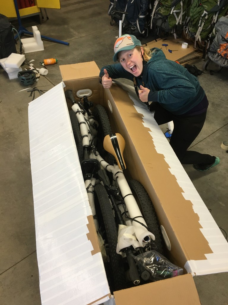
2 bikes, 3 packrafts, 2 paddles, 2 pfd’s! 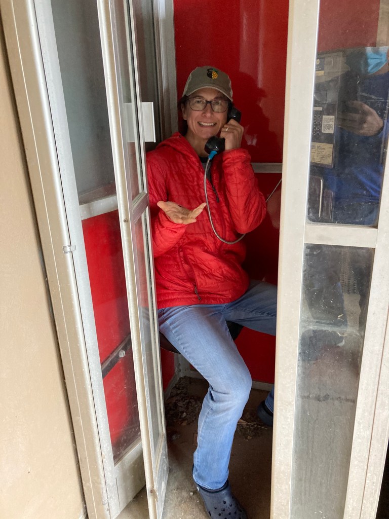
relic from the past! 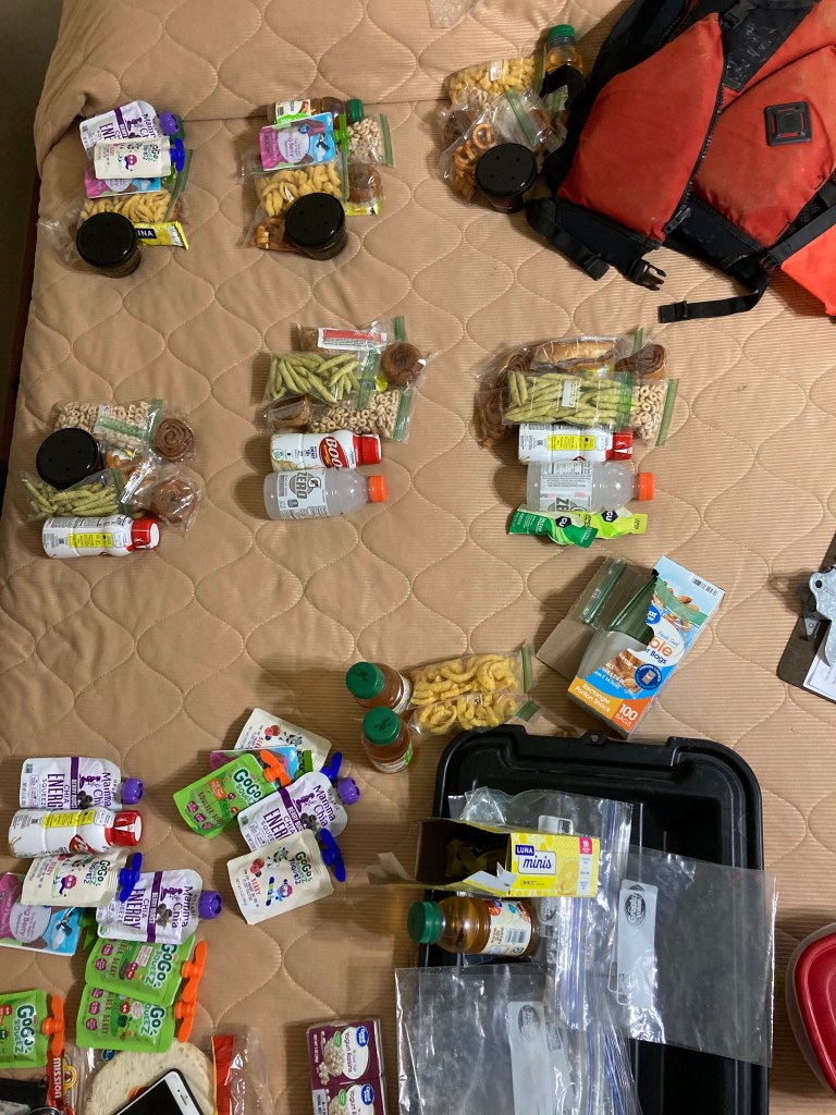
Rachael’s food bundles 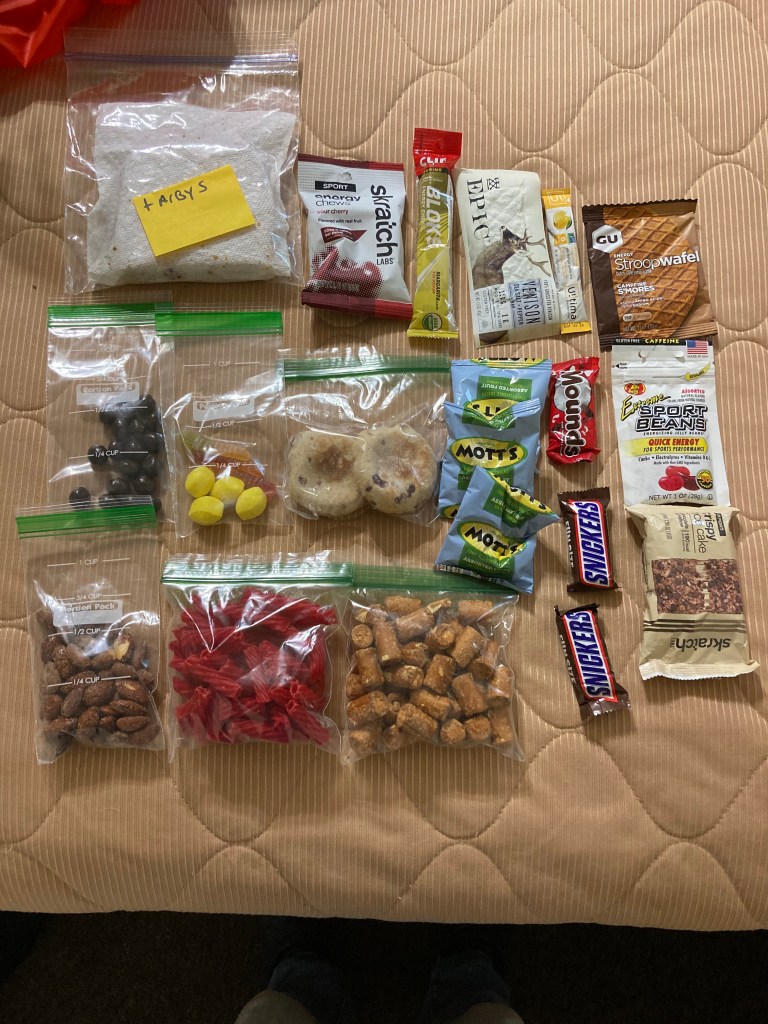
one of my 12 hr food bundles. 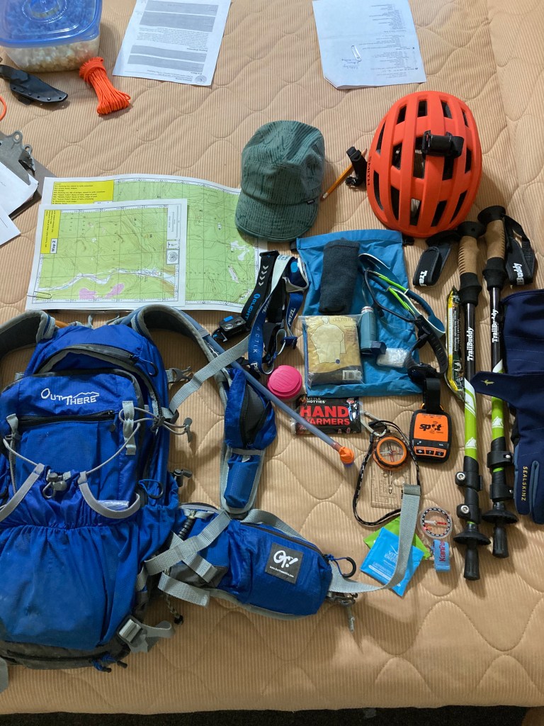
My pack with gear.
Last teacher day of school saw Steve and I packed and ready to head out to Pennsylvania. Rachael and Kate had already landed with a box of bikes, rafts, and race gear! We met up at the Ski Sawmill Resort where I was lucky enough to snag a room. The great unpack and re-pack began. This was the only race I’ve done so far that allowed/transported a gear bin that we could access at multiple points in the race. This was a great help but it only works if you remember to put stuff in it or take other stuff out of it!
The ladies had created and shared a nifty food packing spreadsheet that I quickly adopted and I decided to trust the eat about 150 – 200 cals an hour plan. I had a random selection of things that sounded tasty and I felt pretty ok with it until I saw Rachael’s pile! She is a food packing master! I’m still not really sure what Kate ate during the race other than shok bloks! TA bin packed, I set my bike up and stuffed it in the bed of the truck so we could quickly load the other bikes on the rack in the morning. We had an hour drive to the start, with a bike drop on the way. We had the first section of maps to look at but there weren’t a lot of route choices to make, so off to bed in prep for an early morning.
Saturday: Alarm at 4:30 am, burrito pick up at 5 am, paddle bag & TA bin drop off at 6 am (with a quick kiss for Steve as he headed out for the 15 hr race), we were off to the bike drop. During the drive I learned what a beaver deceiver was and how it helps to keep beavers from damming certain areas. I also learned some other lingo and during a fit of laughter, missed our turn to the bike drop. First nav fail on my part! A quick U-turn and off to the lumber yard we went. The bike drop was plush! A covered area for the bikes (have I mentioned the rain yet??) and a port-o-potty. We could leave a small bit of gear here that we would take with us when we left on the bikes. I was supposed to leave a 6 hr bag of food, that included my 1/2 Arby’s sandwich but it never made it out of the gear bin. The start was another 35 min drive to a very small camping and hiking area.
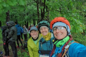
Blurry start picStart: After some encouraging words from Brent and a moment of silence to honor the racers the community has lost, we were given 2 identical prologue maps. Kate took one and raced out to C (or P or 1, I can’t remember and don’t have the map anymore). I headed across the creek for the other 2. One was up a small reentrant and the other was in a small clearing. I made the decision to just cross country back and cross the creek. This was only the first of MANY creek crossings! I think this was about a 3 mile jog, easy points to find, then report back to the start to begin the true Stage 1.
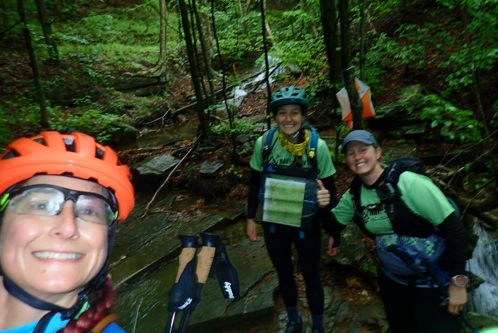
Stage 1 Trek: This was the Rock Run trek which basically just followed the creek, with 8 mandatory points plotted and 9 pseudo-optional F points that were not plotted. The F points would be easy to find if we stayed in the creek. The caveat was for every missed F point we would incur a 30 min penalty. The trek started easy, heading out an old logging road and Kate navigated us to our first CP. From there it was a lovely forested hike, picking up CP’s along the way.
All the cheese at a CP! 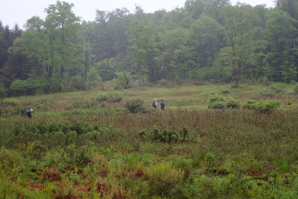
Can you feel the moisture??
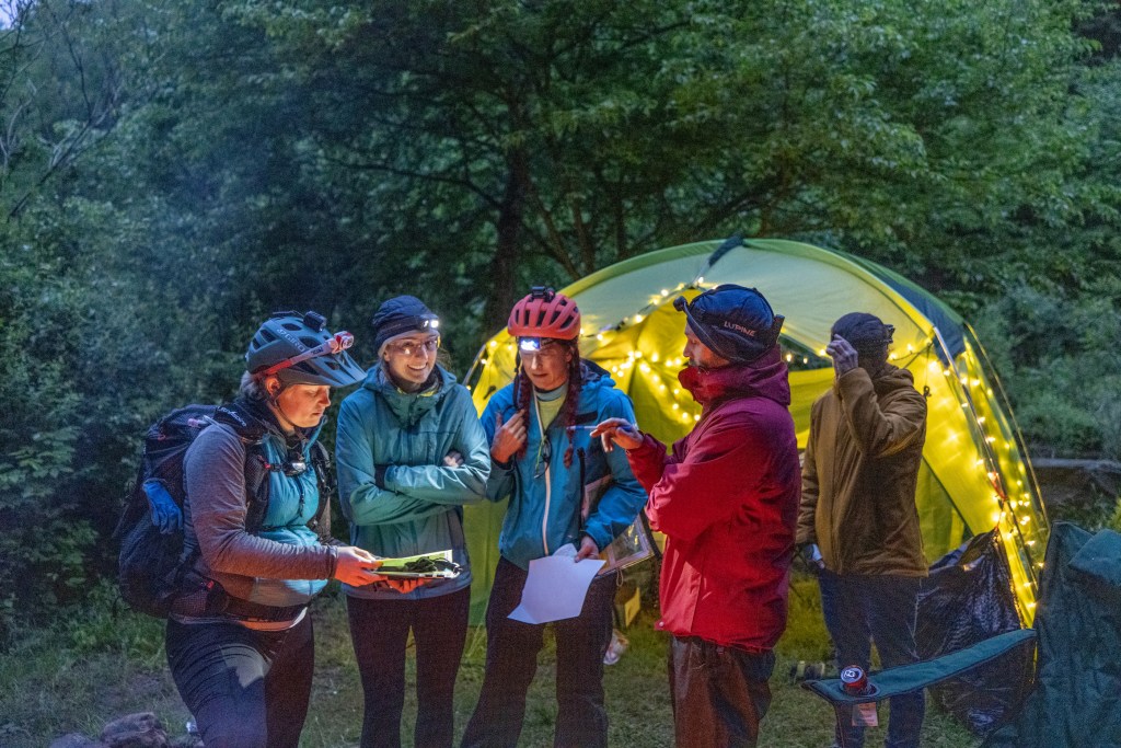
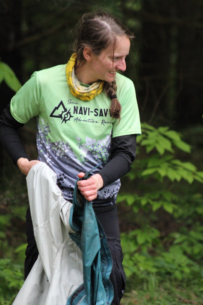
Once we descended into Rock Run, the navigation was less of an issue but the staying upright became a major issue! For me it was basically a 9 hour continuous fall, with momentary interludes of balance. The brown moss/algae was super slick, such that even standing still on it, the current would skate you across the rock. I had decided to bring some trekking poles with me and these made a big difference in my ability to navigate the fast flow and not fall over. Rachael was basically a mountain goat for this section, consistently in the lead and finding the best path. Kate channeled some penguin energy at one point where there was only one way around a rock face and after waiting a bit, hurled herself off the ledge into the chest deep pool. Of course we followed! I’m normally really happy to do a creek hike, but I think I was over this one after 4 hrs. Had the weather been just a bit warmer it would have changed a lot! Going into the is section, I felt pretty smug about my water proof knee high Randy Sun socks. After a full immersion though, I had what amounted to water balloons on my feet and it made the footing even more challenging! I did finally find a spot to lay down flat, take my leg to the sky and then squeeze the water out of my socks. At the manned CP, I took a second to remove the socks, leaving my thin liners on to finish this section. We continued our search for the mandatory CP’s and the elusive F points. We managed to clear this section and with hooves for feet, clomped our way into the bike drop TA at around 5:15 pm. This TA was magical! We lost a good hour there due to the black hole of the warming tent, but it was necessary for both physical and mental health! This was also were I discovered I had forgotten to put the rest of my food on my bike and had instead left it in the bin, which we wouldn’t see until TA 2. After drying out and warming up and planning our next section (with a brief glance at the entire race now that we had the maps) we headed out on the bikes.
Stage 2 Bike: This was the first bike leg and it officially had more maps than mandatory CP’s! 6 maps, 3 mandatory CP’s, and 7 optional points. We knew we’d have to cut some optional points from the course in order to see parts of the whole race. Some of the bike points were located in old mining areas with a spaghetti bowl of roads that we’d be navigating at night. We planned on picking up what we could without risking getting lost and spending too much time out there. We had set a deadline of leaving TA3 after the second trek by 6 am in order to get to the rafting section. We took about 5 hrs on this section, making some on the fly changes to routes. One was the decision to not take the trail from D to F,. We treated it as an out and back and then traveled through the literal sleeping town of Arnot. This was a great move since remember earlier when I was so proud of having gotten my bike stuff together and loaded the night before?? Yeah, I totally forgot to charge my torpedo bike light. In the initial planning we really figured we wouldn’t be doing the bulk of the bike in the dark, so I have left my mega light in the bin. Luckily Kate had a great bike light and a great helmet one, so she loaned me the bike one. We missed the parade in Blossburg but were able to score some road candy when we crossed the bridge! At this point I was in a bit of a caloric hole and would have eaten just about anything someone handed me! Most of the bike CP’s are sort of a blur at this point but I do remember being stunned by the depth of the mine “pond” near one point. I would have loved to have seen this during the day! Rolling into TA 2, we found all the luxuries! Port-o-pots! Our gear bin! The warming tent! I tore into my previously frozen burrito and Starbucks double shot espresso like a ravenous raccoon and it was amazing! Thanks to Kristy for sharing this great idea! I also decided to break out the Run-Goo for the first time since we knew we’d immediately be getting our feet wet. I knew racers loved the stuff but I’d been a no cream racer up to this point! This race changed my mind and now my tote has ALLLL the cream! Fed, lubed, and rested, we headed out on the trek around 11:35 pm.
Stage 3 Trek: This section was entirely in the dark for us, and I wasn’t much help since my night navigation is weak. We only had one mandatory CP and our plan was to get what we could in the area around it. We headed up the road and dove into the woods at what we thought was LL (a historical marker). After not finding and on a timeline, we decided to catch it on the way back and headed on up the road. Not 100 meters down the road we found a huge drive, right to the marker… and so began a rather humorous trek in the dark! Next up was to find the trail and the one mandatory point while picking up few others. We found a trail that was well marked and took us down and across the creek. On up we were looking for W, a rock shelter. No dice. Ok, we’ll look for that one later. On to M12 (Sand Falls). Here’s a late night funny: my brain read the words sand falls and for some reason I was thinking like a sand mine, and walls of cascading sand… it occurred to me while standing in a creek that perhaps I misunderstood the clue! We kept looking for a dog leg in the trail after traveling NE. This never happened and we paused to regroup. As we were trying to figure out what happened one of the lead teams comes barreling down from the north and let us know we were not on the trail we thought we were. To be fair, the instructions did warn us that there were many more trails and old roads in the woods than are on the map! Back down the hill, we found the intersection we were supposed to be on and from there made our way to M12. There was fairly steep track down to the base and Rachael headed down. When she got there though, she couldn’t find the passport! Much panic ensued as we traced our steps in the immediate area. She came back up and Kate double checked all the pockets, luckily finding the passport tucked into one! I offered head down and get the CP and from there it was up and over the top of the falls and on to V for another optional point. This put us at around 2:40 am. We headed back to the junction and picked up W then decided we had time to trek back out to Z, which was off the trail we had originally traveled up. Now it was 3:30 am and we were holding it together really well! Fatigue was a thing but no-one was falling asleep while walking. Kate had some knee pain so she took some Advil and I slammed another double shot espresso. We decided to head back to TA ahead of our timeline in order to get to the rafting section. Back at TA we did a bit better time wise, not getting sucked into the warming tent for too long. Brent gave us the safety lecture about the river entry points for the rafting and we hopped on our bikes for stage 4.
Stage 4 Bike: This was a short bike with only one CP. From what I can recall, it was a lovely bike ride as the sun rose. Of course, we didn’t see the sun, but it did come up! We pushed bikes up a fairly big hill to M13 then had a fast ride down the 15% grade of Wilson Hill road! We zoomed down and into the town of Blackwell and onto the rail trail that brought us to TA 4/5. Spirits were still high at this point.
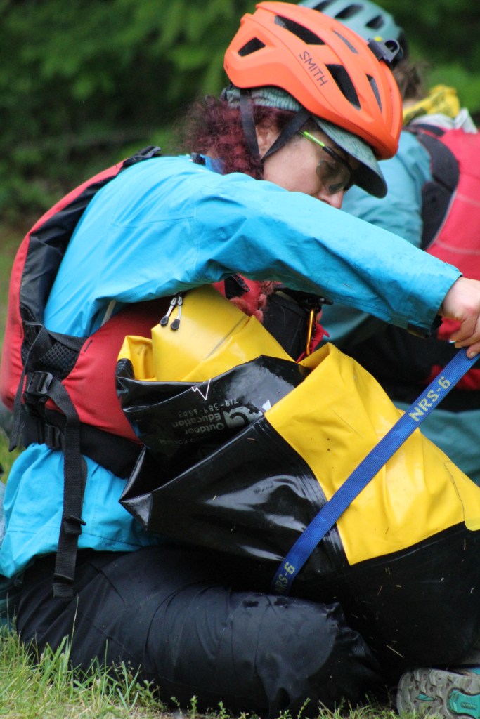
Stage 5 Trek/Packraft: If you refer back to the beginning of this wall of text you’ll note that I said I was most concerned about this section. It wasn’t the fear of doing a new skill (packrafting), but more the concern that I would bonk on the hike up. I was correct to be concerned… Brent had cautioned us to make straight to the put in and not dally around trying to find the CP’s on the outskirts. We headed up Bohen trail, the key word being UP, with more up to follow, and then some more! We went from 850 feet to around 1700 feet during this climb. We had 2 spots we could for sure put into the river, one about 1/3 of the way up. A midway put in was a potential but it hadn’t been scouted. As we came to the first option, we were about 3 hrs into the completely up hill hike. I hit the wall I was afraid of, totally falling apart. I just suck at carrying weight up hill apparently! We re-grouped and tried to come up with options. We had at this point realized that the lovely 15% grade hill we had come down was also one we had to go UP to get back to the start. This was a bit soul crushing! The bike back was only 12 miles but we wanted to budget 3 hrs, including the packing up time at TA 5. Meaning we had to be off the river at 5 pm. Staring at the map, feeling defeated (I can only speak for myself here), we weren’t sure if we could make it to the top put in in time. We decided to just try for HH or GG, then hit JJ before descending to the river and PP. Up the reentrant we went only to find the trail peters out. I had to admit but I was completely useless at this point, not even looking at the maps I had to see what I could offer. We backtracked to the trail and snagged JJ then went up to the top cross county style to aim for HH. What we hoped to find was a lovely open flat area. What we found was a tangle of thick understory that was darn near impenetrable! It was while ensnared in such a tangle that Kate and I decided we were no longer having fun. Rachael succeeded in finding a trail and we again re-grouped and decided to just get off the mountain. Looking back at our trace, we were not even half way to HH, so I think we made the right call. Back down to JJ, then a downhill hike to PP. It was during this downhill section that Kate’s knee pain from the night before made a resurgence. Every step was a stabbing pain but she was a trooper! We made our way down to PP and then the river. The raft inflation went fairly quick and once we were on the water, it felt great to sit for the short 3 mile paddle downstream. We grabbed the two river points we could and then too quickly we were back at the TA. Kate’s knee was not happy about the sitting and no moving, so she took some excedrin for the final stage back. A little caffeine is a wonderful thing! We packed the rafts up as quick as we could and then headed out.
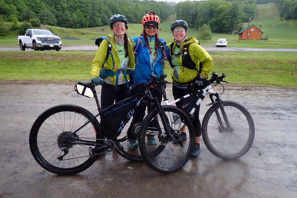
All of us were captured at our best after the rafting section! 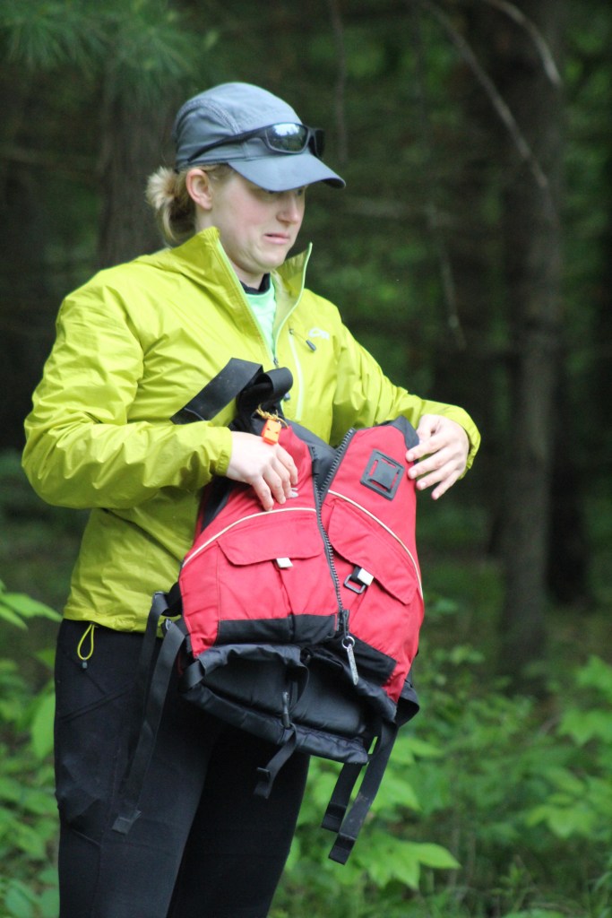
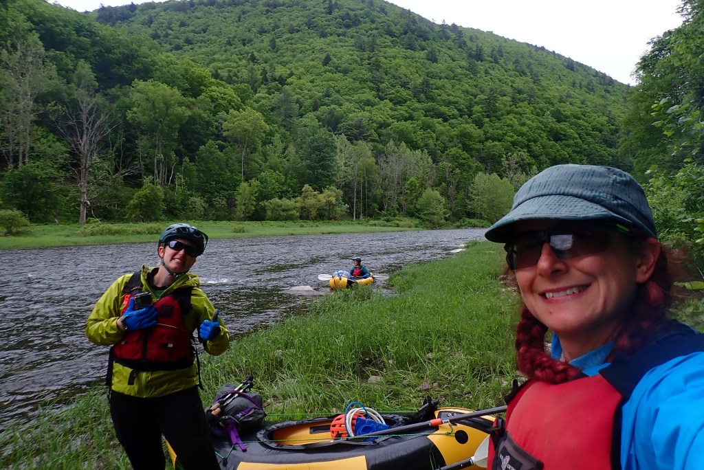
Putting in on the river! 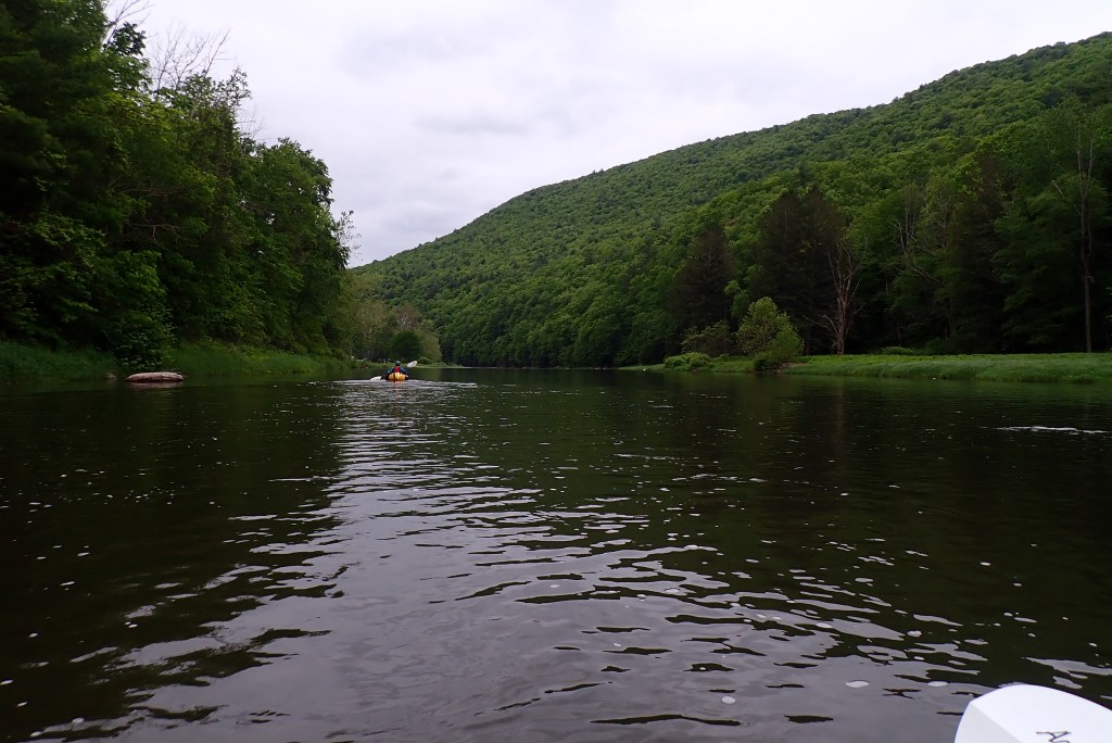
This was soooo nice!
Stage 6 Bike: We traced out an alternative route back to the start that would leave out the epic hill climb. It would be the same gain in elevation but over a longer grade, making it perhaps better for aching knees. We headed out and after a false start, found the alternate road. Not super encouraging, a guy on his front porch yelled out to us that we were going the wrong way… All of the other teams were also heading up the epic hill. As we rounded the corner, the road wasn’t in great shape. Kate decided she’d rather do the epic hill since at least we knew the road was rideable after the hill part. On up we went, walking when we needed and riding when we could. The mist that had been part of our landscape became more of a drizzle as we found the last CP. It was a clue that said Camp _______. At the exact location of the CP, there was a sign for camp fire wood and Camp Caribou. So to be safe, we wrote both! As the rain picked up so did our pace, eager to get back to the warmth of the lodge! Wet, tired, and full of smiles to be done, we rolled into the finish!
Wrap Up Thoughts: I had two main goals for myself this race, one was to no fall apart at night like I did at Nationals and the other was to be stronger on the bike. I feel like I accomplished both of those, so yay! Now to address my weaknesses. I should have been a more active map reader and route helper. I took a backseat because Kate and Rachael are just so fast at it! I need to train with a weight vest on and do more sled pushes to simulate the carrying a heavier pack uphill. Looking back at that section, if I could have held my shit together just a bit longer, we were pretty much at the top of the hard section when we reached JJ. From there to NN was a hike still, but without the horrible elevation changes! Because I had stopped looking at the map and because I still have a lot to learn about topo, I didn’t see this during the race. This was probably the only thing I’m disappointed about for this race! It was a lot of adventure poured (see what I did there) into a quick 36 hrs! I’m thankful for Rachael and Kate allowing me to tag along!
