The Fig 2020 (Virtual sort of) – Nov 14 2020
Weather: 40° start – 54° finish, no precipitation
Team: Solo
Field: ___ total teams, ___ in solo female division
Checkpoints total: 30
Checkpoints I found: 12
Time on Course: 10:27 – (7:51 am – 6:18 pm)
Placing: Not sure yet!
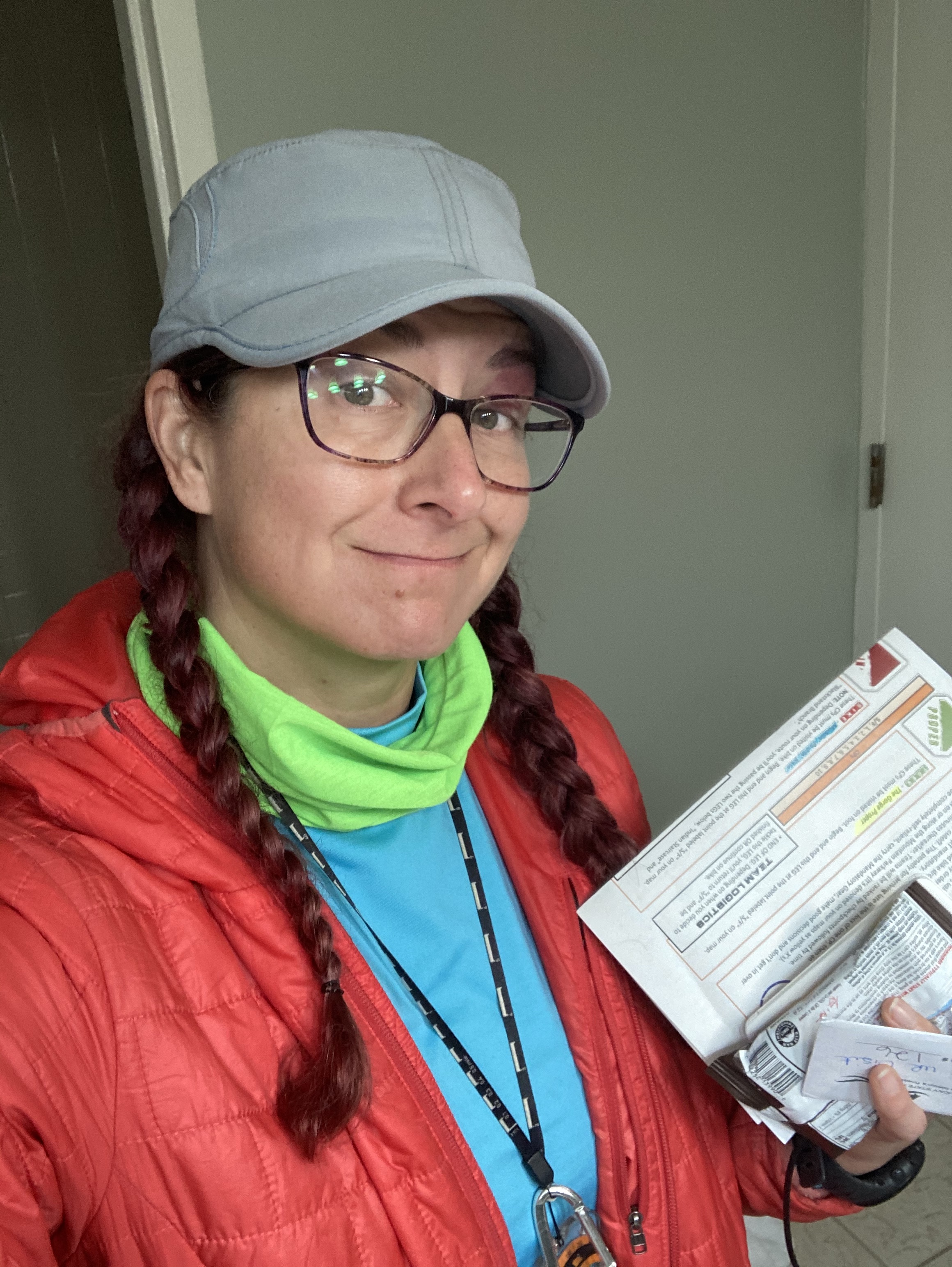
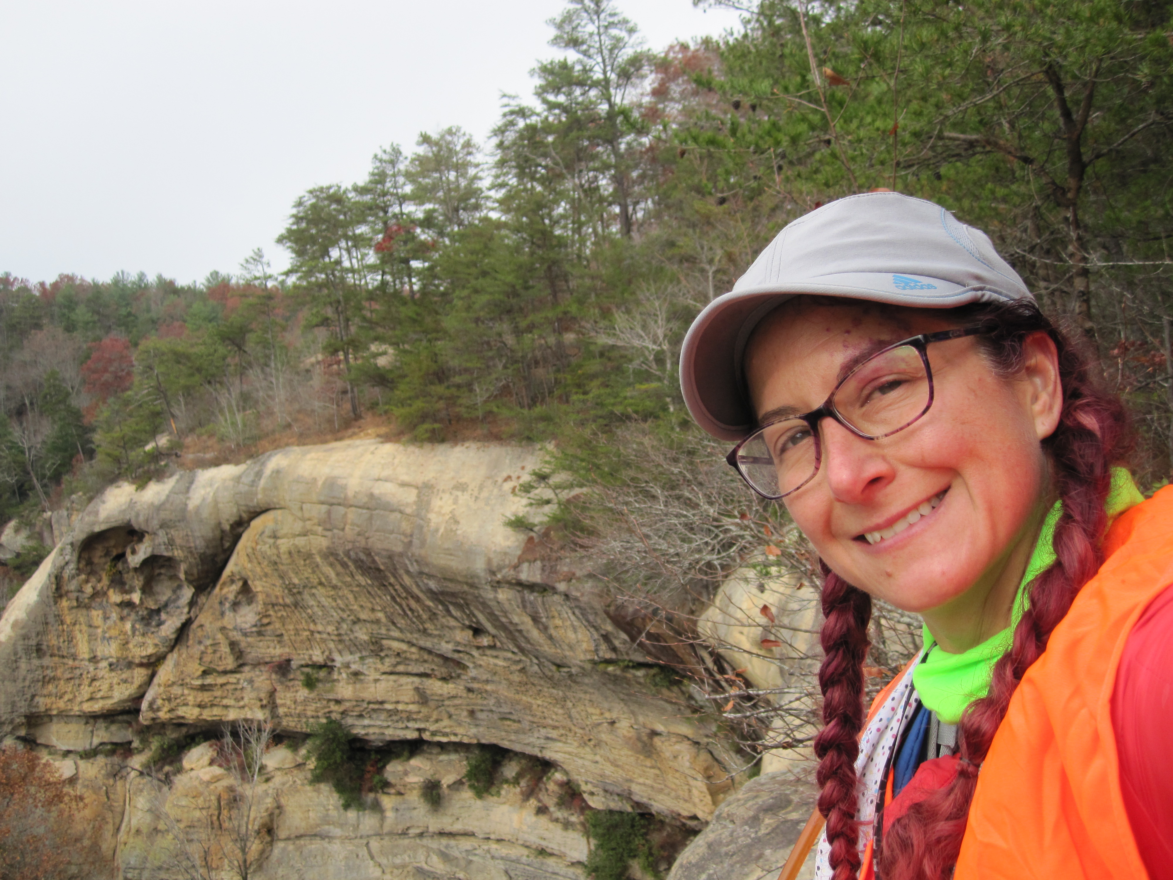
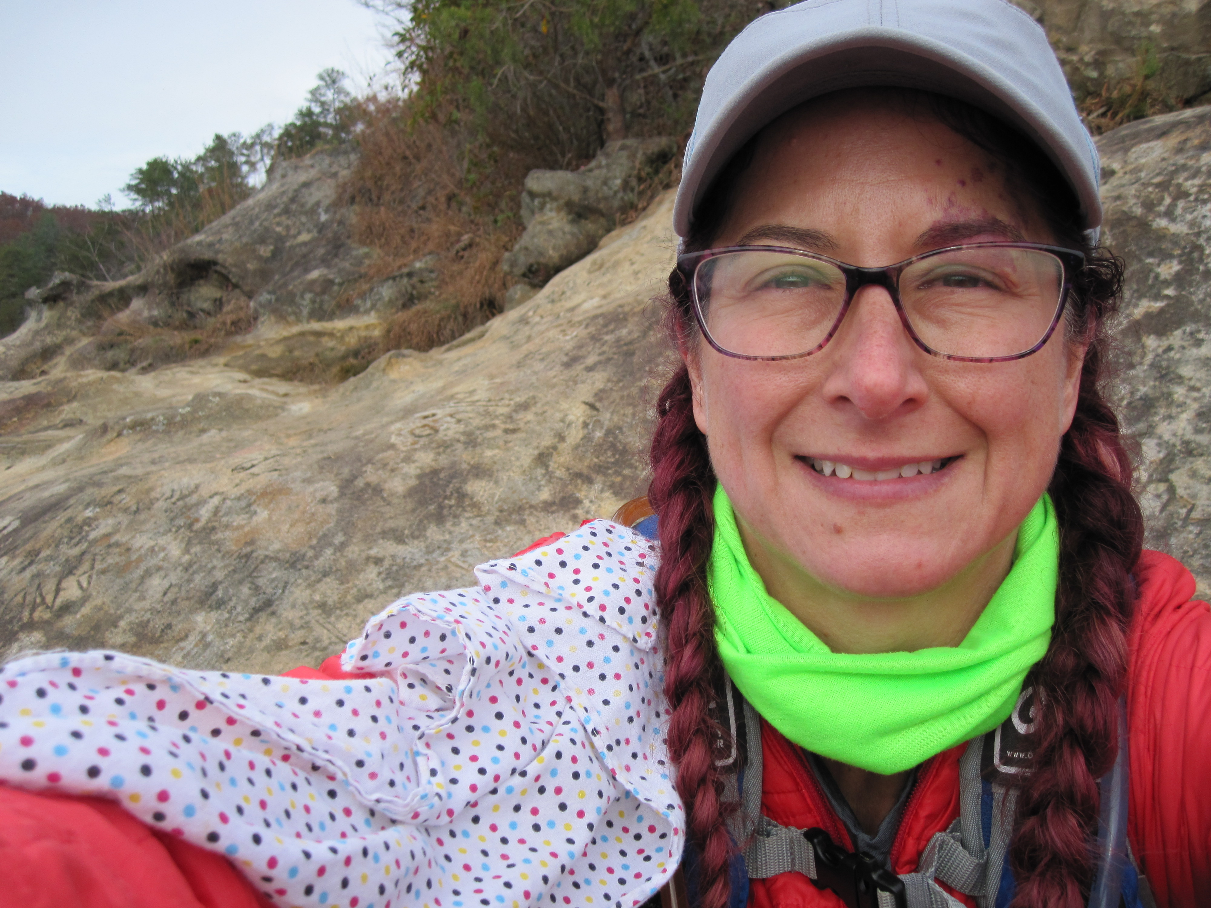
I’m writing this a week after and I’m sure I’ve forgotten some things… but this being 2020, it will be fine, everything is fine! If you are new racer and found this blog, I’ve listed my gear and what I used on this race. Feel free to message me if you want more details!
Our original plan was to head down to the Gorge the first weekend the course was open, when the weather was amazing! Unfortunately, Steve came down with a wicked (non-Covid) head cold and we decided to postpone until he felt better. The following weekend was still decent weather forecasted so we found a room at the lodge and started packing. Due to our school going virtual for that week and beyond, we were able to head out and NOT arrive in the dead of night. The Hemlock lodge in the Natural Bridge State Resort Park is a nice place to stay, centrally located to lots of cool things but unfortunately this year, also 30 mins away from the start.
I’m trying to get better at packing everything the night before to minimize the morning freak out. I’m also trying to pack less stuff, but when I’m a solo racer, I like a little extra security (and extra snacks)! This time I made sure I had my bladder closure, all the necessary equipment, an assortment of foods, lots of layering options, and gloves!
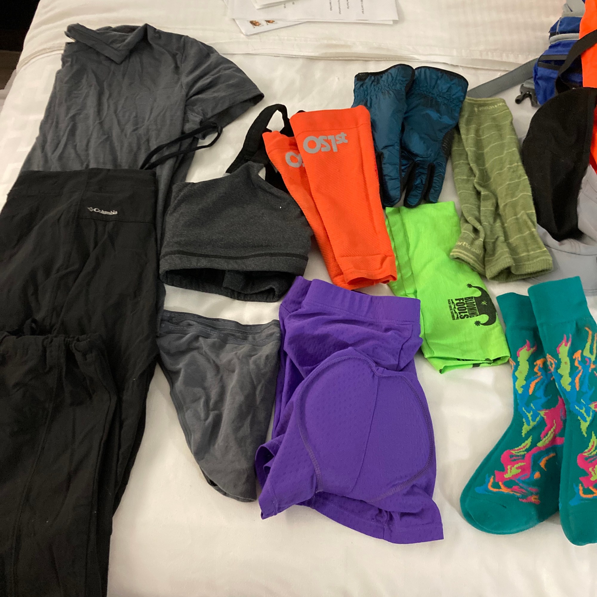
Clothing:
- Long Underwear w/reflective dots
- Bike shorts
- Columbia think hiking pants (if only they had freaking pockets!!)
- Randy Sun short waterproof socks
- OS1st Compression sleeves
- Merino wool tee shirt
- Smartwool arm sleeves
- Underarmour long sleeve mock neck
- Buff for both warmth and for a mask
- Brimmed hat
- Gloves
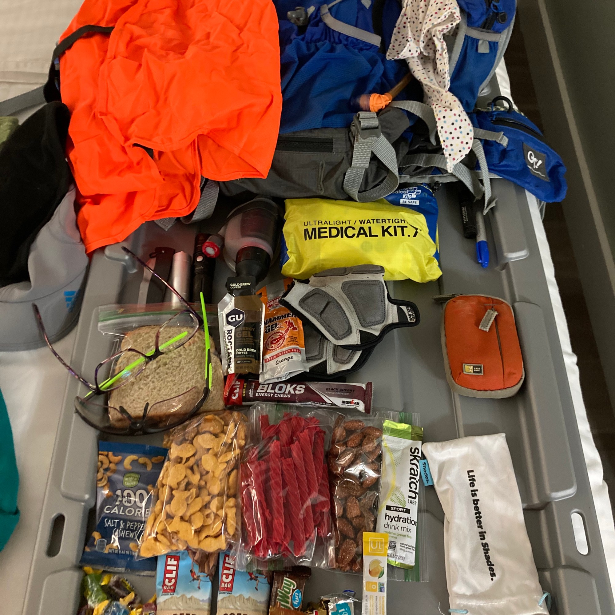
Here is the non food items that went into my OutThere MS2 15L pack:
- Med Kit – paired down to what I’d actually use
- Water filter
- Knife
- Cell phone turned off
- Garmin Fenix with battery pack (embargoed in pack but used to track post race)
- SPOT device
- Fenix hand light
- Bike Gloves (never wore them this time)
- Chapstick
- Sharpie
- Caffeinated Gum
- Rudy Project sport glasses (I need prescription lenses…)
- 1 pack hand warmers in case
- 3 Liter Dual Hydration pack – I freakin love this bladder! One side for water, one side for electrolytes! – emptied it completely by end of race.
Food Items:
- 1 PB & J – eaten
- 2 goo packs
- 1 shockblok
- 1 small pack cashews
- Full zip baggie of goldfish mix cheddar and pretzels – mostly eaten
- Full zip baggie Red Twist licorice – eaten
- 1/2 full zip baggie of garlic almonds – 1/2 eaten
- 2 mini cliff espresso bars – ate 1
- 4 mini candy bars – ate 1
- Handful Jolly Ranchers
- 2 hydration sticks
Bike Items:
- Map Board – love it but want the angled bracket so I can see my compass and bike computer better
- Handlebar mounted compass – this thing is tiny and silly but dang, it really makes it quick and easy to check directions! 100% would recommend!
- Handlebar mounted mirror – I don’t care how goofy it looks, I won’t ride without it now! I hate having cars come up behind me with no warning, so now I can easily check! Plus it folds down for trails.
- Bike computer – allowed and super helpful but don’t forget to watch the topography and map!
- Bike bag with snacks – more gummy things and sport beans.
- Underseat bag – all the bike tools that I have no clue how to use!
Back to the race details!
Saturday morning 5 am alarm! The only issue with the lodge is they don’t have microwaves in the rooms. Mini fridge yes, microwaves no. Knowing this, I thought some egg bites, sou vide style, would make a decent breakfast. Our norm for race day breakfast is the JimmyDean Meat Lovers Breakfast bowl but it requires a microwave. I borrowed the electric kettle from school so I could make hot water fast for both coffee and egg bites. I used the ice bucket, dumped in the hot water, put the still packed egg bites in, then moved on to coffee and getting dressed. My plan worked perfectly, but those egg bites are freaking nasty!! Both Steve and I gagged one down and then pitched the others. Lesson learned, don’t mess with a good thing!
We threw the remainder of the gear in the truck, and I distinctly remember Steve asking me if I had my maps and passport. I assured him I did, all safe in my map case. 30 mins of driving through winding roads we made it to the official start location, saw several other cars withs bike racks. Some of you all got an early start!! Our goal start was 6:30 am, still dark but only for about an hour. We unloaded, got all the stuff attached to the bikes, a quick kiss for luck, and then Steve was out. I, on the other hand, was not. I in fact did NOT have my passport with me… I freaked out, unhooked the map board, threw the bike back on the rack, and then raced after Steve with the truck, in hopes he had grabbed my passport as well as his. Dude had made an impressive distance in a short time but when I caught him but he did not have my passport. I opted to head back to the hotel and just get a later start. An hour and 21 minutes later to be precise.
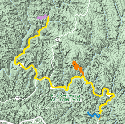
7:51 am – I had to park at the overflow lot and headed out from there. Check point 11 was my first point on the course since I opted to start on the bike. This was probably not my best option. All down hill zooming, eyes watering, fingers chilling, but an easy point to find! Then off to TA 1 for the first trekking section.
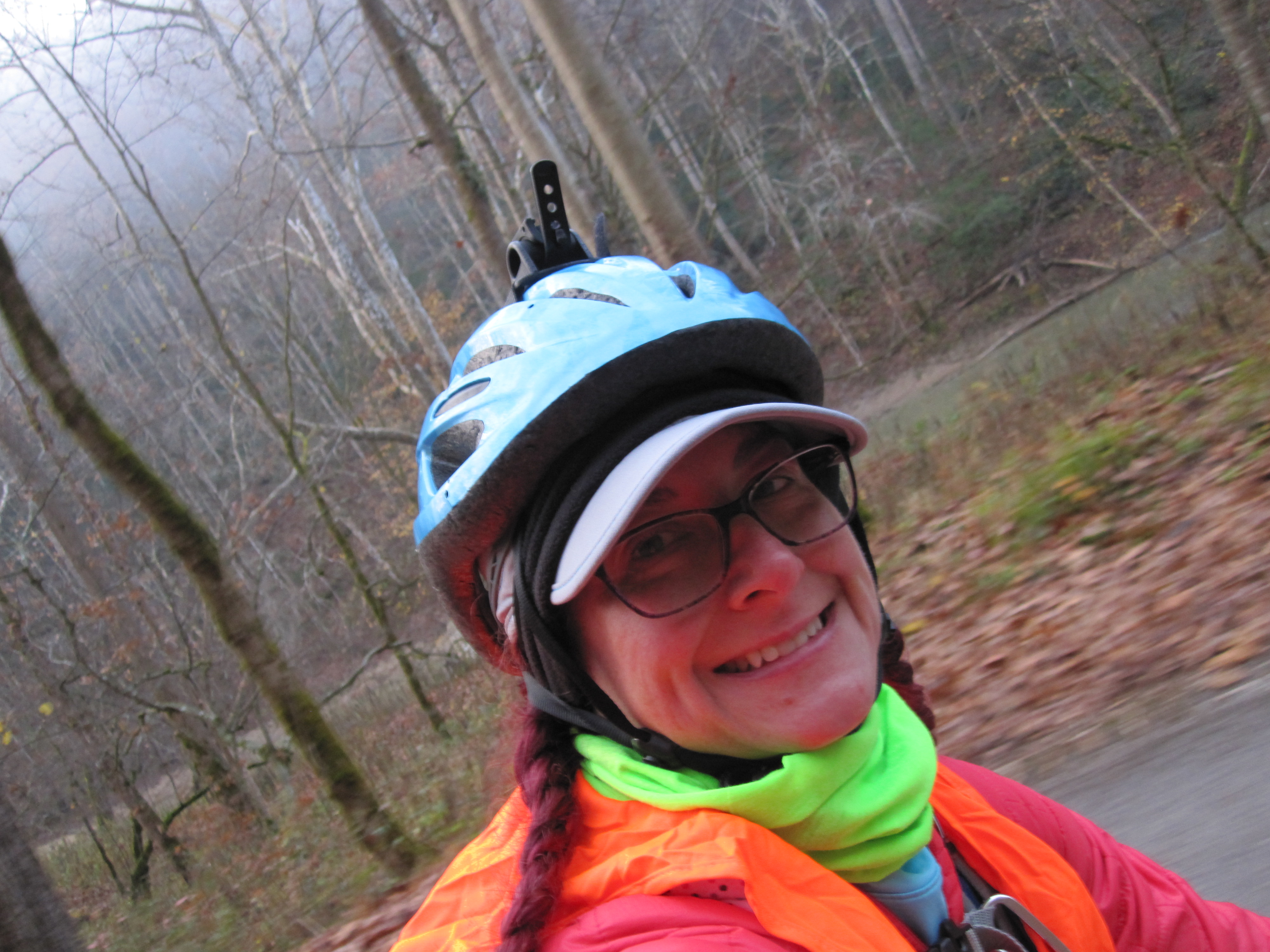
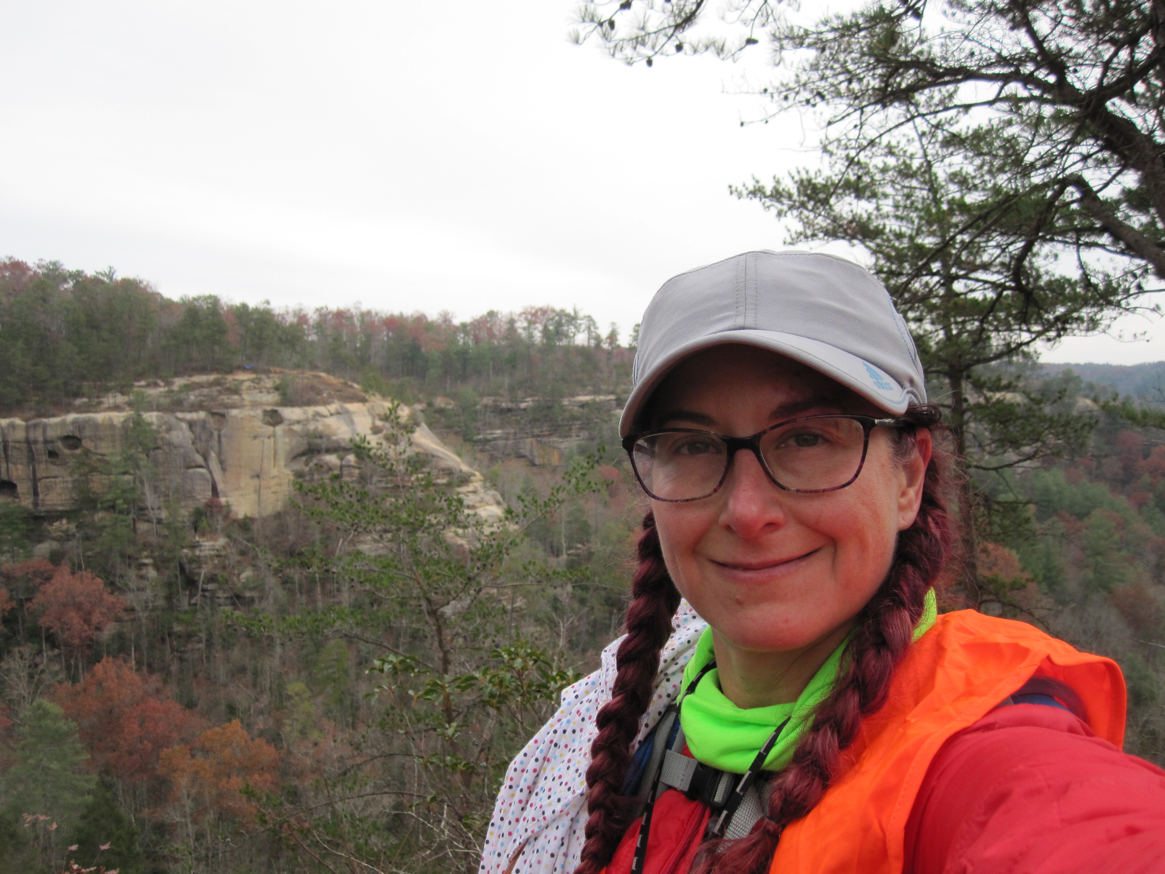
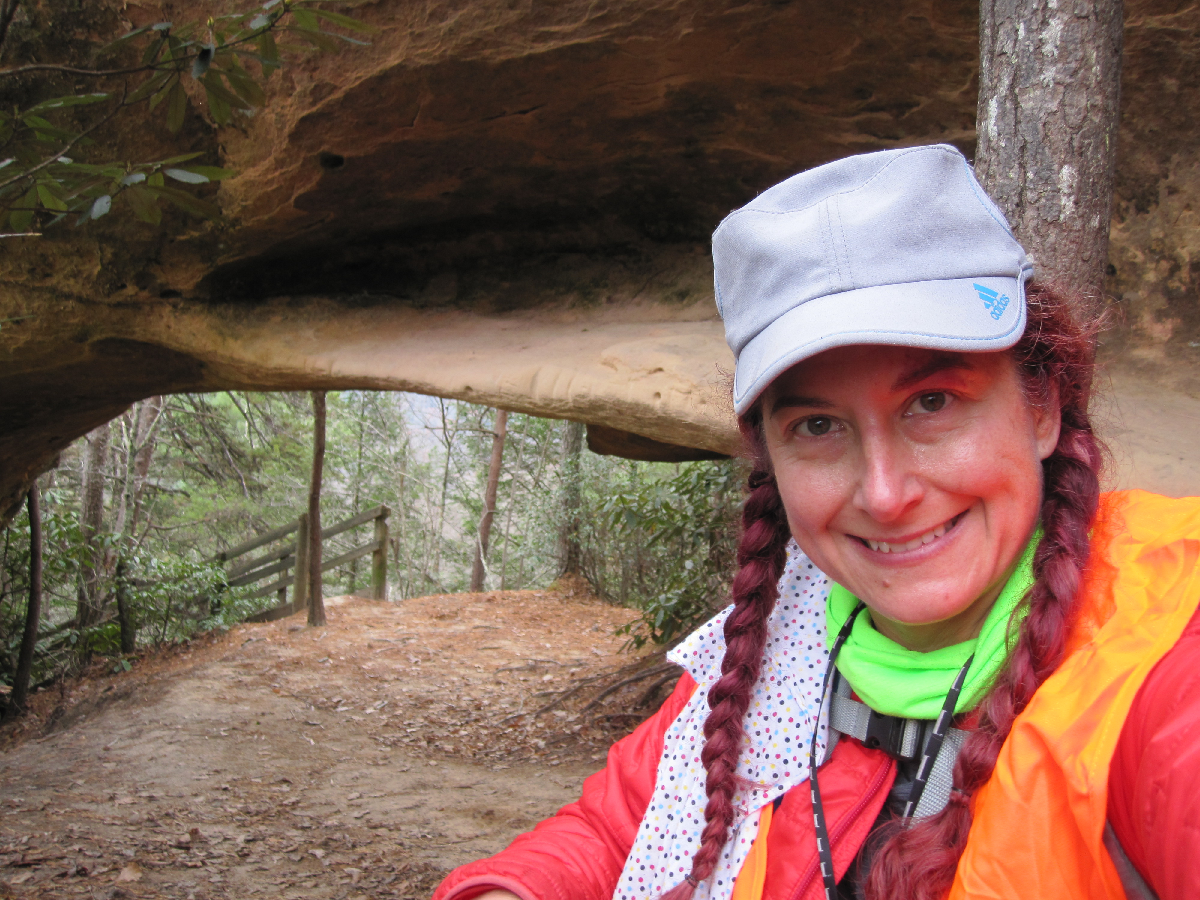
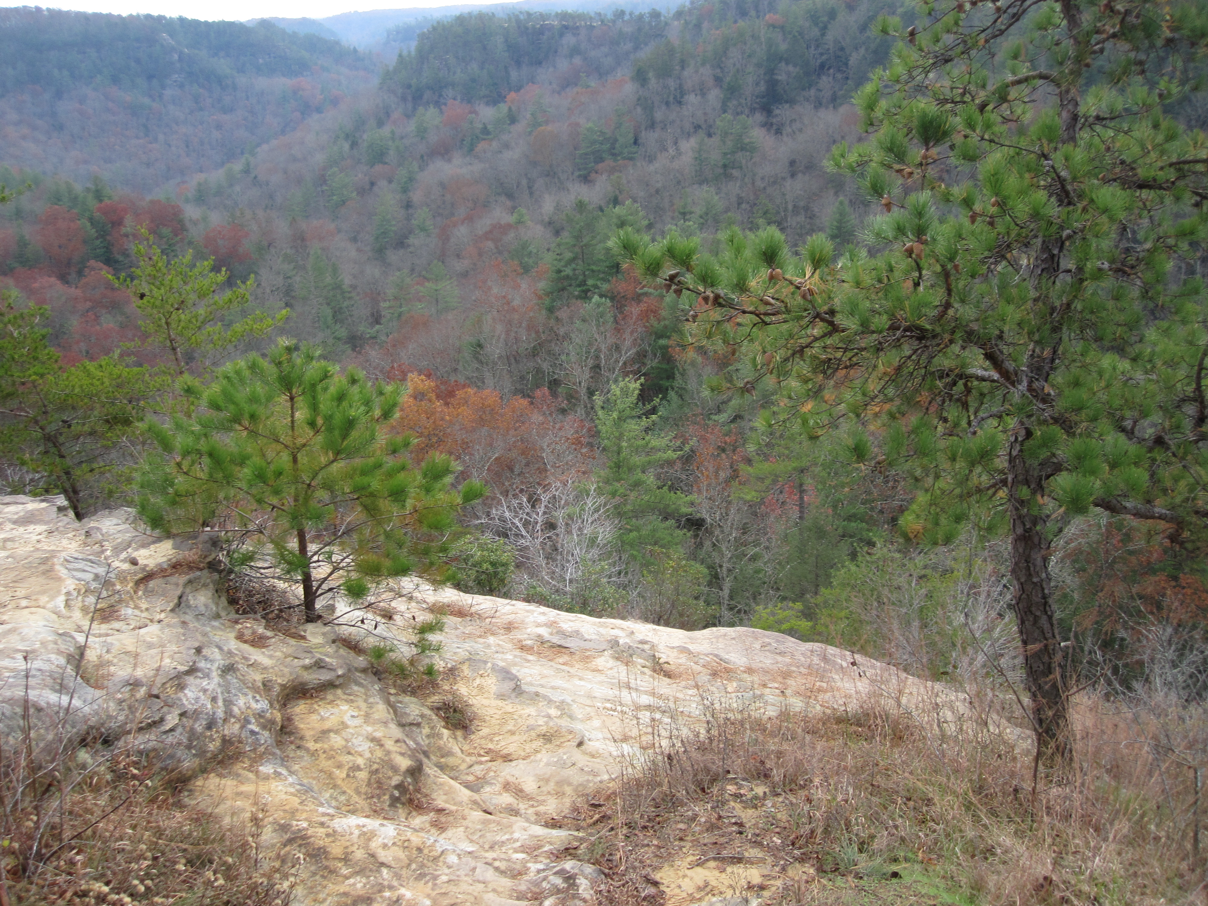
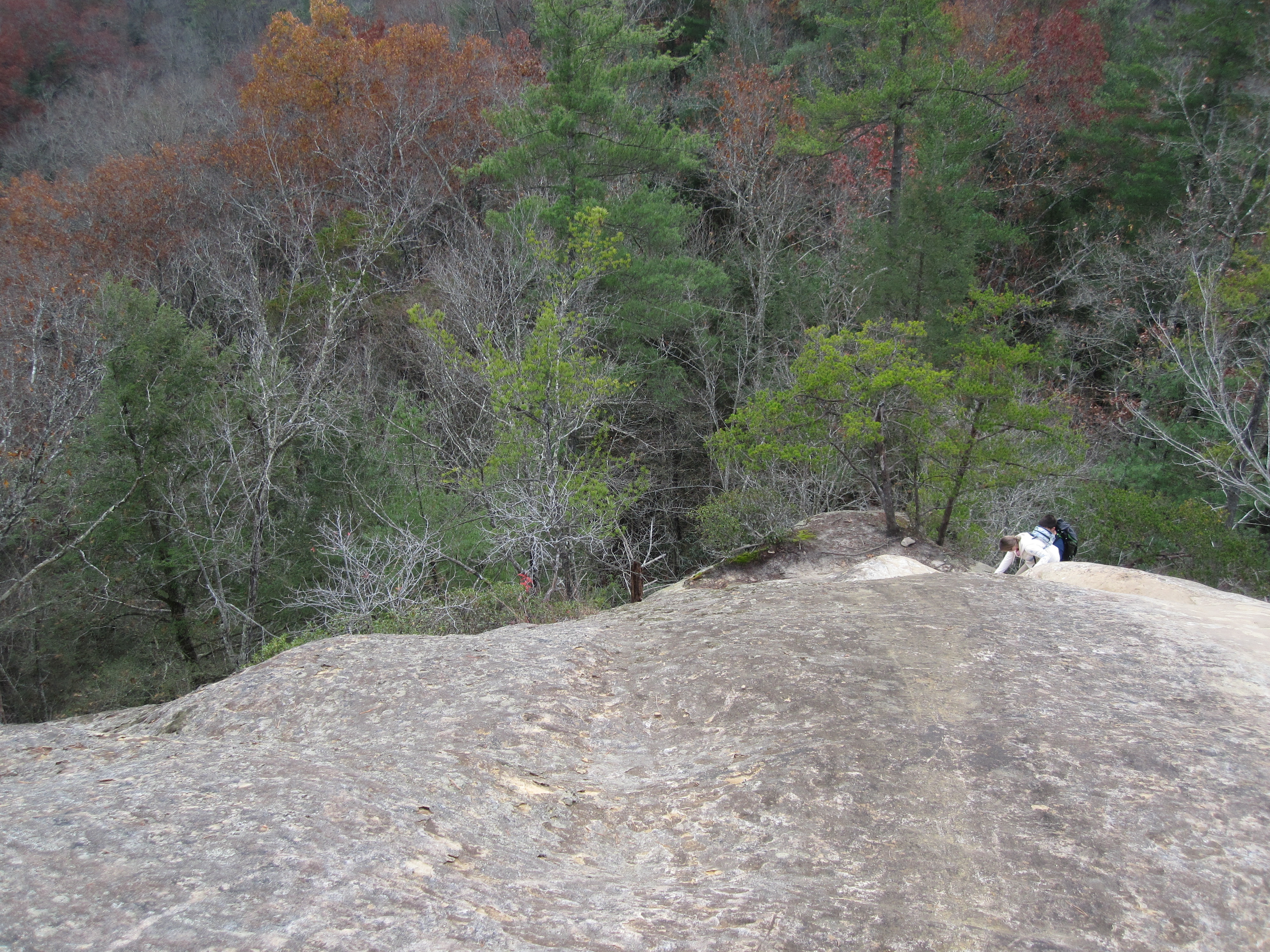
8:30ish – TA 1 at Indian Staircase. My plan was to go 21-22-23-25-24. Since this was the first trek section, I knew I’d have trouble getting the scale of the map correct in my head. Everything in the gorge is sooo much bigger than I expect. This meant the first “big” reentrant I came to expecting to find 21, was in fact NOT the big one I needed. In fact the one I spent at least 15 mins looking in and around was so small as to not even really be on the map! Would this lesson stick with me for the rest of the race? No, no it would not. I did follow my own advice of if I don’t find a CP in 15 mins of looking, move on. This proved correct as usual and just a short jaunt down the trail I found the correct reentrant and CP 21. Off to 22 I went, feeling more confident. I was quickly disabused of such feelings though. I followed the topography but also followed the trails, which is were I usually screw up. I was sure I was at the correct junction and reentrant for 22, in fact there were several footprints to indicate others had gone this way as well… Looking back at my trace and the map, I can clearly see where I went wrong. I did spend about 30 mins searching because I was soooo convinced. Then I bailed and moved on, deciding the reverse the order and head to 24 which seemed to be a much easier CP to find. I didn’t jog the trails because I really needed to follow the landscape this time! A nice walk and bam, Indian Arch CP #24 was mine! From there I did my loop backwards, enjoying a nice flat section on the top of the cliffs. The trails sort of meandered around but I just kept taking the ones that went the direction I needed. Once I hit the big junction near #25 I slowed down and paced out where I thought it would be. I was close, just on the opposite side of the trail than I expected. I headed east to find the staircase and ran into a team of ladies headed to #25. I saw a decent amount of teams on course that day, always fun to see others! The trails really began to spaghetti around and I ended up turned all the way around and ran into Casey. She kindly pointed me in the right direction and off I went, not really sure what construed Indian Staircase and where I was to take a picture. I kept going around until I found a large group of I think scouts posed for a photo op at the end of the cliff. Yep, this was the decent down Indian Staircase I needed! Gulp! It was steep but luckily not slick at all. My altra LonePeaks have some wicked grip thankfully and I scooted down mostly on my butt and soles. Going up would totally have been my preference. At the bottom I hooked around and found 22 finally! So simple when you are in the correct reeentrant! From there it was time to pick up the pace and jog it out. Back at the bike and feeling pretty good, time around 11:30 am I think.
11:37ish – Bike Leg 2 to TA 2. This was really a nice bike section! Roads were not too busy and honestly, the drivers in this section of KY are really considerate! Biking on the roads in Indiana is like taking your life in your hands so I just don’t do it. I didn’t get yelled at or run off the road a single time in KY! I picked up CP 12 quickly and then pedaled out to CP 14. I had already planned to skip #13 because it was so far out of the way and I knew I’d never clear the course anyways. I’m sure it was a lovely hike-a-bike section! I nailed 14 using topo markers and bike computer lengths. I was proud of this one since when I got to the reentrant, there weren’t any other bikes there to indicate I was correct or not. Always a good feeling to find a CP on my own! From 14 to TA 2 was just nice! I haven’t done much much biking at all lately, just too dang busy, but it felt good. Knee seemed to be holding it’s own and not causing too much of a fuss. As I came up to TA 2, I was expecting no parking lot or other indicators, as the clue was simply creek bank. So I blithely cruised right by the parking lot and straight into the creek, where I promptly toppled over because I don’t ride bikes well at all. Now I was wet to my knees but the Randy Sun socks kept my feet dryish! My ego was a tad bruised but I’m sure it was a fun site to witness! Rather than eat crow and go back across immediately and admit I’d screwed up to the other teams in the area, I forged ahead, literally. On the other side, I found a hidden spot to lock up my bike and a built up rock dam that I thought I could cross. It didn’t really matter at this point since I was already wet! Off I went, on what I hoped would take about 1 1/2 hrs to get at least two points.
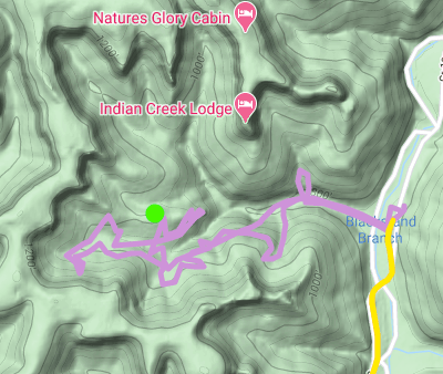
12:58ish – TA 2: I headed down the trail following the creek and saw a CP right there, like right in the middle of the trail. I was more than a bit confused, punched it on CP 26, moved on and then realized doh, that WAS the TA! TA 1 didn’t have a punch so I forgot about this one. I found CP 26 easily enough, then started pacing out to #27. I crossed the creek, saw a likely spur and also found a convenient old logging road. I meandered on, then fell victim to trail psychosis. I don’t even know what happened next. I just kept following the road, completely stopped looking at my map and compass, just zoned out and kept walking. I have no excuse other than it’s 2020 and my brain needed a break I guess? I “woke up” when I saw the giant cabin on the ridge facing me and realized I was cliffed out. This was probably a good thing since it made me go back and I had a second chance to find #27. I did try to zen around for #28 for about half an hour but it did not pan out. I did see tracks of other racers where I went, so somewhere out there is my kindred spirit in racing, we make all the same mistakes! On the way out I made another climb up the spur I thought had to be the key to #27. Still not finding it, I sat down, ate my PB&J, re-grouped, and headed out. Looking back at my trace, you can see below that I was just about on top of the dang thing! I guess I just needed to go a bit higher! In the end, this short trek section lasted over 2 hrs for me and resulted in only two points. Oh yeah, I did punch the TA on my way out at least. In the end I had to cross that damn creek two more times, once on my rock bridge, slipping and getting wet feet again, and then again when I carried my bike across.
3:15 or so – At this point I had to make some decisions. My original plan was to move on to the mountain bike section and then circle back to the Gorge trek. I knew I didn’t have more than 2 1/2 hrs of daylight left at this point and I figured with my luck going the way it was, I should head back to the Gorge now. The bike back felt great, right up until the climbing section that is!
4:51 pm – Made it back to the truck and changed my shoes and socks. The wet shoes and the bike back had resulted in some cold little piggies! I’d thrown my Altra RSM’s in the truck in case I needed them. After a quick note to Steve explaining I was heading out on the trek and had to be back at 7:51pm, I biked over to the official start/finish. I headed down the trial, racing the sinking sun. Partway down, I met Steve coming up and it was so good to see him! I was trekking down with another team in front, so I moved at their pace and that probably saved me from overshooting CP 1. At this point it was getting pretty dark, so headlamp on, I decided to try for one more CP before calling it quits. I’d gotten my thumb compass out for this section so I could practice thumbing the map more. I headed out on the trail, looking for an easier way up to #2. I found a reentrant that seemed likely, but it petered out and then I noticed that I no longer had my main compass around my neck. I knew exactly where it was, snarled in the mountain laurel bushes back at CP #1. I decided to abort my attempt for CP #2, and instead go and find my compass. This proved pretty easy, and then it was just a matter of climbing back out of the Gorge! I finally made the rim, back to the finish at 6:18 pm.
All in all, it was not my best race. Several silly mistakes and a couple of big ones. That being said, it was still a great day alone, mostly, in the woods! Racing solo is pretty cool, you have no one to blame for the mistakes, and it is a good time for reflection. Having teammates is also great though, they help keep you steady, double check the points that could become mistakes, and provide great distraction from pain!
Totals: 32.81 miles on bike, 9.48 miles on foot.