CIA by Dino – 12 hr Adventure Race
Date: Oct 2 2020 8 am – 8 pm
Team: Solo
Field: 51 total teams, 1 in solo female division
Checkpoints total: 28
Checkpoints I found: 15
Time on Course: 11:08
Placing: first in division (only one), 39th overall.
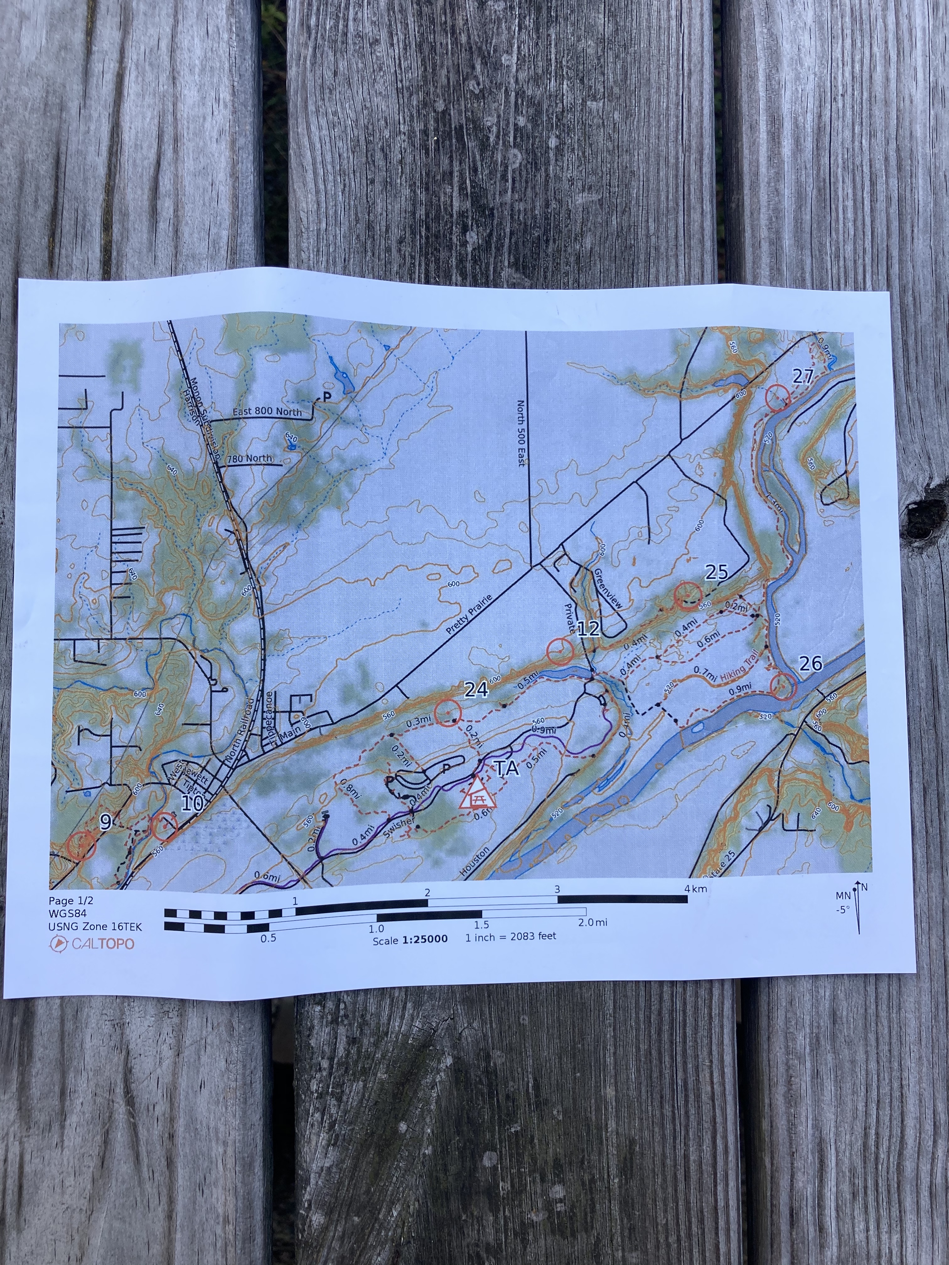
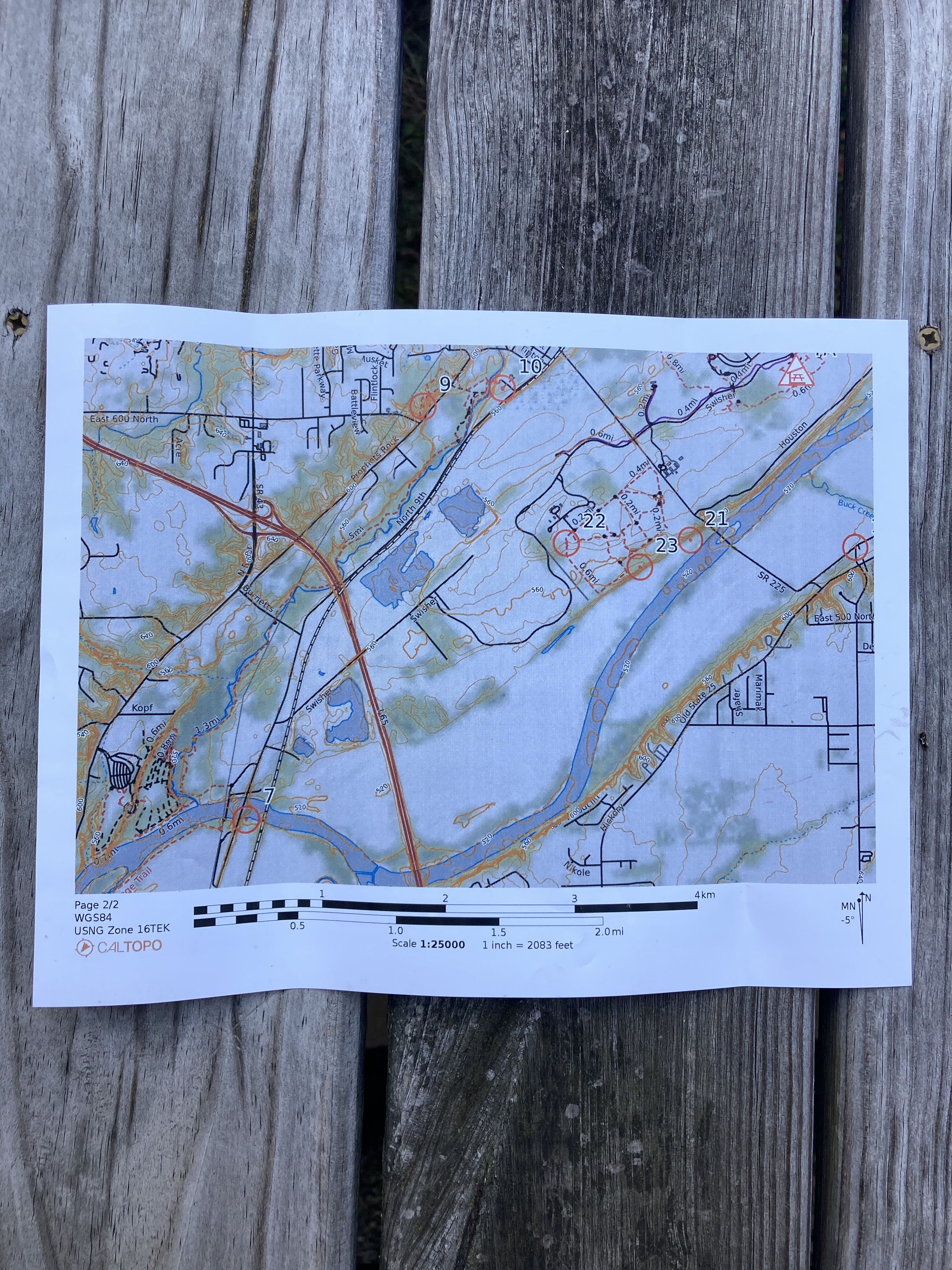
Distance traveled: see map here
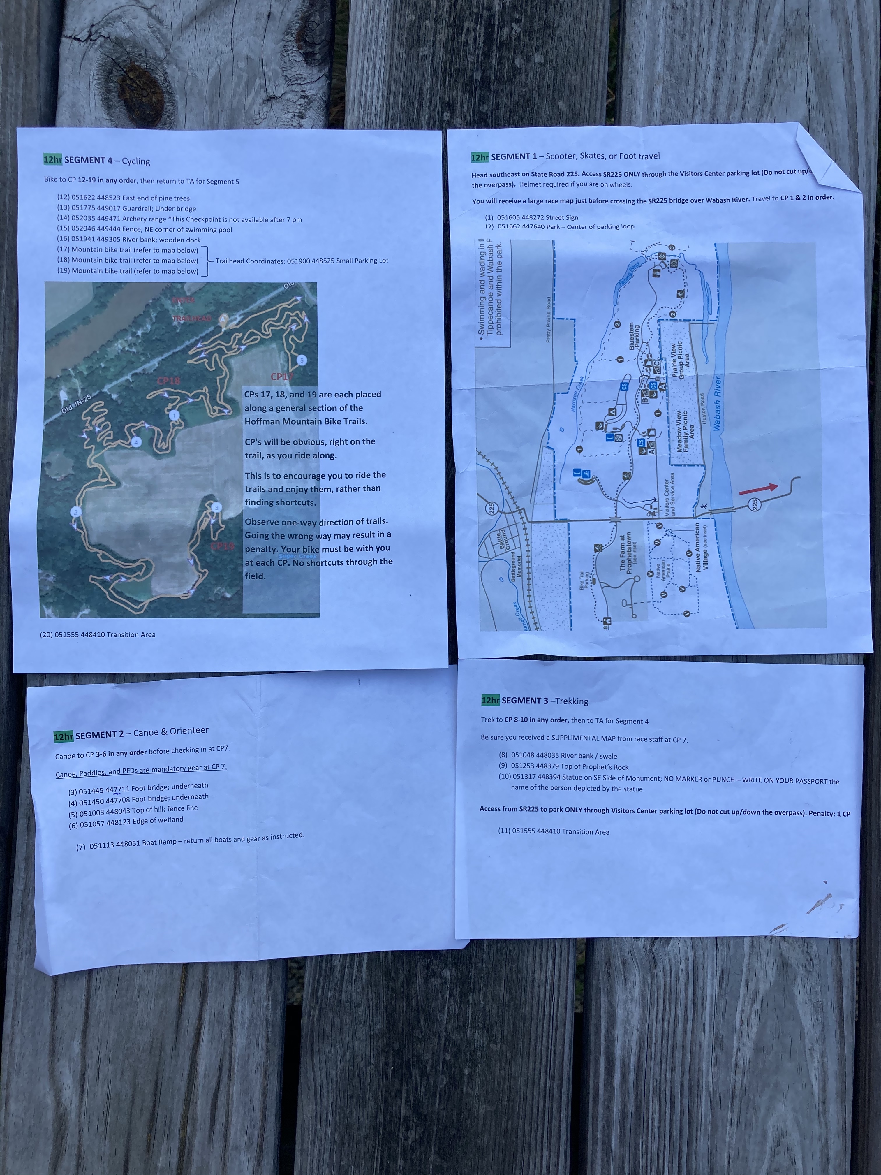
- Scooter: 7.25 miles (8:00 am – 9:15 am)
- Kayak & Trek: 12.5 miles (9.25 water, 3.25 trekking) (9:15 am – 1:38pm)
- Trek: 7.7 miles (1:53 pm – 4:08 pm)
- Biking: 15.7 miles (9.7 mile road, 6 mile trail) (4:41 pm – 7:08 pm)
- Total: 43.15 miles
I was really excited for this race, since it was only the 2nd one of the year for me! I tried hard to get a team together but by the time I “met” a new racer on FB Team Finder group, the team slots were full so solo was my option!
Steve and I drove up after school on Friday and stayed at a pretty gross Days Inn. Our room came complete with a dirty sock and used pair of flip flops, but the bed was clean and the water was hot. We were actually on time for the race meeting and got to set up our TA area with the tent and tables. I still had to pack my backpack so I kept my race tote in the truck, which turned out to be a saving grace! We picked up some killer cheesy breadsticks from Fox’s Den pizza, the required gas station snack, and headed back to pack and deal with last minute details. It was at this moment that I realized while filling my 3L dual bladder that I had left the dang closure piece at home!! Thank goodness there was a Meier store just 5 mins away and I was able to get a 2L bladder for only $9.99. Not the best quality but it will live in my race tote now as a back up! I called it quits and went to bed around 11:20 pm, alarm set for 5:30 am.
Race day morning was cool and overcast. We hit the Dunkin Donuts for breakfast and coffee and made it to the TA with time to spare. At 7:50 am Brian let us know that the first leg would be via scooter/skates if we had them and that we’d get a map on course.
Scooter Leg: 3,2,1 – GO!! I put myself in the mid back pack to start since my scooter skills are not great. I was pleased to see how much easier the large wheels did than the smaller ones and I slowly made up some space. My right glute probably grew 2” during this segment since I wasn’t able to alternate pushing legs very well! We scootered to the Visitors Center and were given our large map and had 2 points to plot. This was my first time plotting solo so I was slow at it but the points made sense so I went with it. Back on the scooter and off to the one lane bridge. Just across the bridge, my stupid compass lanyard closure failed (really a bad design) and my compass fell off. I heard it and immediately stopped. Luckily there was a kind rollerblader behind me who almost crashed rescuing my compass from the truck that was barreling down on us! The truck wheel was perfectly in line to crush my compass! Thank you unknown racer! Checkpoint 1 was a road sign, easy to find! From there it was a big uphill and then a straight shot down a very long road. I wasn’t sure how I’d feel after a 7 mile scooter but I can confirm that if I had run it, I would have been hurting a lot more! At the end of the straight shot, we turned left and then into a housing division. Some fun downhills and then out to the park where we switched to the canoe/kayak leg.
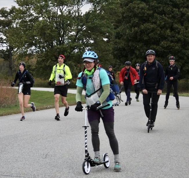
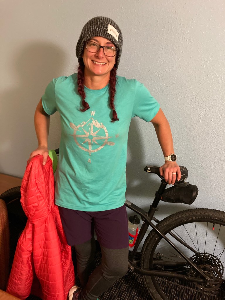
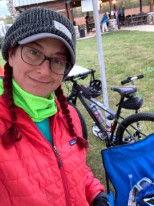
Me and my trusty steed!
Notes for future scooter legs:
- Find a way to get the handle bars higher
Kayak Leg: I picked up my instructions, dropped the scooter in the truck, and sat down to plot 5 points. This is where I just sort of lost my ability to plot… The first clue was foot bridge, and was plotted off the river. I guess I was just expecting the points to be on the river so I was convinced I had made a mistake. Which I then spent about 10 mins re-doing and kept getting the same spot so I went with it, then read the top of the instructions that clearly said “Canoe and Orienteer”. The kayak was the sit in kind, much easier to deal with than the sit on ones! The Wildcat Creek was beautiful, I’ll definitely come back when the weather is more conducive to swimming. The water level was low but I made it at least an hour before I had to get out and drag my kayak over a low spot. Other than just being epically long, with a few ugly strainers, the paddle was fine! The points on this leg all required orienteering so I was watching the map and trying to decide where I’d get out if I didn’t have other boats in front. I’m not sure I would have stopped where the rest of the boats were parked if I were out there alone. Trying to paddle, keep the map orientated, and read the compass was a challenge! This is when having a team really helps. I docked the kayak and heading up the trail following other racers. The 1:25K scale map was hard for me to see much detail for these points. The clues were both footbridges so if I could find a bridge that would help! We went up the stairs and it really seemed like we should have been on the lower trail, which we had just passed. The group in front of me choose to turn around at that point and I went ahead to check around the corner. Bam, bridge! Refer to rule #1, you’ve never gone as far as you thing you have! From there I just followed the trail and found another bridge. Then I thought I could make a loop around but that dead ended, so made an out and back.
Back in the kayak for a much longer paddle, with many more drags, until we hit the Wabash river. The next trek had a clear mark of where to get off the river so I beached and headed into the bush. I knew there should be a trail to my left, so cut across and was pleased to find it! I was thumbing the map, looking at the compass, and trying to get my soaking wet feet to warm up so I could jog. Everything seemed to be going so well…. The map we had showed 2 trails, and I was looking for sharp corner as my landmark. I guess I got onto the middle trail instead of the outermost one, then I bushwhacked over, completely missing my sharp corner. From there, chaos ensued. I basically did the thing where I ran around randomly for a bit, then said screw it, go find the other point and then at least I’d know where I was. I went up the amphitheater and had a short sit down in the sun, unfolded the map to get a bigger picture, and then still didn’t know where I was. This happened at the last race as well. It’s like my brain just goes NOPE, I will not help you with this task. I did see a big field, and I did see other races crossing it so I followed and yep, there was point #5. From there I was able to make sense of the map and hiked back to get #6. This time paying super close attention to the trail directions and sticking to the outside. A quick jog back to the water and then this leg was done!
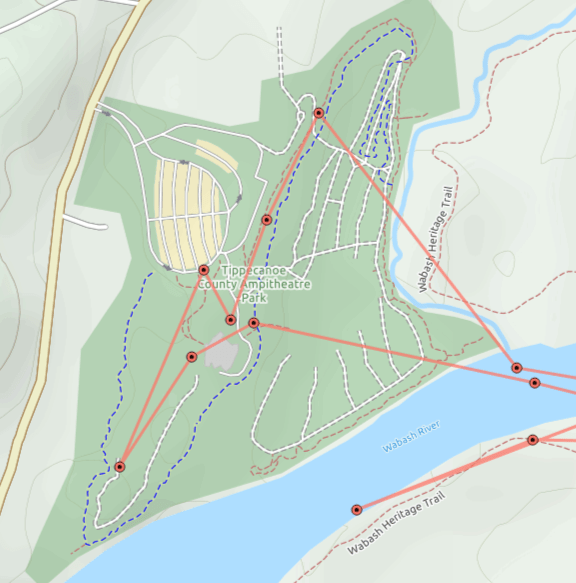
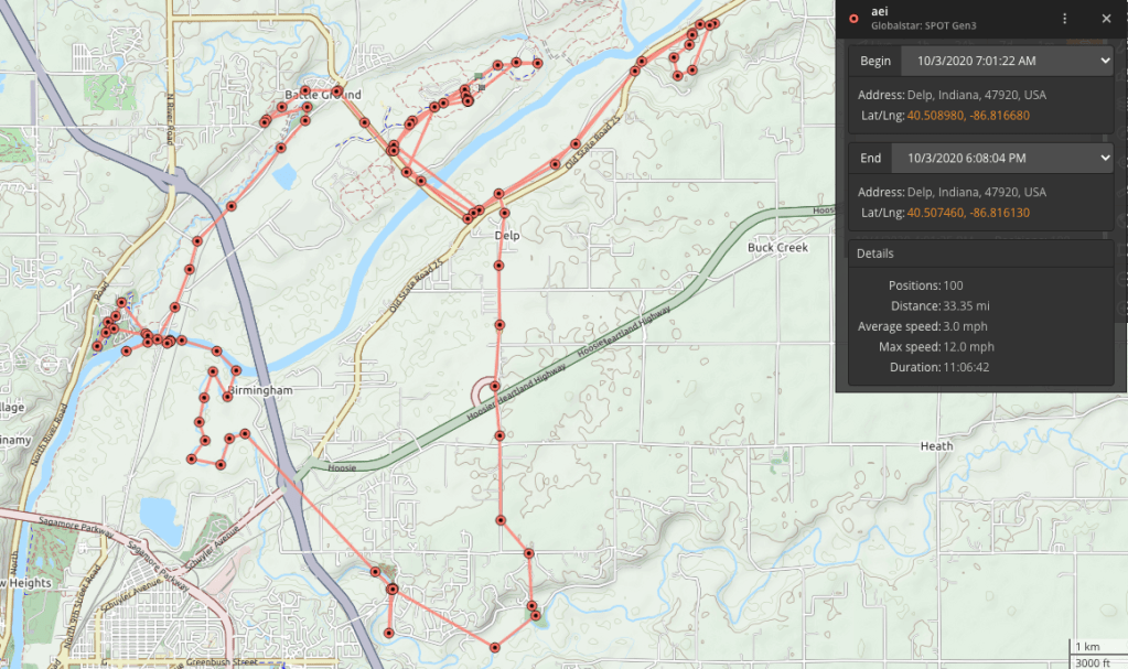
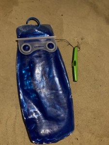
The Spot device trace of my trek. It only takes a mark every 5 mins so those straight lines are not true!
Notes for future kayak legs:
- Put the pack into the dry bag idiot, especially if the weather is cold.
- Find a way to make the map easier to deal with, and use a wrist compass.
- Eating and drinking while solo is too hard.
Trek Leg 1: We were given another set of instructions and 3 points to plot, plus a supplemental map for this leg. We technically didn’t have to plot points 9 & 10 but I did anyway since I needed the practice. This led to a critical error on my part, *see bike leg. I got so wrapped up in the big map that I neglected looking at the supplemental one closely. I stuck to the road and was happy with my jogging pace for the most part. I knew #10 was going to be easy, so I didn’t have to follow the map too much. I did wonder if using the pipeline cut was legal since it was almost on top of #9, but it required crossing a largish creek and I played it safe on the roads. From 10 to nine should have been easy, especially if I was looking at the small map, which I was not. Eventually I made my way across the road and down to the small parking lot for the Prophet’s Rock trail. At the top I knew the checkpoint was west of the pipeline cut, but since I wasn’t looking at the small map, I didn’t see the details. I probably spent at least 15 mins looking for this point. After this it was another trek back to the TA. During this section I met up with a couple doing the 4 hr version and we chatted about the sport.
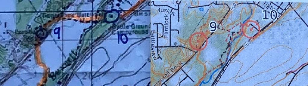
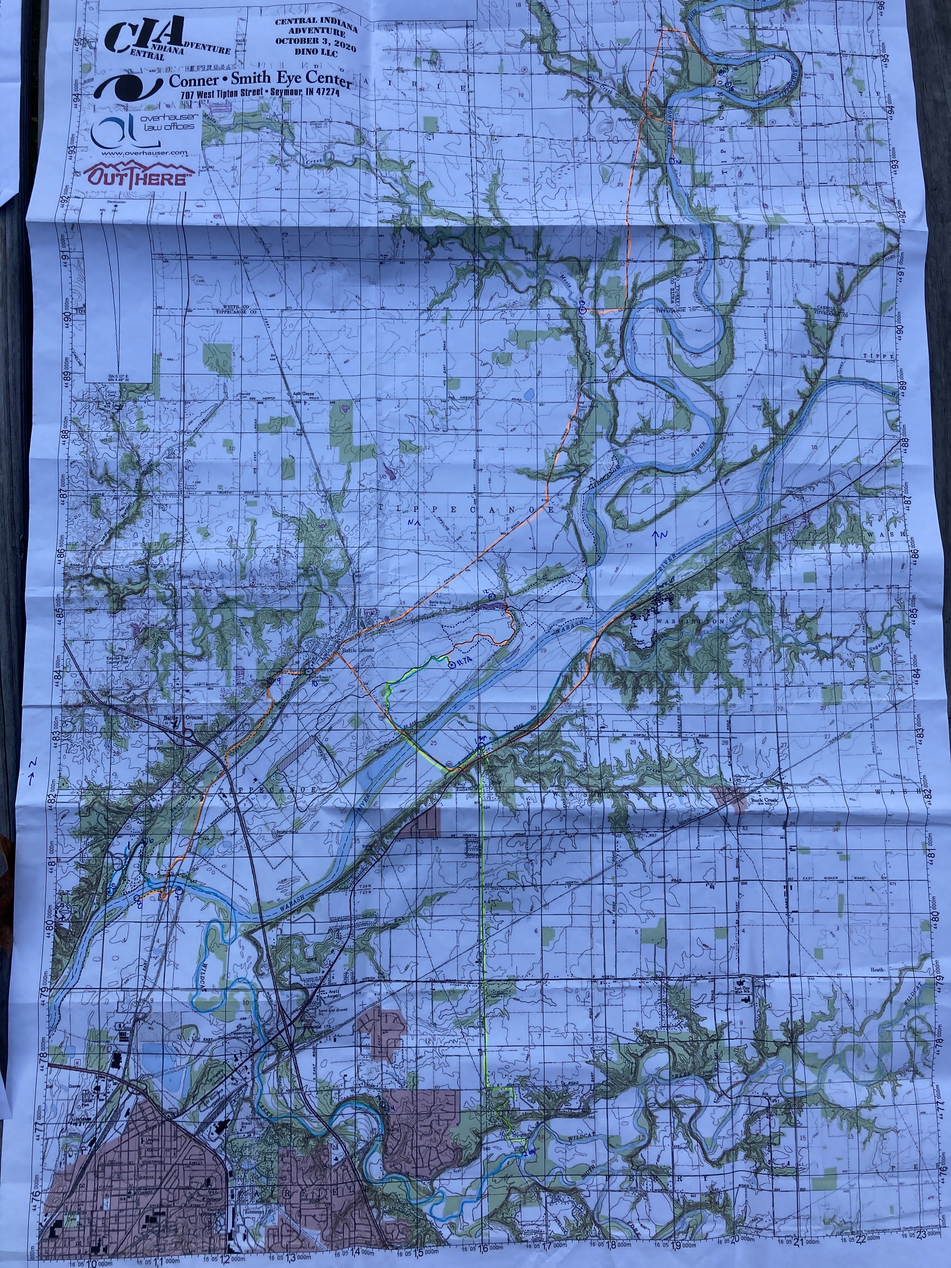
Big map vs supplemental map
Bike Leg: I spent waaaayyyy to long in TA before heading out on the bike (35 mins). I have no excuse except it felt nice to sit down and I wanted to eat my pb&j! I also had to plot 6 more points and then route plan what I thought I could get done in the time remaining. I knew 12 was close to the TA and I could grab it and then either loop up to the farthest points, then back down to the mountain biking section, or I could just head to the mtn biking. I wasn’t feeling very confident of my navigation skills at this point. I decided to try for 12 then head to mtn biking. Here is were that critical mistake from before with the supplemental map was compounded. I never looked on the other side of the paper to see that 12 was on there in a much larger scale!! I biked down to the correct area, was fairly certain I knew which road to take but there was a ranger in a truck parked there and I was too chicken to just bike down it. I bailed on 12 and headed to the mtn biking loop where I was assured I’d get 3 more points.

Oh #12, how you taunt me so! That supplemental map would have helped so much!
The bike there was easy and when I got to the trails the volunteer assured me that as long as I just stayed on the trail and always went right, I’d literally run into the checkpoints. These trails were a spaghetti bowl! If any teams tried to jump trail to shortcut, I bet they missed at least one checkpoint! I really enjoyed the ride, made it over some obstacles that were larger than ones I’d ridden before. I also walked some stuff that I’m pretty certain I would have died on! I’m a cautious biker at the best of times and racing solo made me even more so. I made it out unscathed and headed back to the TA. I had about an hour left but since I’d failed to find 12 already, I decided to call it quits. This was probably playing it too safe but I didn’t want to be late and risk losing points. Had I seen the other side of the supplemental map, I totally would have gone back to get 12 since I was on the right road for sure! Oh well, add that to the lessons learned!
Notes for future bike legs:
- • The handlebar mirror was the bomb for roads. Not great for woods but easy to fold over.
- • The handlebar compass was great, made for easy navigation checks.
- • Bike computer was working, get that figured out.
Overall, I’m ok with my performance on this race. I knew going in that mentally I was exhausted from school and that I was probably going to make some mistakes. I like racing alone since I don’t feel the pressure to go fast, but I also like having a team to rely on for help (like looking at both sides of the paper…). I wore my glasses for pretty much the entire race and damn, it was nice to be able to see so far away, but it made map reading a challenge!