
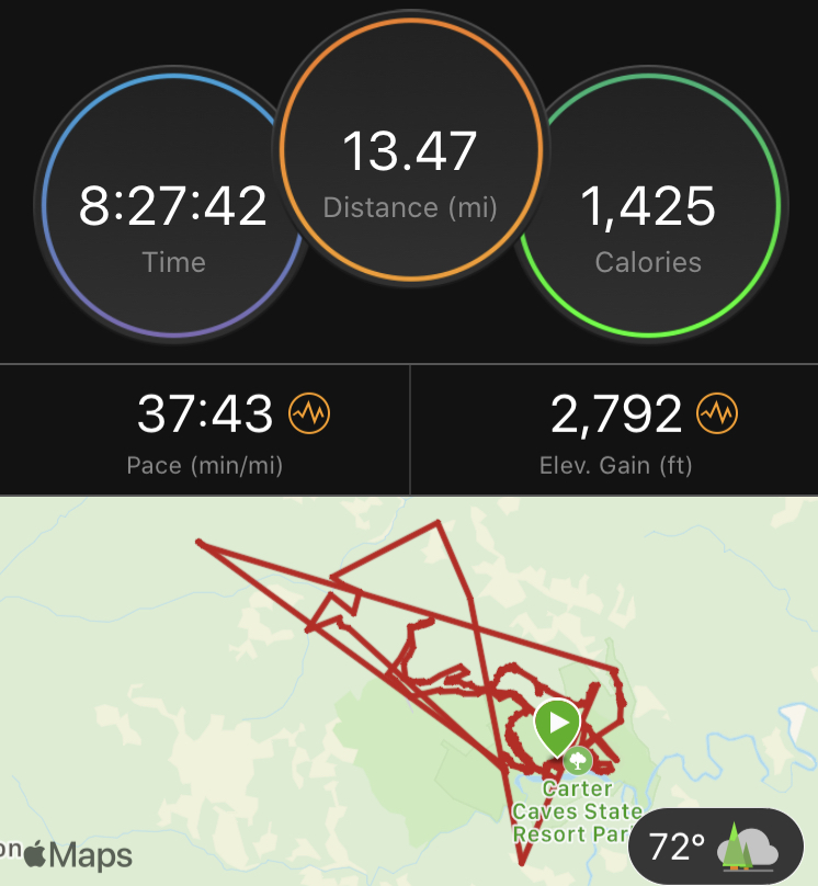
Aug 22, 2020
8 hrs
Carter Caves State Resort Park, Kentucky
Team: Wander Women Adventure League (Heather and Julia)
Steve and I drove down right after school on Friday, getting to the lodge around 8:15 pm. I’d packed my tote the week before and just had to put my pack together. It almost seemed too easy, the lack of running around at the last minute was surprising! The maps were to be handed out at 7 am Saturday and my teammates were driving down in the morning. Not much left to do but try and sleep!
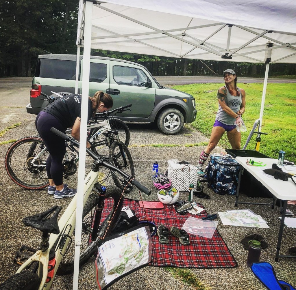
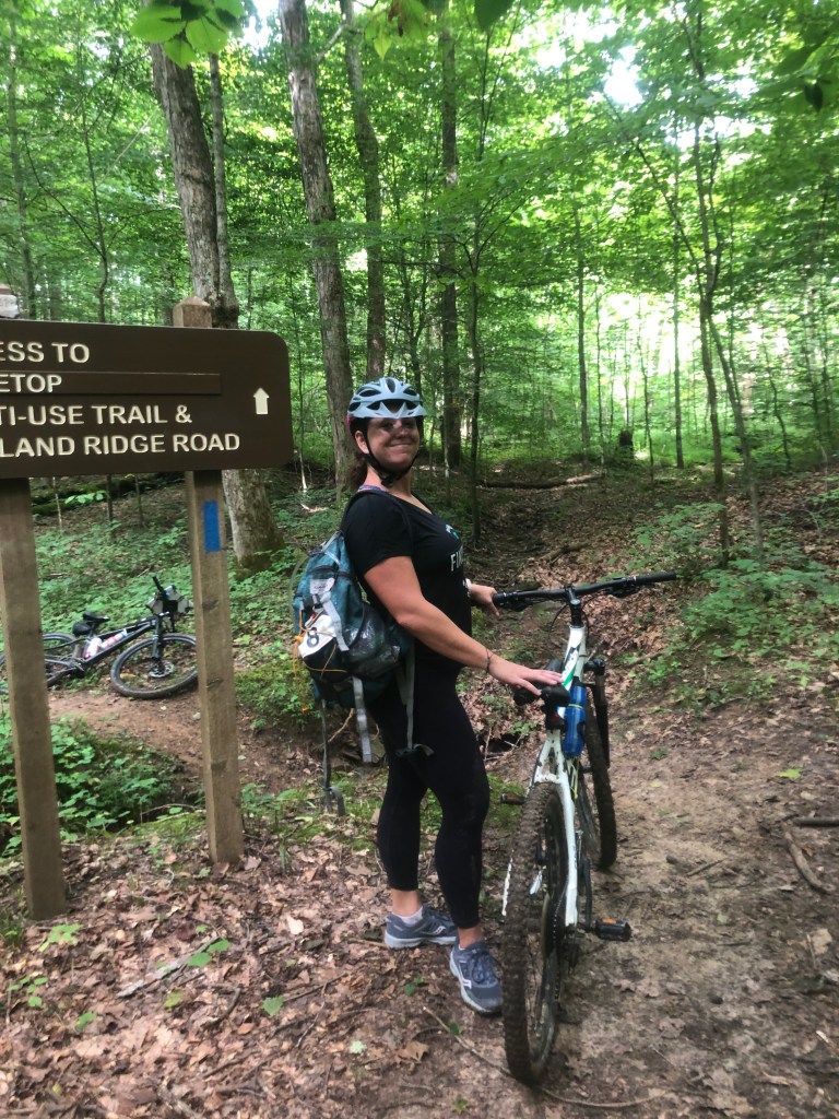
Saturday morning dawned a little misty and drizzly but warm and humid. Alarm at 5:30 am, in the truck and heading to the TA at 6:15 am. Steve drove down with me and then headed back to grab us some breakfast. I may not be the best racer but I can set up a bomb TA! Heather and Julia made it right at 7 am and then we got our maps and the fun began!
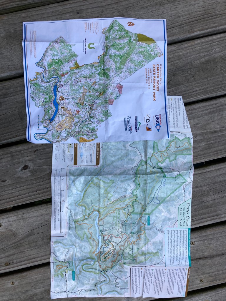
The maps included a 1:15,000 orienteering style map and a park trail map, were the scale was roughly 1” was 0.25 mile. Going back and forth between the two was a challenge for me for sure! The checkpoints were all pre-marked so we just needed to figure out our routes. I planned to use the SPOT tracker and even had it all set up and turned on, I just forgot to hit the track button. My embargoed Garmin watch must have gotten bumped so it paused for section or two.
The race began with a prologue were we ran out to Raven Bridge on TBT trail and back on RBT trail. This helped space out the teams a bit.
Leg 1 was paddle boarding on Smoky Valley Lake, a pretty small and narrow lake. Each of us had to go out and get a point on the lake. We sent Heather off for the farthest point since she had the most experience on the board. I wish I had watched the pre-race video sooner, since having a kayak paddle would have been great since I stayed kneeling on the board. Julia took the middle checkpoint, not necessarily the closest one but easier to navigate to. I took the one on the end of the island just in case the water was too shallow and I needed to wade. None of us fell in unexpectedly!
Leg 2 was the first bike leg with 4 points, all mandatory. We went in order of 4, 5, 6, & 7. Four and five were on an old golf course, which was what through me for my first nav goof. For some reason I was just completely turned around and we spent at least 5 mins looking for a trailhead that did not exist. Once on the course though, it was clear sailing! Point 6 was out on the far west side of the map. We headed out on the Cave Branch road to the KHT trail. Six was at a creek crossing and we stopped one too soon but quickly moved on and Julia found it.
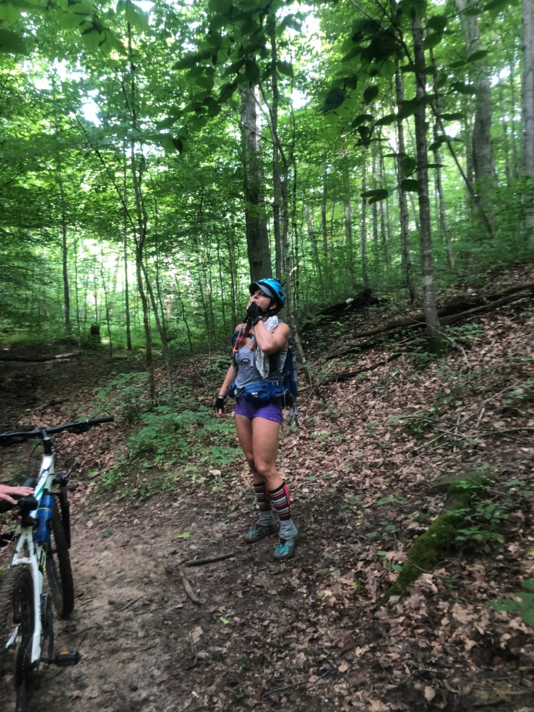
Seven was down a short little multi-use trail and we had originally planned on looping around on the CBT trail but given the state of the trails, we opted to do an out and back to stay on the road.
The turn back to camp came up quicker than I anticipated but we stopped and took some time to orient the map and all was well. We got growled at by a shaggy dog and visited by a beautiful butterfly. We had a great ride back to the TA, spirits and morale high!

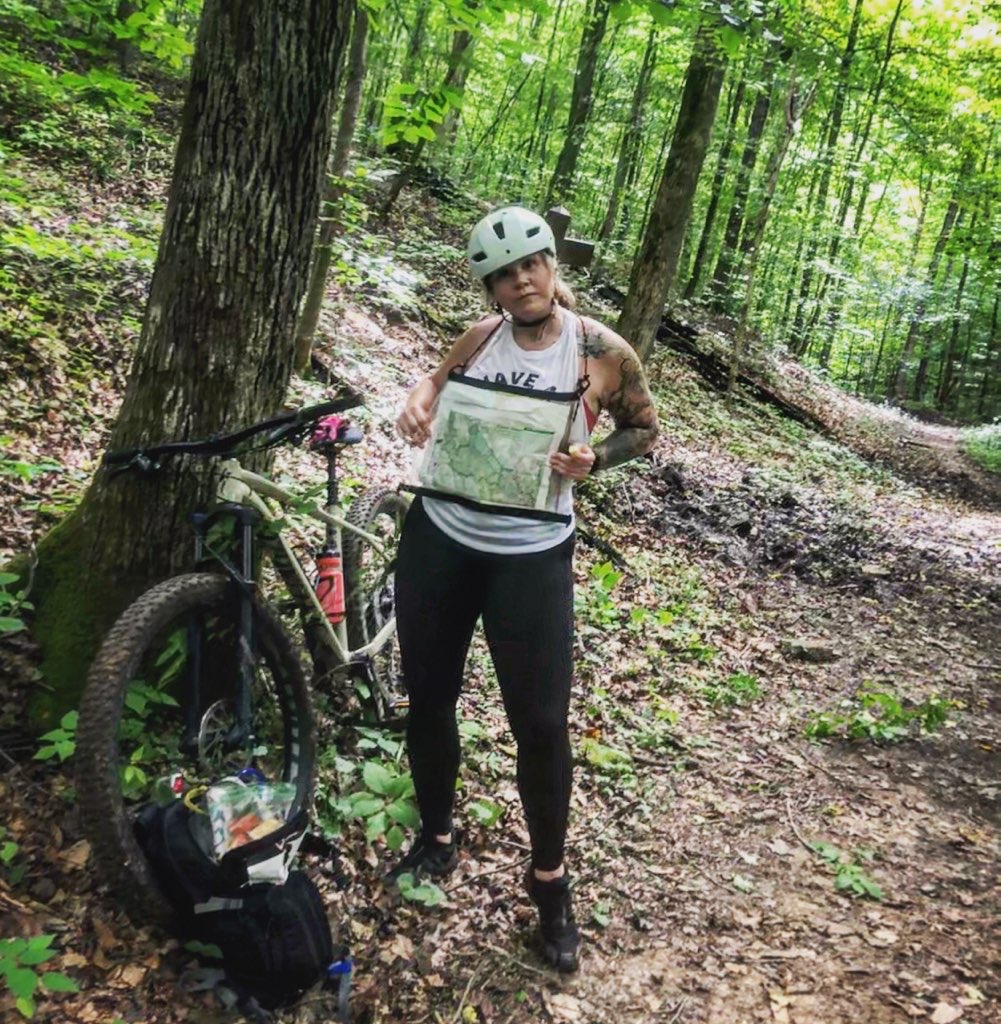
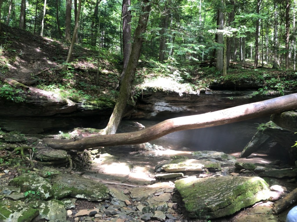
Leg 3 was the trek, points 8 – 15, choose any 3 for mandatory. We knew going in that clearing the points in this section would be a challenge but also that we wanted the practice of navigating. Things started out ok, headed right to pt 8, then right back to the road with a jog down to 9 (Laurel Cave). We went in the main entrance and made our way through. This cave is super easy to navigate, had a cool stream flowing through it, and Heather and Julia really enjoyed the experience! We got to the other end and got the checkpoint, exiting into what felt like a Jurassic Park scene. From 9 to 11 was a short hike to Horn Hollow Cave. This was our view when we got there, beautiful!
We spent a few minutes enjoying the scene then dove into the cave to find the point. The instructions clearly said south end… we went all the way through the cave, came out the exit, then took the trail back around to try again. We looked around the opening for about 5 mins before deciding to go back in when Heather turned around and found it! All of us had walked right by it before! As we made our way back to the other end we found two teams who had done just what we had! Basically from here on out, all of my choices were wrong! I hiked us out too far to find a trail that was right back at the cave we had just come out, probably costing us at least 20-30 mins but the travel was easy. Once we found a trail (I’m not convinced it was the one I was looking for) it was big hike up to the top again then out to find pt 10. After being gun-shy about overshooting the last trail, this time I undershot the point by a huge margin! So begin the cracks in my confidence as a navigator. We knew that 13 would be easy (Natural Bridge) and it was! At this point we needed to make some decisions. Heather had taken a fall on the way to 10 and wrenched her knee. We had about 1:45 of time remaining, with 3 points on the trek remaining. We wanted to clear this section and it should have been possible. We made it to 12 in good time and I was able to nail the location! Finally, I needed a boost! Unfortunately, this boost was short lived. We decided to push on, everyone feeling ok with a second wind. We jogged it out and I was confident of our location. Leaving the last known location I should have checked both maps but just sort of forgot the trail map was a thing! On our way to the Shangra La Arch we planned to pick up pt 10 but to do this, we would have had to been on the correct trail. I took us down the KHT instead of the 4C’s trail, which then took us about a mile out of the way one direction. I’m not even sure I was looking at my compass at this point since if I’d been paying attention, I should have been clued in my the fact that we were going NW and not south! We hit a wall when we realized that not only were we completely lost but were also going to be super late getting back. We retraced our steps back to the last known junction, I looked at the park map, saw the yellow and orange blazes and bam, an hour later we were home!
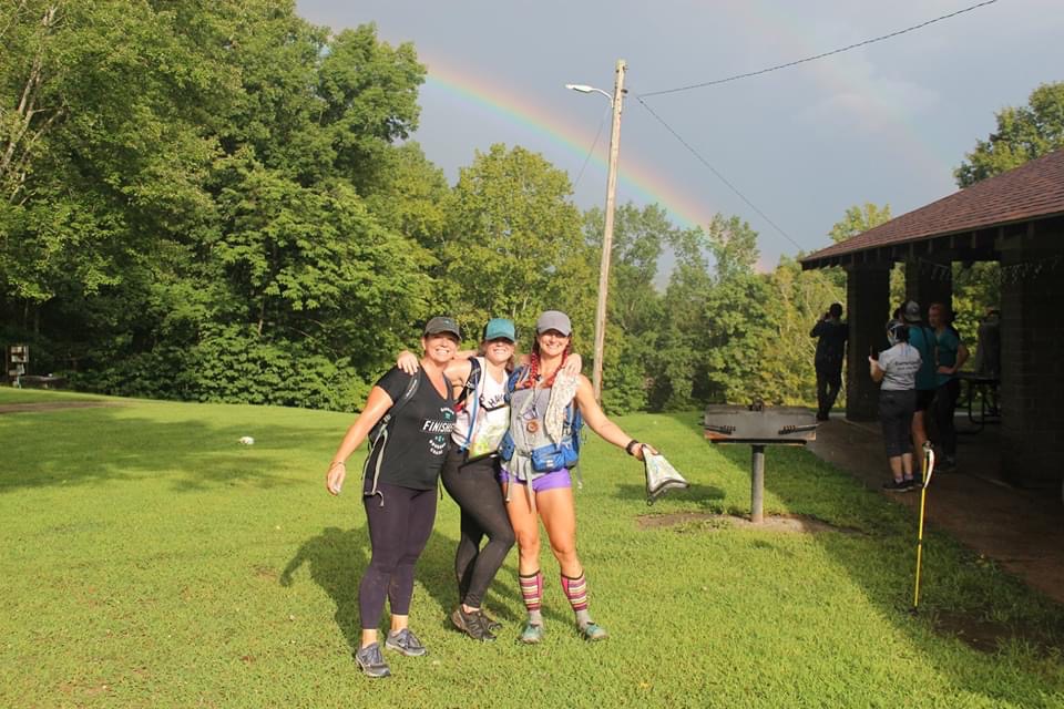
Nothing like walking in and having the whole race clap, thanks ladies it was a nice touch! We were greeted with a beautiful rainbow, a delicious chicken wrap, and the news that while we were dead last, we were official finishers!
Lessons Learned (some for at least the 5th time) – I should really re-read these before the next race!
*Review how to set up SPOT tracker, before the race!
*If close to an hour to cutoff, head BACK NOW! The 2nd wind never lasts as long as you thing!
*Stop carrying so much food for short races, especially during hot weather.
*Slow down and check map at each intersection! This means look at the damn compass more often as well.
